


<< Our Photo Pages >> Myklebust Round Barrows - Round Barrow(s) in Norway in Sogn og Fjordane
Submitted by kenntha88 on Monday, 08 October 2012 Page Views: 2999
Neolithic and Bronze AgeSite Name: Myklebust Round Barrows Alternative Name: RundehogenCountry: Norway
NOTE: This site is 11.619 km away from the location you searched for.
Fylke: Sogn og Fjordane Type: Round Barrow(s)
Nearest Village: Nordfjordeid
Latitude: 61.909419N Longitude: 5.989437E
Condition:
| 5 | Perfect |
| 4 | Almost Perfect |
| 3 | Reasonable but with some damage |
| 2 | Ruined but still recognisable as an ancient site |
| 1 | Pretty much destroyed, possibly visible as crop marks |
| 0 | No data. |
| -1 | Completely destroyed |
| 5 | Superb |
| 4 | Good |
| 3 | Ordinary |
| 2 | Not Good |
| 1 | Awful |
| 0 | No data. |
| 5 | Can be driven to, probably with disabled access |
| 4 | Short walk on a footpath |
| 3 | Requiring a bit more of a walk |
| 2 | A long walk |
| 1 | In the middle of nowhere, a nightmare to find |
| 0 | No data. |
| 5 | co-ordinates taken by GPS or official recorded co-ordinates |
| 4 | co-ordinates scaled from a detailed map |
| 3 | co-ordinates scaled from a bad map |
| 2 | co-ordinates of the nearest village |
| 1 | co-ordinates of the nearest town |
| 0 | no data |
Internal Links:
External Links:
")
In the small village of Nordfjordeid at an old farm site called Myklebust are two large round barrows. They are called "Rundehogen" and "Skjoratippen". Rundehogen is 30 metres in diameter and around 4 metres in height. Skjoratippen is 32 metres in diameter and 4 metres in height. The site had originally 5 mounds, but three mounds have been lost in later years. In the Rundehogen, the famous Myklebust ship was found.
The largest of the five mounds at Myklebust Nordfjordeid, Rundhogjen, is lying on a flat plain by the sea, visible from the highway. It has been excavated in 1903 by Anders Lorange who found the remains of a fire pit where a boat or a large ship was burned and covered with a mound of 30 metres in diameter and 4 feet in height. Initially there had been a 4 m wide and 1 m deep ditch surrounding the mound that was attached to the ground with a broad soil bench.
Lorange found iron nails, shield bulges, burned weapons that had been destroyed and a large copper kettle that contained the ashes and bones of a male person. Probably this copper kettle is of Irish origin, adorned with three bronze figures. One of these became known as "Myklebust man." He also found the remains of a peacock seen in the excavation of the Gokstad ship, which means it was an exceptionally rich grave.
Wood remains from the Myklebust ship were not found, but the excavations revealed a charred layer, which showed that the ship was about 25 meters long. A rusted lump found in Rundhogjen consisted of 58 shields bulges indicated that it had 29 arms on each side. The discovery is probably from the 800's or 900's. The large amount of shield bulges suggest the ship had a row of shields hanging on each side of the ship.
The better-preserved Viking ships Gokstad and Oseberg led to the Myklebust discovery being overshadowed and forgotten partly because it was so poorly preserved. The estimated length of this ship makes it the largest vessel from the Viking Age which has ever been found in Norway!
It has been suggested that the man who is buried in the ship is King Audbjorn, who, according to the sagas, was killed in the battle of Solskjel year 876. This is just a myth and cannot be proved.
Archaeologist Haakon Shetelig revealed in 1902 two female burials and four digs in Skjoratippen mound which originally was 10 metres in diameter and 3.8 metres high. This mound was used for about 200 years and contained at least six rich burials! About 50 metres east of Skjoratippen was a burial mound that was 27 metres long, in it were found coal and rivets for a boat or a ship that was probably burned by the Vikings. Probably a very similar burial like the one at Rundehogen.
On top of the "Skjoratippen" barrow is a standing stone. This is however not ancient, it was raised as a memory stone after the excavations that took place in 1902.
You may be viewing yesterday's version of this page. To see the most up to date information please register for a free account.
")
")
")
")
Do not use the above information on other web sites or publications without permission of the contributor.
Nearby Images from Flickr
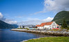


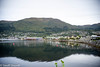
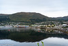

The above images may not be of the site on this page, but were taken nearby. They are loaded from Flickr so please click on them for image credits.
Click here to see more info for this site
Nearby sites
Click here to view sites on an interactive map of the areaKey: Red: member's photo, Blue: 3rd party photo, Yellow: other image, Green: no photo - please go there and take one, Grey: site destroyed
Download sites to:
KML (Google Earth)
GPX (GPS waypoints)
CSV (Garmin/Navman)
CSV (Excel)
To unlock full downloads you need to sign up as a Contributory Member. Otherwise downloads are limited to 50 sites.
Turn off the page maps and other distractions
Nearby sites listing. In the following links * = Image available
7.3km W 277° Viljane standing stone* Standing Stone (Menhir)
7.5km W 275° Naustdal standing stone* Standing Stone (Menhir)
8.5km SE 146° Heksesteinen* Carving
13.9km SE 143° Vereide barrow cemetery* Barrow Cemetery
14.9km SE 144° Tystad Standing Stone* Standing Stone (Menhir)
17.0km SE 143° Karnil's Mound* Round Barrow(s)
17.2km SE 142° Austrheim standing stone* Standing Stone (Menhir)
19.6km SSE 148° Trondehaugen* Round Barrow(s)
19.8km SSE 147° Mardal* Barrow Cemetery
35.4km N 360° Steinneset standing stones* Standing Stones
36.9km WNW 295° Selje barrow cemetery* Barrow Cemetery
37.0km WNW 287° Barmen Runestone* Carving
37.0km WNW 287° Hornsetra standing stone* Standing Stone (Menhir)
37.2km WNW 286° Korsneset standing stone* Standing Stone (Menhir)
37.6km WSW 254° Vingen* Rock Art
38.9km N 350° Selvåg standing stone* Standing Stone (Menhir)
39.0km E 90° Vellane standing stone* Standing Stone (Menhir)
39.6km NNW 327° Larsnes Standing Stones* Standing Stones
47.0km S 182° Furebø Standing Stone* Standing Stone (Menhir)
49.1km N 350° Osnes Standing Stone* Standing Stone (Menhir)
49.3km N 350° Oshaugen cairn* Cairn
49.3km N 5° Hjørungavåg standing stones* Standing Stones
50.7km N 350° Ryssholmen Standing Stone* Standing Stone (Menhir)
50.8km N 350° Laberget standing stone* Standing Stone (Menhir)
51.0km N 2° Hareid standing stones* Standing Stones
View more nearby sites and additional images


 We would like to know more about this location. Please feel free to add a brief description and any relevant information in your own language.
 Wir möchten mehr über diese Stätte erfahren. Bitte zögern Sie nicht, eine kurze Beschreibung und relevante Informationen in Deutsch hinzuzufügen.
 Nous aimerions en savoir encore un peu sur les lieux. S'il vous plaît n'hesitez pas à ajouter une courte description et tous les renseignements pertinents dans votre propre langue.
 Quisieramos informarnos un poco más de las lugares. No dude en añadir una breve descripción y otros datos relevantes en su propio idioma.