


<< Our Photo Pages >> Giske standing stone - Standing Stone (Menhir) in Norway in Møre og Romsdal
Submitted by kenntha88 on Sunday, 12 August 2012 Page Views: 1472
Neolithic and Bronze AgeSite Name: Giske standing stoneCountry: Norway
NOTE: This site is 1.396 km away from the location you searched for.
Fylke: Møre og Romsdal Type: Standing Stone (Menhir)
Nearest Town: Ålesund Nearest Village: Giske
Latitude: 62.498948N Longitude: 6.050098E
Condition:
| 5 | Perfect |
| 4 | Almost Perfect |
| 3 | Reasonable but with some damage |
| 2 | Ruined but still recognisable as an ancient site |
| 1 | Pretty much destroyed, possibly visible as crop marks |
| 0 | No data. |
| -1 | Completely destroyed |
| 5 | Superb |
| 4 | Good |
| 3 | Ordinary |
| 2 | Not Good |
| 1 | Awful |
| 0 | No data. |
| 5 | Can be driven to, probably with disabled access |
| 4 | Short walk on a footpath |
| 3 | Requiring a bit more of a walk |
| 2 | A long walk |
| 1 | In the middle of nowhere, a nightmare to find |
| 0 | No data. |
| 5 | co-ordinates taken by GPS or official recorded co-ordinates |
| 4 | co-ordinates scaled from a detailed map |
| 3 | co-ordinates scaled from a bad map |
| 2 | co-ordinates of the nearest village |
| 1 | co-ordinates of the nearest town |
| 0 | no data |
Internal Links:
External Links:
")
The mound is around 10 metres across and around 0,5 metres in height, no excavations have been taking place here. The standing stone is around 2 metres in height and around 30-40cm wide. It has a smooth surface and a very pretty shape.
The mound is hard to see because of the high grass growing on top of it.
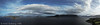
The site has a very pretty ocean view.
You may be viewing yesterday's version of this page. To see the most up to date information please register for a free account.
")
")
")
")
Do not use the above information on other web sites or publications without permission of the contributor.
Nearby Images from Flickr


The above images may not be of the site on this page, but were taken nearby. They are loaded from Flickr so please click on them for image credits.
Click here to see more info for this site
Nearby sites
Click here to view sites on an interactive map of the areaKey: Red: member's photo, Blue: 3rd party photo, Yellow: other image, Green: no photo - please go there and take one, Grey: site destroyed
Download sites to:
KML (Google Earth)
GPX (GPS waypoints)
CSV (Garmin/Navman)
CSV (Excel)
To unlock full downloads you need to sign up as a Contributory Member. Otherwise downloads are limited to 50 sites.
Turn off the page maps and other distractions
Nearby sites listing. In the following links * = Image available
681m ENE 63° Mjeltehaugen Barrow* Artificial Mound
3.6km NE 50° Skjonghelleren* Cave or Rock Shelter
3.6km SSW 196° Eilifrøysa Gravhaug* Cairn
3.8km SSW 194° Hogsteinneset standing stones* Standing Stones
4.2km WSW 249° Alnestrøya standing stone* Standing Stone (Menhir)
4.6km NNW 346° Synes standing stone* Standing Stone (Menhir)
7.5km N 3° Blimshaugen mound* Round Barrow(s)
7.5km N 2° Sjøskardet standing stone* Standing Stone (Menhir)
14.7km S 184° Hareid standing stones* Standing Stones
16.5km S 177° Hjørungavåg standing stones* Standing Stones
19.5km SW 217° Laberget standing stone* Standing Stone (Menhir)
19.6km SW 217° Ryssholmen Standing Stone* Standing Stone (Menhir)
20.5km SW 214° Oshaugen cairn* Cairn
20.7km SSW 214° Osnes Standing Stone* Standing Stone (Menhir)
29.0km SSW 200° Selvåg standing stone* Standing Stone (Menhir)
30.4km S 186° Steinneset standing stones* Standing Stones
41.0km SW 218° Larsnes Standing Stones* Standing Stones
42.5km ENE 68° Naustvollen* Standing Stone (Menhir)
51.6km NE 48° Korsbø-Smøla* Standing Stones
53.4km NE 55° Tangen (Aukra)* Round Barrow(s)
54.2km NE 54° Prestegardsskogen* Round Barrow(s)
56.4km ENE 77° Kråkneset Cairns* Cairn
58.6km NE 52° Hoksnes* Standing Stone (Menhir)
61.0km NE 54° Reithaugen Round Barrow(s)
61.8km SW 216° Selje barrow cemetery* Barrow Cemetery
View more nearby sites and additional images


 We would like to know more about this location. Please feel free to add a brief description and any relevant information in your own language.
 Wir möchten mehr über diese Stätte erfahren. Bitte zögern Sie nicht, eine kurze Beschreibung und relevante Informationen in Deutsch hinzuzufügen.
 Nous aimerions en savoir encore un peu sur les lieux. S'il vous plaît n'hesitez pas à ajouter une courte description et tous les renseignements pertinents dans votre propre langue.
 Quisieramos informarnos un poco más de las lugares. No dude en añadir una breve descripción y otros datos relevantes en su propio idioma.