 with our Megalithic Portal iPhone app")


<< Text Pages >> Mianroud Mound - Ancient Village or Settlement in Iran
Submitted by davidmorgan on Thursday, 27 January 2011 Page Views: 3817
Multi-periodSite Name: Mianroud MoundCountry: Iran
NOTE: This site is 1.196 km away from the location you searched for.
Type: Ancient Village or Settlement
Nearest Town: Marvdasht
Latitude: 29.882819N Longitude: 52.809877E
Condition:
| 5 | Perfect |
| 4 | Almost Perfect |
| 3 | Reasonable but with some damage |
| 2 | Ruined but still recognisable as an ancient site |
| 1 | Pretty much destroyed, possibly visible as crop marks |
| 0 | No data. |
| -1 | Completely destroyed |
| 5 | Superb |
| 4 | Good |
| 3 | Ordinary |
| 2 | Not Good |
| 1 | Awful |
| 0 | No data. |
| 5 | Can be driven to, probably with disabled access |
| 4 | Short walk on a footpath |
| 3 | Requiring a bit more of a walk |
| 2 | A long walk |
| 1 | In the middle of nowhere, a nightmare to find |
| 0 | No data. |
| 5 | co-ordinates taken by GPS or official recorded co-ordinates |
| 4 | co-ordinates scaled from a detailed map |
| 3 | co-ordinates scaled from a bad map |
| 2 | co-ordinates of the nearest village |
| 1 | co-ordinates of the nearest town |
| 0 | no data |
Be the first person to rate this site - see the 'Contribute!' box in the right hand menu.
Internal Links:
External Links:
Ancient Settlement in Iran.
A Neolithic settlement dating from 6000 BCE discovered in 2005.
Recent finds include accessories made of turquoise and seashells, as well as bone and stone tools, clay figurines and Neolithic patterned earthenware.
You may be viewing yesterday's version of this page. To see the most up to date information please register for a free account.
Do not use the above information on other web sites or publications without permission of the contributor.
Nearby Images from Flickr
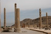
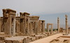
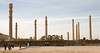
The above images may not be of the site on this page, but were taken nearby. They are loaded from Flickr so please click on them for image credits.
Click here to see more info for this site
Nearby sites
Click here to view sites on an interactive map of the areaKey: Red: member's photo, Blue: 3rd party photo, Yellow: other image, Green: no photo - please go there and take one, Grey: site destroyed
Download sites to:
KML (Google Earth)
GPX (GPS waypoints)
CSV (Garmin/Navman)
CSV (Excel)
To unlock full downloads you need to sign up as a Contributory Member. Otherwise downloads are limited to 50 sites.
Turn off the page maps and other distractions
Nearby sites listing. In the following links * = Image available
8.1km ENE 65° Tall-e Bakun* Ancient Village or Settlement
10.3km ENE 57° Persepolis* Ancient Palace
11.9km NE 39° Naqsh-e Rajab* Rock Art
13.4km NNE 28° Naghsh-e-Rostam* Rock Cut Tomb
14.5km NE 41° Estakhr* Ancient Village or Settlement
17.4km W 265° Gondashlu Stone Quarry Ancient Mine, Quarry or other Industry
48.8km NE 45° Tomb of Cyrus* Chambered Tomb
50.0km NE 45° Pasargadae* Ancient Palace
51.1km NE 45° Tall-e Takht* Hillfort
119.6km W 265° Bishapur* Ancient Village or Settlement
148.3km SSE 167° Yasouj Ancient Village or Settlement
250.1km WSW 254° Kharg Island Rock Art
329.3km NNW 339° Marabin Fire Temple* Ancient Temple
442.4km SW 217° Jawan Chambered Tomb Chambered Tomb
463.8km SSW 209° Dilmun Ancient Village or Settlement
465.7km SSW 209° Al Hajar Barrow Cemetery
465.7km SSW 210° Jannusan Barrow Cemetery
466.3km SSW 210° Barbar Temple Ancient Temple
466.7km SSW 210° Shakhurah Barrow Cemetery
470.5km SSW 209° Dilmun Monuments and Settlement* Ancient Village or Settlement
471.2km SSW 210° Janabiyah Barrow Cemetery
471.8km NNW 344° Kashan National Museum* Museum
472.3km WNW 301° Chogha Zanbil* Ancient Temple
472.5km SSW 209° cultural landscape of Ali Barrow Cemetery
473.3km NNW 344° Tepe Sialk* Ancient Temple
View more nearby sites and additional images


 We would like to know more about this location. Please feel free to add a brief description and any relevant information in your own language.
 Wir möchten mehr über diese Stätte erfahren. Bitte zögern Sie nicht, eine kurze Beschreibung und relevante Informationen in Deutsch hinzuzufügen.
 Nous aimerions en savoir encore un peu sur les lieux. S'il vous plaît n'hesitez pas à ajouter une courte description et tous les renseignements pertinents dans votre propre langue.
 Quisieramos informarnos un poco más de las lugares. No dude en añadir una breve descripción y otros datos relevantes en su propio idioma.