


<< Text Pages >> Valkenburg Flint Mine - Ancient Mine, Quarry or other Industry in Netherlands
Submitted by jopplanje on Monday, 11 March 2013 Page Views: 3019
Multi-periodSite Name: Valkenburg Flint Mine Alternative Name: Vuursteenmijn van ValkenburgCountry: Netherlands
NOTE: This site is 11.055 km away from the location you searched for.
Type: Ancient Mine, Quarry or other Industry
Nearest Town: Maastricht Nearest Village: Valkenburg a/d Geul
Latitude: 50.865480N Longitude: 5.823470E
Condition:
| 5 | Perfect |
| 4 | Almost Perfect |
| 3 | Reasonable but with some damage |
| 2 | Ruined but still recognisable as an ancient site |
| 1 | Pretty much destroyed, possibly visible as crop marks |
| 0 | No data. |
| -1 | Completely destroyed |
| 5 | Superb |
| 4 | Good |
| 3 | Ordinary |
| 2 | Not Good |
| 1 | Awful |
| 0 | No data. |
| 5 | Can be driven to, probably with disabled access |
| 4 | Short walk on a footpath |
| 3 | Requiring a bit more of a walk |
| 2 | A long walk |
| 1 | In the middle of nowhere, a nightmare to find |
| 0 | No data. |
| 5 | co-ordinates taken by GPS or official recorded co-ordinates |
| 4 | co-ordinates scaled from a detailed map |
| 3 | co-ordinates scaled from a bad map |
| 2 | co-ordinates of the nearest village |
| 1 | co-ordinates of the nearest town |
| 0 | no data |
Internal Links:
External Links:
Ancient Mine in the Netherlands
Remains of 7 pits of an ancient flint mine. The location is at the Plenkertstraat in Valkenburg, near the open air theatre and the Roman Catacombes (replica). More information on: megalieten.planje.info and vuursteenmijnen.nl.
You may be viewing yesterday's version of this page. To see the most up to date information please register for a free account.
Do not use the above information on other web sites or publications without permission of the contributor.
Nearby Images from Flickr
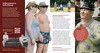


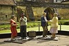
The above images may not be of the site on this page, but were taken nearby. They are loaded from Flickr so please click on them for image credits.
Click here to see more info for this site
Nearby sites
Click here to view sites on an interactive map of the areaKey: Red: member's photo, Blue: 3rd party photo, Yellow: other image, Green: no photo - please go there and take one, Grey: site destroyed
Download sites to:
KML (Google Earth)
GPX (GPS waypoints)
CSV (Garmin/Navman)
CSV (Excel)
To unlock full downloads you need to sign up as a Contributory Member. Otherwise downloads are limited to 50 sites.
Turn off the page maps and other distractions
Nearby sites listing. In the following links * = Image available
1.6km WNW 291° Gerlachusputje Holy Well or Sacred Spring
9.3km N 10° Sweikhuizen (341113) Ancient Village or Settlement
9.6km SW 215° Rijckholt Flint Mine* Ancient Mine, Quarry or other Industry
9.7km SW 221° Informatiecentrum Mijn Rijckholt Museum
9.8km WSW 257° Stenen van Sint-Pietersberg* Stone Circle
11.5km SSE 164° Slijpsteen van Slenaken Polissoir
11.9km NNW 338° Archeologiemuseum Stein* Museum
15.2km SE 131° Lambertusbron Holy Well or Sacred Spring
16.2km SE 137° Grafheuvel Vijlenerbos (47148) Round Barrow(s)
16.7km NW 315° Stenen op de Mechelse Heide* Natural Stone / Erratic / Other Natural Feature
17.2km NNE 23° Grabhügelgruppe in der Westerheide Barrow Cemetery
18.3km SE 131° Grafheuvel Vaals (47150) Round Barrow(s)
20.1km ESE 116° Lousberg Flint Quarry* Ancient Mine, Quarry or other Industry
20.6km SE 131° Grabhügelgruppe Unterer Backertsweg Barrow Cemetery
21.6km SE 132° Grabhügelgruppe Ginsterbrückweg Barrow Cemetery
22.4km SE 133° Klausberg Hügelgrab* Round Barrow(s)
22.6km WNW 297° Het Stenenpad* Museum
24.4km WNW 291° Duivelstenen van Langerlo* Standing Stones
25.0km SE 130° Zyklopensteine* Natural Stone / Erratic / Other Natural Feature
25.6km N 355° Regionaal archeologisch museum* Museum
26.8km WSW 250° Gallo-Romeins Museum* Museum
27.0km WSW 250° Tongeren standbeeld van Ambiorix* Modern Stone Circle etc
27.9km WSW 249° Romeinse Muur, Tongeren* Vitrified Fort
30.0km W 280° Kruisveldstraat* Stone Circle
30.1km ESE 120° Varnenum* Ancient Temple
View more nearby sites and additional images


 We would like to know more about this location. Please feel free to add a brief description and any relevant information in your own language.
 Wir möchten mehr über diese Stätte erfahren. Bitte zögern Sie nicht, eine kurze Beschreibung und relevante Informationen in Deutsch hinzuzufügen.
 Nous aimerions en savoir encore un peu sur les lieux. S'il vous plaît n'hesitez pas à ajouter une courte description et tous les renseignements pertinents dans votre propre langue.
 Quisieramos informarnos un poco más de las lugares. No dude en añadir una breve descripción y otros datos relevantes en su propio idioma.