


<< Our Photo Pages >> Hellvik - Round Barrow(s) in Norway in Rogaland
Submitted by kenntha88 on Friday, 09 October 2020 Page Views: 325
Neolithic and Bronze AgeSite Name: HellvikCountry: Norway
NOTE: This site is 6.084 km away from the location you searched for.
Fylke: Rogaland Type: Round Barrow(s)
Nearest Town: Egersund Nearest Village: Hellvik
Latitude: 58.484568N Longitude: 5.887162E
Condition:
| 5 | Perfect |
| 4 | Almost Perfect |
| 3 | Reasonable but with some damage |
| 2 | Ruined but still recognisable as an ancient site |
| 1 | Pretty much destroyed, possibly visible as crop marks |
| 0 | No data. |
| -1 | Completely destroyed |
| 5 | Superb |
| 4 | Good |
| 3 | Ordinary |
| 2 | Not Good |
| 1 | Awful |
| 0 | No data. |
| 5 | Can be driven to, probably with disabled access |
| 4 | Short walk on a footpath |
| 3 | Requiring a bit more of a walk |
| 2 | A long walk |
| 1 | In the middle of nowhere, a nightmare to find |
| 0 | No data. |
| 5 | co-ordinates taken by GPS or official recorded co-ordinates |
| 4 | co-ordinates scaled from a detailed map |
| 3 | co-ordinates scaled from a bad map |
| 2 | co-ordinates of the nearest village |
| 1 | co-ordinates of the nearest town |
| 0 | no data |
Internal Links:
External Links:
")
Inside a large fenced in grassy grazing ground for sheeps at the Hellvik farm is a really pretty round barrow. It is covered only with grass and can easily be seen from a far distance.
The barrow is 11 metres in diameter and around 2 metres in height according to kulturminnesøk. It has a very pretty rounded shape.
You may be viewing yesterday's version of this page. To see the most up to date information please register for a free account.
")
")
Do not use the above information on other web sites or publications without permission of the contributor.
Nearby Images from Flickr
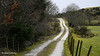
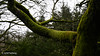
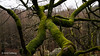
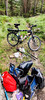
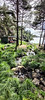
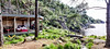
The above images may not be of the site on this page, but were taken nearby. They are loaded from Flickr so please click on them for image credits.
Click here to see more info for this site
Nearby sites
Click here to view sites on an interactive map of the areaKey: Red: member's photo, Blue: 3rd party photo, Yellow: other image, Green: no photo - please go there and take one, Grey: site destroyed
Download sites to:
KML (Google Earth)
GPX (GPS waypoints)
CSV (Garmin/Navman)
CSV (Excel)
To unlock full downloads you need to sign up as a Contributory Member. Otherwise downloads are limited to 50 sites.
Turn off the page maps and other distractions
Nearby sites listing. In the following links * = Image available
7.7km ESE 121° Gamle Prestegårdsvei* Standing Stone (Menhir)
8.9km SE 124° Stoplesteinane* Stone Circle
10.8km NNW 328° Vetteland Rune Stone* Carving
13.5km WNW 300° Midtre-Kvassheim* Barrow Cemetery
13.6km WNW 299° Sør-Kvassheim* Barrow Cemetery
14.0km WNW 301° Kvassheim cemetery* Barrow Cemetery
14.0km WNW 302° Revhaugen* Round Barrow(s)
14.7km NW 307° Rothauane* Cairn
14.7km ENE 78° Møgedal Runestone* Carving
14.9km WNW 302° Hårr* Long Barrow
15.0km NNE 27° Laksesvela* Barrow Cemetery
16.0km WNW 303° Hårvegen* Barrow Cemetery
17.3km NW 306° Stavnheim* Barrow Cemetery
19.3km NW 312° Haugelandshauen* Round Barrow(s)
19.3km NW 311° Bleigjehauen* Round Barrow(s)
19.5km NW 309° Sør-Husvegg* Barrow Cemetery
19.6km NW 310° Finnshaug* Barrow Cemetery
19.6km NW 311° Kolhauen* Round Barrow(s)
19.7km NNE 33° Auglend av Store Svela* Ancient Village or Settlement
20.4km NW 313° Nyvlestadhaugo* Round Barrow(s)
20.4km NNE 30° Storrsheia av Vigeså* Ancient Village or Settlement
20.5km NNE 27° Uadal av Vigeså* Ancient Village or Settlement
21.0km NW 313° Varhaug Barrows* Round Barrow(s)
21.5km NW 312° Kålhaug-Varhaug* Barrow Cemetery
21.9km NE 37° Øyane av Vigesdal barrow cemetery* Barrow Cemetery
View more nearby sites and additional images


 We would like to know more about this location. Please feel free to add a brief description and any relevant information in your own language.
 Wir möchten mehr über diese Stätte erfahren. Bitte zögern Sie nicht, eine kurze Beschreibung und relevante Informationen in Deutsch hinzuzufügen.
 Nous aimerions en savoir encore un peu sur les lieux. S'il vous plaît n'hesitez pas à ajouter une courte description et tous les renseignements pertinents dans votre propre langue.
 Quisieramos informarnos un poco más de las lugares. No dude en añadir una breve descripción y otros datos relevantes en su propio idioma.