


<< Text Pages >> Ommelebommelesteen - Natural Stone / Erratic / Other Natural Feature in Netherlands in Flevoland
Submitted by Hunengrab77 on Sunday, 18 June 2023 Page Views: 114
Natural PlacesSite Name: Ommelebommelesteen Alternative Name: OmmelebommelestiênCountry: Netherlands
NOTE: This site is 5.958 km away from the location you searched for.
Province: Flevoland Type: Natural Stone / Erratic / Other Natural Feature
Nearest Town: Urk
Latitude: 52.661750N Longitude: 5.590970E
Condition:
| 5 | Perfect |
| 4 | Almost Perfect |
| 3 | Reasonable but with some damage |
| 2 | Ruined but still recognisable as an ancient site |
| 1 | Pretty much destroyed, possibly visible as crop marks |
| 0 | No data. |
| -1 | Completely destroyed |
| 5 | Superb |
| 4 | Good |
| 3 | Ordinary |
| 2 | Not Good |
| 1 | Awful |
| 0 | No data. |
| 5 | Can be driven to, probably with disabled access |
| 4 | Short walk on a footpath |
| 3 | Requiring a bit more of a walk |
| 2 | A long walk |
| 1 | In the middle of nowhere, a nightmare to find |
| 0 | No data. |
| 5 | co-ordinates taken by GPS or official recorded co-ordinates |
| 4 | co-ordinates scaled from a detailed map |
| 3 | co-ordinates scaled from a bad map |
| 2 | co-ordinates of the nearest village |
| 1 | co-ordinates of the nearest town |
| 0 | no data |
Internal Links:
External Links:
Natural Stone / Erratic / Other Natural Feature in Flevoland
Erratic stone in the IJsselmeer (previously Zuiderzee), visible from the shore of the former fisher's island Urk, surrounded with folklore about the origin of children. Compare the Poppestien in the Frisian village Bergum, there seem to be more Dutch villages with similar stories surrounding boulders.
You may be viewing yesterday's version of this page. To see the most up to date information please register for a free account.
Do not use the above information on other web sites or publications without permission of the contributor.
Nearby Images from Flickr
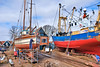
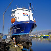
The above images may not be of the site on this page, but were taken nearby. They are loaded from Flickr so please click on them for image credits.
Click here to see more info for this site
Nearby sites
Click here to view sites on an interactive map of the areaKey: Red: member's photo, Blue: 3rd party photo, Yellow: other image, Green: no photo - please go there and take one, Grey: site destroyed
Download sites to:
KML (Google Earth)
GPX (GPS waypoints)
CSV (Garmin/Navman)
CSV (Excel)
To unlock full downloads you need to sign up as a Contributory Member. Otherwise downloads are limited to 50 sites.
Turn off the page maps and other distractions
Nearby sites listing. In the following links * = Image available
12.9km E 96° Ens (340995) Ancient Village or Settlement
18.8km SSW 214° Museum Batavialand Museum
20.0km WNW 285° Zuiderzeemuseum Museum
22.6km NNW 342° F1 Rijsterbos* Passage Grave
24.7km W 278° Grafheuvel Grootebroek (45447) Round Barrow(s)
30.5km WNW 282° Grafheuvels Wervershoof (46172) Round Barrow(s)
30.7km NNE 19° Zwerfsteen St. Nicolaasga* Natural Stone / Erratic / Other Natural Feature
30.9km WNW 282° Grafheuvel Wervershoof (46173) Round Barrow(s)
31.0km SSE 151° Zwerfsteen Doornspijk Natural Stone / Erratic / Other Natural Feature
37.2km ENE 64° Geologisch Monument Wolterholten* Natural Stone / Erratic / Other Natural Feature
37.5km NE 35° Zwerfsteen van Rottum* Natural Stone / Erratic / Other Natural Feature
38.1km SSE 160° Grafheuvels Nunspeet (45813) Round Barrow(s)
38.6km SSW 207° Almere Hout (511926) Ancient Village or Settlement
38.7km SSW 206° Almere Hout (511924) Ancient Village or Settlement
38.7km SSW 206° Almere Hout (511925) Ancient Village or Settlement
39.0km ENE 60° Grafheuvels Steenwijkerwold (46051) Round Barrow(s)
39.0km ENE 62° Grafheuvels Eesveen (46050) Round Barrow(s)
39.4km ENE 64° Koe en Kalf* Natural Stone / Erratic / Other Natural Feature
39.5km ENE 62° Grafheuvel Eesveen (46049) Round Barrow(s)
39.8km SSW 205° Almere Hout (511927) Ancient Village or Settlement
39.8km S 172° Grafheuvel Harderwijk (45438) Round Barrow(s)
39.9km SSE 158° Grafheuvel Vierhouten (45816) Round Barrow(s)
40.0km SSW 204° Almere Hout (511928) Ancient Village or Settlement
40.1km S 172° Grafheuvel Ermelo (45503) Round Barrow(s)
40.2km S 172° Grafheuvel Harderwijk (46218) Round Barrow(s)
View more nearby sites and additional images


 We would like to know more about this location. Please feel free to add a brief description and any relevant information in your own language.
 Wir möchten mehr über diese Stätte erfahren. Bitte zögern Sie nicht, eine kurze Beschreibung und relevante Informationen in Deutsch hinzuzufügen.
 Nous aimerions en savoir encore un peu sur les lieux. S'il vous plaît n'hesitez pas à ajouter une courte description et tous les renseignements pertinents dans votre propre langue.
 Quisieramos informarnos un poco más de las lugares. No dude en añadir una breve descripción y otros datos relevantes en su propio idioma.