


<< Our Photo Pages >> Håkon's Mound - Round Barrow(s) in Norway in Hordaland
Submitted by kenntha88 on Monday, 20 August 2012 Page Views: 1682
Neolithic and Bronze AgeSite Name: Håkon's Mound Alternative Name: SeimCountry: Norway
NOTE: This site is 9.601 km away from the location you searched for.
Fylke: Hordaland Type: Round Barrow(s)
Nearest Town: Bergen Nearest Village: Lindås
Latitude: 60.616001N Longitude: 5.278480E
Condition:
| 5 | Perfect |
| 4 | Almost Perfect |
| 3 | Reasonable but with some damage |
| 2 | Ruined but still recognisable as an ancient site |
| 1 | Pretty much destroyed, possibly visible as crop marks |
| 0 | No data. |
| -1 | Completely destroyed |
| 5 | Superb |
| 4 | Good |
| 3 | Ordinary |
| 2 | Not Good |
| 1 | Awful |
| 0 | No data. |
| 5 | Can be driven to, probably with disabled access |
| 4 | Short walk on a footpath |
| 3 | Requiring a bit more of a walk |
| 2 | A long walk |
| 1 | In the middle of nowhere, a nightmare to find |
| 0 | No data. |
| 5 | co-ordinates taken by GPS or official recorded co-ordinates |
| 4 | co-ordinates scaled from a detailed map |
| 3 | co-ordinates scaled from a bad map |
| 2 | co-ordinates of the nearest village |
| 1 | co-ordinates of the nearest town |
| 0 | no data |
Internal Links:
External Links:
")
This huge and very pretty round mound is called Håkonshaugen because the legend say King Håkon the good is buried here. This is highly speculative and cannot be proved, however the barrow is a very pretty example of a large round iron age barrow.
The mound is located on a grassy hillside with a very beautiful view over the fjord and the nearby islands. The terrain is steep and the tomb almost appear to have been built into the hillside.
It is around 35 metres wide and around 3-4 metres high. It has a very beautiful rounded shape! The grass growing around the barrow and the grass on top is regularly beeing cut short, making the mound very easy to see and to photograph!
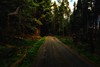
When I visited this site it was raining heavily and it was very windy, I was soaked after 2 minutes of beeing out of my car!
You may be viewing yesterday's version of this page. To see the most up to date information please register for a free account.
")
")
")
Do not use the above information on other web sites or publications without permission of the contributor.
Nearby Images from Flickr


The above images may not be of the site on this page, but were taken nearby. They are loaded from Flickr so please click on them for image credits.
Click here to see more info for this site
Nearby sites
Click here to view sites on an interactive map of the areaKey: Red: member's photo, Blue: 3rd party photo, Yellow: other image, Green: no photo - please go there and take one, Grey: site destroyed
Download sites to:
KML (Google Earth)
GPX (GPS waypoints)
CSV (Garmin/Navman)
CSV (Excel)
To unlock full downloads you need to sign up as a Contributory Member. Otherwise downloads are limited to 50 sites.
Turn off the page maps and other distractions
Nearby sites listing. In the following links * = Image available
881m NW 317° Rydland standing stones* Standing Stones
1.1km SSE 155° Votno standing stones* Standing Stones
15.3km SSW 193° Kongshaugen Mound* Round Barrow(s)
36.2km S 177° Grimseidvegen Standing Stone* Standing Stone (Menhir)
38.5km S 176° Munkevollen* Stone Circle
47.3km S 170° Ulven standing stone* Standing Stone (Menhir)
48.3km SSE 166° Lyssand-Smiehaugen* Round Barrow(s)
48.6km SSE 166° Hatvikvegen-Kongshaugen* Standing Stone (Menhir)
49.0km SSE 166° Solstrand Garden* Cairn
50.0km S 171° Skipalehaugen* Round Barrow(s)
51.7km S 170° Tennhaugen-Kongahaugen* Round Barrow(s)
53.4km SSE 161° Hansahaugen* Round Barrow(s)
54.1km SSE 161° Varmeholo* Rock Art
54.1km SSE 161° Steingsland* Cist
54.2km SSE 162° Vinnes Standing Stone* Standing Stone (Menhir)
54.2km SSE 161° Vollena-Stengsland* Cist
54.2km SSE 161° Mattisbrekka* Rock Art
54.5km SSE 162° Stølarøyso* Cairn
54.6km ESE 119° Grova* Round Barrow(s)
54.6km SSE 161° Revhaugen Hordaland* Cairn
57.0km E 89° Byrkjehaugen* Round Barrow(s)
59.3km ESE 113° Krakahaugen* Round Barrow(s)
59.5km E 89° Kvåle* Cist
59.7km E 89° Ormshaugen* Round Barrow(s)
59.9km ESE 122° Salthammeren Stone Age Carvings* Rock Art
View more nearby sites and additional images


 We would like to know more about this location. Please feel free to add a brief description and any relevant information in your own language.
 Wir möchten mehr über diese Stätte erfahren. Bitte zögern Sie nicht, eine kurze Beschreibung und relevante Informationen in Deutsch hinzuzufügen.
 Nous aimerions en savoir encore un peu sur les lieux. S'il vous plaît n'hesitez pas à ajouter une courte description et tous les renseignements pertinents dans votre propre langue.
 Quisieramos informarnos un poco más de las lugares. No dude en añadir una breve descripción y otros datos relevantes en su propio idioma.