<< Our Photo Pages >> Domsteinane - Stone Circle in Norway in Rogaland
Submitted by kenntha88 on Sunday, 19 August 2012 Page Views: 8664
Neolithic and Bronze AgeSite Name: DomsteinaneCountry: Norway Fylke: Rogaland Type: Stone Circle
Nearest Town: Sola Nearest Village: Stavanger
Latitude: 58.871909N Longitude: 5.605903E
Condition:
| 5 | Perfect |
| 4 | Almost Perfect |
| 3 | Reasonable but with some damage |
| 2 | Ruined but still recognisable as an ancient site |
| 1 | Pretty much destroyed, possibly visible as crop marks |
| 0 | No data. |
| -1 | Completely destroyed |
| 5 | Superb |
| 4 | Good |
| 3 | Ordinary |
| 2 | Not Good |
| 1 | Awful |
| 0 | No data. |
| 5 | Can be driven to, probably with disabled access |
| 4 | Short walk on a footpath |
| 3 | Requiring a bit more of a walk |
| 2 | A long walk |
| 1 | In the middle of nowhere, a nightmare to find |
| 0 | No data. |
| 5 | co-ordinates taken by GPS or official recorded co-ordinates |
| 4 | co-ordinates scaled from a detailed map |
| 3 | co-ordinates scaled from a bad map |
| 2 | co-ordinates of the nearest village |
| 1 | co-ordinates of the nearest town |
| 0 | no data |
Internal Links:
External Links:
I have visited· I would like to visit
BruteNorse would like to visit
lichen visited on 1st Sep 2020 - their rating: Cond: 3 Amb: 4 Access: 4
tofono have visited here
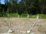
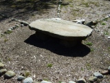
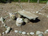
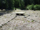
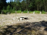
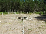
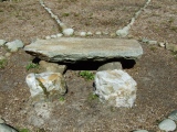
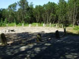
The stones around the outer edge are around 1 to 1.2 metres tall and with the tops ending in a point. In the centre of the stone circle is a stone formation consisting of a huge flat stone placed on top of two smaller square-shaped rocks, forming what looks like a table or altar. Just next to the altar it was found two white blocks of quartz. Around the altar was a ring of smaller round rocks.
From the ring of smaller rocks surrounding the altar is 8 lines of smaller round rocks radiating outward and reaching the edge of the outer ring of standing stones. All the outer standing stones are connected with another ring of smaller rocks between them, forming a circle.
Scandinavian stone rings are mostly associated with burials, but no burial was ever found in this stone circle. (In some stone circles, graves could have been added later and the stone circle actually older than the graves.)
The absence of graves and the altar in the middle makes it very possible that this monument have had other purposes, possibly ritualistic ones in the older iron age period.
This type of stone circles are very rare in scandinavia, and this is probably one of the most or the most unique stone circles in Norway.
The circle has been described several times since the 1700s. Until the 1800s, the whole circle was covered in sand, over the years several of the stones was taken away to be used in stairs, building constructions or garden furniture in several farms around the area. It was only some very few remains left of it in the beginning of the 1900s. In 2008, the stones were found again and replaced in their original positions based on descriptions from earlyer drawings. Today it can be seen as it was in its original shape.
So, what purpose did this monument have? Maybe a sun altar? A sacrificial site? I hope for theories and ideas from other users of this site!
If we would ever have something as a Scandinavian answer to stonehenge, this must be the closest we will ever get!
Note: Lots of new site submissions from Norway - thanks Kenneth
You may be viewing yesterday's version of this page. To see the most up to date information please register for a free account.






Do not use the above information on other web sites or publications without permission of the contributor.
Click here to see more info for this site
Nearby sites
Click here to view sites on an interactive map of the areaKey: Red: member's photo, Blue: 3rd party photo, Yellow: other image, Green: no photo - please go there and take one, Grey: site destroyed
Download sites to:
KML (Google Earth)
GPX (GPS waypoints)
CSV (Garmin/Navman)
CSV (Excel)
To unlock full downloads you need to sign up as a Contributory Member. Otherwise downloads are limited to 50 sites.
Turn off the page maps and other distractions
Nearby sites listing. In the following links * = Image available
1.2km S 177° Rægehaugene* Chambered Tomb
1.3km WSW 241° Ølbør Helleristninger* Rock Art
2.7km NNE 16° Melhaugen* Round Barrow(s)
3.1km N 8° Sømme standing stone* Standing Stone (Menhir)
3.2km S 186° Kjellehaugvegen* Standing Stone (Menhir)
3.3km S 176° Ormhaug (Orm's Mound)* Round Barrow(s)
3.5km SSW 200° Helland Runestone* Carving
3.6km ENE 62° Skadberg* Ancient Village or Settlement
3.6km SSW 203° Vigdelsvegen* Round Barrow(s)
3.7km SSW 205° Hedland Runestone* Carving
4.3km N 5° Hogstad standing stones* Standing Stones
4.6km S 185° Rudlehaugen* Round Barrow(s)
4.7km S 187° Valhaug* Round Barrow(s)
5.0km S 191° Byberg* Round Barrow(s)
5.1km E 96° Soma* Standing Stone (Menhir)
5.4km N 6° Risa Standing Stone* Standing Stone (Menhir)
5.5km SSW 195° Høseberghaugen* Round Barrow(s)
5.5km SSW 194° Horhørshaugen* Round Barrow(s)
5.7km S 191° Helheihaug* Round Barrow(s)
5.8km SSW 212° Dødssnødjo* Cairn
6.9km N 4° Stølsberget Standing Stones* Standing Stones
7.0km SSW 212° Tangarhaug* Cairn
7.2km SSW 205° Sele Runestone* Carving
7.8km N 2° Meling Standing Stone* Standing Stone (Menhir)
8.7km NNE 12° Fluberget* Rock Art
View more nearby sites and additional images




 We would like to know more about this location. Please feel free to add a brief description and any relevant information in your own language.
 Wir möchten mehr über diese Stätte erfahren. Bitte zögern Sie nicht, eine kurze Beschreibung und relevante Informationen in Deutsch hinzuzufügen.
 Nous aimerions en savoir encore un peu sur les lieux. S'il vous plaît n'hesitez pas à ajouter une courte description et tous les renseignements pertinents dans votre propre langue.
 Quisieramos informarnos un poco más de las lugares. No dude en añadir una breve descripción y otros datos relevantes en su propio idioma.