

<< Our Photo Pages >> Forrières - Stone Circle in Belgium in Luxembourg
Submitted by Alta-Falisa on Wednesday, 01 July 2015 Page Views: 2662
Neolithic and Bronze AgeSite Name: Forrières Alternative Name: Pierres du DiableCountry: Belgium
NOTE: This site is 4.963 km away from the location you searched for.
Province: Luxembourg Type: Stone Circle
Nearest Town: Rochefort
Latitude: 50.130400N Longitude: 5.267100E
Condition:
| 5 | Perfect |
| 4 | Almost Perfect |
| 3 | Reasonable but with some damage |
| 2 | Ruined but still recognisable as an ancient site |
| 1 | Pretty much destroyed, possibly visible as crop marks |
| 0 | No data. |
| -1 | Completely destroyed |
| 5 | Superb |
| 4 | Good |
| 3 | Ordinary |
| 2 | Not Good |
| 1 | Awful |
| 0 | No data. |
| 5 | Can be driven to, probably with disabled access |
| 4 | Short walk on a footpath |
| 3 | Requiring a bit more of a walk |
| 2 | A long walk |
| 1 | In the middle of nowhere, a nightmare to find |
| 0 | No data. |
| 5 | co-ordinates taken by GPS or official recorded co-ordinates |
| 4 | co-ordinates scaled from a detailed map |
| 3 | co-ordinates scaled from a bad map |
| 2 | co-ordinates of the nearest village |
| 1 | co-ordinates of the nearest town |
| 0 | no data |
Internal Links:
External Links:
")
In 1849, J.B. Geubel (archaeologist, but principally judge to nearby Marche-en-Famenne) described the site as :
"un assemblage de six Dol-men, formant à peu près un cercle, composés chacun de trois pierres l’une formant la table sur les deux autres. Les tables ont été renversées et chacune d’elles est encore appuyée contre ses bâses (sic)".
He interpretes the site as :
" (un) monument qui doit appartenir au druidisme […]. Comme il n’y a que 17 pierres, je me suis informé du sort de la 18e et l’on m’a dit qu’il y a très longtemps, elle avait servi à l’empierrement du chemin qui longe cette colline."
A that time, 17 stones were present. Geubel left a drawing a one of the triliths (see underneath) but none of the others.
The first academic excavations were conducted in August 1897 ; by then, six more stones has gone.
The excavations couldn't date the monument due to the scarcity of inconclusive artefacts (flints, bones, pottery) found on site. The initial occupation of the site may be the Bronze Age.
The site has been re-used at various epochs.
The site was bought by the State in 1949 and listed in 1974.
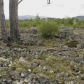
Today, six stones of various sizes subsist under a few small trees. At the beginning of the 20th c., a Cross has been erected in front of the site.
Main source : You may be viewing yesterday's version of this page. To see the most up to date information please register for a free account.
")
")
")
")
Do not use the above information on other web sites or publications without permission of the contributor.
Nearby Images from Flickr
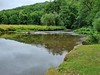
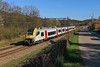
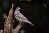
The above images may not be of the site on this page, but were taken nearby. They are loaded from Flickr so please click on them for image credits.
Click here to see more info for this site
Nearby sites
Click here to view sites on an interactive map of the areaKey: Red: member's photo, Blue: 3rd party photo, Yellow: other image, Green: no photo - please go there and take one, Grey: site destroyed
Download sites to:
KML (Google Earth)
GPX (GPS waypoints)
CSV (Garmin/Navman)
CSV (Excel)
To unlock full downloads you need to sign up as a Contributory Member. Otherwise downloads are limited to 50 sites.
Turn off the page maps and other distractions
Nearby sites listing. In the following links * = Image available
7.8km NNE 24° Bois des Lus* Modern Stone Circle etc
10.8km NNE 28° Pierre Saint-Hubert* Marker Stone
10.9km SSW 212° Pierre Misautée* Natural Stone / Erratic / Other Natural Feature
11.5km NNE 25° Pierre de Pîrîre* Modern Stone Circle etc
12.4km W 262° Lavaux-Sainte-Anne* Modern Stone Circle etc
19.9km ENE 63° Source Miraculeuse de Saint Thibaut Holy Well or Sacred Spring
24.7km WNW 294° Trou de Chaleux* Cave or Rock Shelter
26.1km SSE 150° Menhir de Renaumont* Standing Stone (Menhir)
27.0km NE 39° Menhirs d'Oppagne* Standing Stones
27.5km NE 39° Oppagne Dolmen* Burial Chamber or Dolmen
27.5km NE 39° Oppagne Menhirs* Standing Stones
27.6km NE 41° Pas-Bayard* Rock Outcrop
27.7km E 99° La Pierre Druidique* Polissoir
27.9km NE 39° Menhir Danthine* Standing Stone (Menhir)
28.1km NE 39° Alignement de Danthine* Stone Row / Alignment
28.8km NE 38° Bois du Vesin Menhir* Standing Stones
28.8km NE 41° Pierre du Carrefour des Sorcières* Natural Stone / Erratic / Other Natural Feature
28.8km NE 41° Cercle Historique* Museum
29.0km NE 39° Menhirs du Champ de la Longue Pierre* Standing Stone (Menhir)
29.0km NE 39° Wéris Dolmen* Burial Chamber or Dolmen
29.7km NE 39° Menhir de Morville* Standing Stone (Menhir)
29.9km NE 41° Pierre Haina* Rock Outcrop
30.1km NE 41° Lit du Diable* Rock Outcrop
30.4km E 86° Monument Europalia Portugal* Modern Stone Circle etc
32.7km NE 37° Menhir de Heyd* Standing Stone (Menhir)
View more nearby sites and additional images


 We would like to know more about this location. Please feel free to add a brief description and any relevant information in your own language.
 Wir möchten mehr über diese Stätte erfahren. Bitte zögern Sie nicht, eine kurze Beschreibung und relevante Informationen in Deutsch hinzuzufügen.
 Nous aimerions en savoir encore un peu sur les lieux. S'il vous plaît n'hesitez pas à ajouter une courte description et tous les renseignements pertinents dans votre propre langue.
 Quisieramos informarnos un poco más de las lugares. No dude en añadir una breve descripción y otros datos relevantes en su propio idioma.