


<< Our Photo Pages >> Roquepertuse - Ancient Temple in France in Provence:Alpes-Maritimes (06)
Submitted by Andy B on Monday, 04 July 2011 Page Views: 10015
Multi-periodSite Name: RoquepertuseCountry: France
NOTE: This site is 10.263 km away from the location you searched for.
Département: Provence:Alpes-Maritimes (06) Type: Ancient Temple
Nearest Town: Aix-en-Provence Nearest Village: Velaux
Latitude: 43.532300N Longitude: 5.269900E
Condition:
| 5 | Perfect |
| 4 | Almost Perfect |
| 3 | Reasonable but with some damage |
| 2 | Ruined but still recognisable as an ancient site |
| 1 | Pretty much destroyed, possibly visible as crop marks |
| 0 | No data. |
| -1 | Completely destroyed |
| 5 | Superb |
| 4 | Good |
| 3 | Ordinary |
| 2 | Not Good |
| 1 | Awful |
| 0 | No data. |
| 5 | Can be driven to, probably with disabled access |
| 4 | Short walk on a footpath |
| 3 | Requiring a bit more of a walk |
| 2 | A long walk |
| 1 | In the middle of nowhere, a nightmare to find |
| 0 | No data. |
| 5 | co-ordinates taken by GPS or official recorded co-ordinates |
| 4 | co-ordinates scaled from a detailed map |
| 3 | co-ordinates scaled from a bad map |
| 2 | co-ordinates of the nearest village |
| 1 | co-ordinates of the nearest town |
| 0 | no data |
Internal Links:
External Links:
I have visited· I would like to visit
Andy B has visited here
")
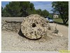
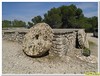
Officially, the findings have been dated to the 3rd century BC. This age has been established based on Celtic expansion into the area, which took place around the same time. However, the clothing and gestures of certain statues found at the site suggest that they date from the 5th or 6th century BC, instead. These statues are distinguished by their unique seated position, comparable to the upright and cross-legged seated position found in statues depicting the Buddha.
The first interpretations of archaeologists was that this was a secluded sanctuary. The latest findings, from various multidisciplinary studies, suggest that it was an agglomeration of about 0.5 hectares with a sanctuary to the north, as well as a bulwark of protection.
The site is important in part because it provides evidence for the Celtic "head cult" described in Greek and Roman accounts.
Read more at Wikipedia
Note: Excavations suggest the French Celts had a taste for beer
You may be viewing yesterday's version of this page. To see the most up to date information please register for a free account.
Do not use the above information on other web sites or publications without permission of the contributor.
Nearby Images from Flickr
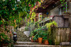
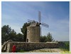
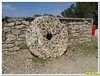
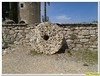
The above images may not be of the site on this page, but were taken nearby. They are loaded from Flickr so please click on them for image credits.
Click here to see more info for this site
Nearby sites
Click here to view sites on an interactive map of the areaKey: Red: member's photo, Blue: 3rd party photo, Yellow: other image, Green: no photo - please go there and take one, Grey: site destroyed
Download sites to:
KML (Google Earth)
GPX (GPS waypoints)
CSV (Garmin/Navman)
CSV (Excel)
To unlock full downloads you need to sign up as a Contributory Member. Otherwise downloads are limited to 50 sites.
Turn off the page maps and other distractions
Nearby sites listing. In the following links * = Image available
5.5km SSW 198° Oppidum ligure du Castellas* Ancient Village or Settlement
11.9km W 279° Oppidum de Constantine* Ancient Village or Settlement
13.8km SSW 192° Montretout Oppidium Hillfort
13.8km E 81° Entremont Oppidium* Hillfort
14.5km E 92° Mousse Fountain Holy Well or Sacred Spring
14.9km E 93° La Blaque Burial Chamber or Dolmen
18.2km S 185° Abri de Laure Cave or Rock Shelter
18.2km S 185° Les Heritages Cave or Rock Shelter
19.8km NNW 337° Oppidum St Jean de Vernègues* Ancient Village or Settlement
19.8km NNE 30° Le Moulestre Cave or Rock Shelter
19.9km NNE 31° St-Valentin Cave or Rock Shelter
20.4km E 85° Sepulture de St-Marc Burial Chamber or Dolmen
20.5km SSW 195° Pas de la Fosse Artificial Mound
22.4km SE 130° Grotte du Facteur Cave or Rock Shelter
22.6km W 266° Castellan Oppidium Hillfort
22.9km W 264° Rassuen Cave or Rock Shelter
23.3km SE 130° Grotte de l'Ermite Cave or Rock Shelter
23.7km SE 124° Oppidium de Mimet Ancient Village or Settlement
23.7km ENE 61° Dolmen de La Plaine 1 Burial Chamber or Dolmen
24.0km N 8° Les Vachons (Lauris) Cave or Rock Shelter
24.2km E 95° Dolmen de Maurely Burial Chamber or Dolmen
24.5km WSW 251° Oppidum Saint-Blaise* Ancient Village or Settlement
24.5km E 101° Grotte Sicard Cave or Rock Shelter
24.5km ESE 101° Grotte des Abeilles Cave or Rock Shelter
24.6km E 101° Grotte de la Marane Cave or Rock Shelter
View more nearby sites and additional images


 We would like to know more about this location. Please feel free to add a brief description and any relevant information in your own language.
 Wir möchten mehr über diese Stätte erfahren. Bitte zögern Sie nicht, eine kurze Beschreibung und relevante Informationen in Deutsch hinzuzufügen.
 Nous aimerions en savoir encore un peu sur les lieux. S'il vous plaît n'hesitez pas à ajouter une courte description et tous les renseignements pertinents dans votre propre langue.
 Quisieramos informarnos un poco más de las lugares. No dude en añadir una breve descripción y otros datos relevantes en su propio idioma.