

<< Text Pages >> Grafheuvel Lage Vuursche (45134) - Round Barrow(s) in Netherlands in Utrecht
Submitted by XIII on Saturday, 25 July 2015 Page Views: 1189
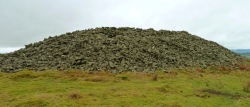
Neolithic and Bronze AgeSite Name: Grafheuvel Lage Vuursche (45134)Country: Netherlands
NOTE: This site is 4.354 km away from the location you searched for.
Province: Utrecht Type: Round Barrow(s)
Nearest Town: Lage Vuursche
Latitude: 52.190308N Longitude: 5.235815E
Condition:
| 5 | Perfect |
| 4 | Almost Perfect |
| 3 | Reasonable but with some damage |
| 2 | Ruined but still recognisable as an ancient site |
| 1 | Pretty much destroyed, possibly visible as crop marks |
| 0 | No data. |
| -1 | Completely destroyed |
| 5 | Superb |
| 4 | Good |
| 3 | Ordinary |
| 2 | Not Good |
| 1 | Awful |
| 0 | No data. |
| 5 | Can be driven to, probably with disabled access |
| 4 | Short walk on a footpath |
| 3 | Requiring a bit more of a walk |
| 2 | A long walk |
| 1 | In the middle of nowhere, a nightmare to find |
| 0 | No data. |
| 5 | co-ordinates taken by GPS or official recorded co-ordinates |
| 4 | co-ordinates scaled from a detailed map |
| 3 | co-ordinates scaled from a bad map |
| 2 | co-ordinates of the nearest village |
| 1 | co-ordinates of the nearest town |
| 0 | no data |
Be the first person to rate this site - see the 'Contribute!' box in the right hand menu.
Internal Links:
External Links:
Round Barrow in Utrecht
Rijksmonument (national monument) number: 45134
You may be viewing yesterday's version of this page. To see the most up to date information please register for a free account.
Do not use the above information on other web sites or publications without permission of the contributor.
Nearby Images from Flickr
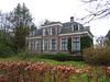
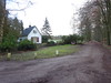
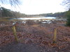
The above images may not be of the site on this page, but were taken nearby. They are loaded from Flickr so please click on them for image credits.
Click here to see more info for this site
Nearby sites
Click here to view sites on an interactive map of the areaKey: Red: member's photo, Blue: 3rd party photo, Yellow: other image, Green: no photo - please go there and take one, Grey: site destroyed
Download sites to:
KML (Google Earth)
GPX (GPS waypoints)
CSV (Garmin/Navman)
CSV (Excel)
To unlock full downloads you need to sign up as a Contributory Member. Otherwise downloads are limited to 50 sites.
Turn off the page maps and other distractions
Nearby sites listing. In the following links * = Image available
1.0km SSW 209° Grafheuvels Lage Vuursche (45252) Round Barrow(s)
1.5km SW 219° Kei van Lage Vuursche Natural Stone / Erratic / Other Natural Feature
5.1km ESE 116° Enghenbergje* Round Barrow(s)
5.3km NNW 342° Grafheuvels Laren (45642)* Round Barrow(s)
5.3km NNW 345° Grafheuvel Laren (45636) Round Barrow(s)
5.3km NNW 343° Zeven Bergjes* Round Barrow(s)
5.9km NW 312° Kei van Hilversum* Natural Stone / Erratic / Other Natural Feature
6.5km NNW 343° Geologisch Museum Hofland* Museum
6.8km NNW 329° Grafheuvels Westerheide* Round Barrow(s)
6.8km NNW 331° Grafheuvels Westerheide 2* Round Barrow(s)
6.9km NNW 334° Grafheuvel Laren (45634) Round Barrow(s)
7.0km NNW 337° Grafheuvel Laren (45635) Round Barrow(s)
7.2km NNW 335° Grafheuvels Westerheide 3* Round Barrow(s)
7.4km NNW 329° Grafheuvels Hilversum (45550) Round Barrow(s)
7.6km NNW 332° Zwerfkei Aardjesberg* Natural Stone / Erratic / Other Natural Feature
8.1km SE 124° Grafheuvel Monnikenbosch (45993)* Round Barrow(s)
10.3km ESE 120° Galgenberg Amersfoort (45449)* Round Barrow(s)
10.4km ESE 119° Grafheuvel Amersfoort (45448) Round Barrow(s)
10.4km N 351° Grafheuvel Huizen (45654) Round Barrow(s)
11.1km ESE 112° Amersfoortse Kei* Natural Stone / Erratic / Other Natural Feature
11.3km SE 133° Grafheuvels Oud Leusden Round Barrow(s)
13.8km SE 141° Grafheuvels Leusden Zuid (45629)* Round Barrow(s)
14.1km SSW 213° De Gesloten Steen* Natural Stone / Erratic / Other Natural Feature
15.2km SSE 157° Grafheuvels Driebergen Rijsenburg (45504)* Round Barrow(s)
16.0km SSE 152° Zwerfsteneneiland Modern Stone Circle etc
View more nearby sites and additional images


 We would like to know more about this location. Please feel free to add a brief description and any relevant information in your own language.
 Wir möchten mehr über diese Stätte erfahren. Bitte zögern Sie nicht, eine kurze Beschreibung und relevante Informationen in Deutsch hinzuzufügen.
 Nous aimerions en savoir encore un peu sur les lieux. S'il vous plaît n'hesitez pas à ajouter une courte description et tous les renseignements pertinents dans votre propre langue.
 Quisieramos informarnos un poco más de las lugares. No dude en añadir una breve descripción y otros datos relevantes en su propio idioma.