


<< Our Photo Pages >> Pierre du Diable (Haillot) - Standing Stones in Belgium in Namur
Submitted by Alta-Falisa on Sunday, 24 August 2014 Page Views: 2981
Neolithic and Bronze AgeSite Name: Pierre du Diable (Haillot)Country: Belgium
NOTE: This site is 2.626 km away from the location you searched for.
Province: Namur Type: Standing Stones
Nearest Town: Haillot
Latitude: 50.447840N Longitude: 5.145930E
Condition:
| 5 | Perfect |
| 4 | Almost Perfect |
| 3 | Reasonable but with some damage |
| 2 | Ruined but still recognisable as an ancient site |
| 1 | Pretty much destroyed, possibly visible as crop marks |
| 0 | No data. |
| -1 | Completely destroyed |
| 5 | Superb |
| 4 | Good |
| 3 | Ordinary |
| 2 | Not Good |
| 1 | Awful |
| 0 | No data. |
| 5 | Can be driven to, probably with disabled access |
| 4 | Short walk on a footpath |
| 3 | Requiring a bit more of a walk |
| 2 | A long walk |
| 1 | In the middle of nowhere, a nightmare to find |
| 0 | No data. |
| 5 | co-ordinates taken by GPS or official recorded co-ordinates |
| 4 | co-ordinates scaled from a detailed map |
| 3 | co-ordinates scaled from a bad map |
| 2 | co-ordinates of the nearest village |
| 1 | co-ordinates of the nearest town |
| 0 | no data |
Internal Links:
External Links:
 (PID:121862)")
Like all the menhirs of the region, its typical trapezoidal shape ("Zeupire") is quite obvious, even if the tip is missing. The material is the typical Puddingstone.
Photo : 03 August 2014.
You may be viewing yesterday's version of this page. To see the most up to date information please register for a free account.
 (PID:131527)")
 (PID:121996)")
 (PID:121968)")
Do not use the above information on other web sites or publications without permission of the contributor.
Nearby Images from Flickr

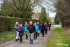
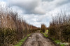
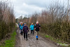
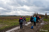
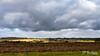
The above images may not be of the site on this page, but were taken nearby. They are loaded from Flickr so please click on them for image credits.
Click here to see more info for this site
Nearby sites
Click here to view sites on an interactive map of the areaKey: Red: member's photo, Blue: 3rd party photo, Yellow: other image, Green: no photo - please go there and take one, Grey: site destroyed
Download sites to:
KML (Google Earth)
GPX (GPS waypoints)
CSV (Garmin/Navman)
CSV (Excel)
To unlock full downloads you need to sign up as a Contributory Member. Otherwise downloads are limited to 50 sites.
Turn off the page maps and other distractions
Nearby sites listing. In the following links * = Image available
1.4km N 356° Coussin de Saint-Mort* Early Christian Sculptured Stone
9.2km E 101° Othée Tumulus* Barrow Cemetery
9.3km W 267° Grottes de Goyet* Cave or Rock Shelter
9.4km WNW 296° Grotte Scladina* Cave or Rock Shelter
19.0km NE 41° Menhir du Grand Bois* Standing Stone (Menhir)
19.1km NE 41° Musée du Château de Jehay* Museum
19.7km W 269° Pierre du Diable (Velaine sur Meuse)* Burial Chamber or Dolmen
19.8km W 275° Musée archéologique de Namur* Museum
19.8km W 274° Grognon* Ancient Village or Settlement
20.3km E 85° Grosse Pierre d'Ellemelle* Standing Stone (Menhir)
21.1km ENE 78° Borne seigneurale de Houchenée* Marker Stone
21.4km WSW 243° Menhirs de Frappe-Cul* Natural Stone / Erratic / Other Natural Feature
22.6km WSW 241° Musée Archéologique de la Haute-Meuse* Museum
23.6km WSW 242° Pierres Jumelles d'Annevoie* Rock Outcrop
24.6km NE 49° Grottes Schmerling* Cave or Rock Shelter
24.7km NE 53° Prehistomuseum* Museum
25.0km SW 228° Pierre du Diable - Anhée* Rock Outcrop
28.3km SSE 151° Pierre de Pîrîre* Modern Stone Circle etc
28.5km ENE 70° Fine Pierre de Plainevaux* Rock Outcrop
28.7km W 266° Pierre Sainte-Agathe* Rock Outcrop
29.0km SSW 209° Trou de Chaleux* Cave or Rock Shelter
29.1km SW 234° Montaigle Castle Caves* Museum
29.1km SSE 152° Pierre Saint-Hubert* Marker Stone
29.2km ESE 116° Bois du Vesin Menhir* Standing Stones
29.5km NE 34° Tumulus de Noville* Round Barrow(s)
View more nearby sites and additional images


 We would like to know more about this location. Please feel free to add a brief description and any relevant information in your own language.
 Wir möchten mehr über diese Stätte erfahren. Bitte zögern Sie nicht, eine kurze Beschreibung und relevante Informationen in Deutsch hinzuzufügen.
 Nous aimerions en savoir encore un peu sur les lieux. S'il vous plaît n'hesitez pas à ajouter une courte description et tous les renseignements pertinents dans votre propre langue.
 Quisieramos informarnos un poco más de las lugares. No dude en añadir una breve descripción y otros datos relevantes en su propio idioma.