


<< Our Photo Pages >> Lavaux-Sainte-Anne - Modern Stone Circle etc in Belgium in Namur
Submitted by davidmorgan on Sunday, 05 July 2015 Page Views: 2001
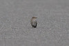
Modern SitesSite Name: Lavaux-Sainte-AnneCountry: Belgium
NOTE: This site is 4.487 km away from the location you searched for.
Province: Namur Type: Modern Stone Circle etc
Nearest Town: Lavaux-Sainte-Anne
Latitude: 50.115406N Longitude: 5.094722E
Condition:
| 5 | Perfect |
| 4 | Almost Perfect |
| 3 | Reasonable but with some damage |
| 2 | Ruined but still recognisable as an ancient site |
| 1 | Pretty much destroyed, possibly visible as crop marks |
| 0 | No data. |
| -1 | Completely destroyed |
| 5 | Superb |
| 4 | Good |
| 3 | Ordinary |
| 2 | Not Good |
| 1 | Awful |
| 0 | No data. |
| 5 | Can be driven to, probably with disabled access |
| 4 | Short walk on a footpath |
| 3 | Requiring a bit more of a walk |
| 2 | A long walk |
| 1 | In the middle of nowhere, a nightmare to find |
| 0 | No data. |
| 5 | co-ordinates taken by GPS or official recorded co-ordinates |
| 4 | co-ordinates scaled from a detailed map |
| 3 | co-ordinates scaled from a bad map |
| 2 | co-ordinates of the nearest village |
| 1 | co-ordinates of the nearest town |
| 0 | no data |
Internal Links:
External Links:
I have visited· I would like to visit
SallyJacobsDeHaydock visited on 23rd Jun 2015 - their rating: Cond: 4 Amb: 4 Access: 5
")
Photo credit: Sally Jacobs / De Haydock photography
You may be viewing yesterday's version of this page. To see the most up to date information please register for a free account.
Do not use the above information on other web sites or publications without permission of the contributor.
Nearby Images from Flickr

The above images may not be of the site on this page, but were taken nearby. They are loaded from Flickr so please click on them for image credits.
Click here to see more info for this site
Nearby sites
Click here to view sites on an interactive map of the areaKey: Red: member's photo, Blue: 3rd party photo, Yellow: other image, Green: no photo - please go there and take one, Grey: site destroyed
Download sites to:
KML (Google Earth)
GPX (GPS waypoints)
CSV (Garmin/Navman)
CSV (Excel)
To unlock full downloads you need to sign up as a Contributory Member. Otherwise downloads are limited to 50 sites.
Turn off the page maps and other distractions
Nearby sites listing. In the following links * = Image available
9.9km SE 139° Pierre Misautée* Natural Stone / Erratic / Other Natural Feature
12.4km E 82° Forrières* Stone Circle
15.5km NW 318° Trou de Chaleux* Cave or Rock Shelter
17.8km ENE 60° Bois des Lus* Modern Stone Circle etc
20.6km ENE 57° Pierre Saint-Hubert* Marker Stone
21.0km NE 55° Pierre de Pîrîre* Modern Stone Circle etc
25.0km NW 324° Pierre du Diable - Anhée* Rock Outcrop
27.9km NW 315° Montaigle Castle Caves* Museum
29.7km W 265° Malgré Tout* Museum
30.7km NNW 328° Musée Archéologique de la Haute-Meuse* Museum
31.0km NNW 326° Pierres Jumelles d'Annevoie* Rock Outcrop
31.5km NNW 331° Menhirs de Frappe-Cul* Natural Stone / Erratic / Other Natural Feature
31.7km SSW 208° Pierre à marier* Natural Stone / Erratic / Other Natural Feature
31.9km ENE 70° Source Miraculeuse de Saint Thibaut Holy Well or Sacred Spring
32.8km SE 130° Menhir de Renaumont* Standing Stone (Menhir)
33.5km SW 222° Roc la Tour Natural Stone / Erratic / Other Natural Feature
37.0km N 351° Grottes de Goyet* Cave or Rock Shelter
37.0km NE 53° Menhirs d'Oppagne* Standing Stones
37.1km N 6° Pierre du Diable (Haillot)* Standing Stones
37.5km NNE 20° Othée Tumulus* Barrow Cemetery
37.6km NE 52° Oppagne Dolmen* Burial Chamber or Dolmen
37.6km NE 52° Oppagne Menhirs* Standing Stones
37.9km SW 231° Les Dames de Meuse Natural Stone / Erratic / Other Natural Feature
37.9km NE 54° Pas-Bayard* Rock Outcrop
37.9km NE 52° Menhir Danthine* Standing Stone (Menhir)
View more nearby sites and additional images


 We would like to know more about this location. Please feel free to add a brief description and any relevant information in your own language.
 Wir möchten mehr über diese Stätte erfahren. Bitte zögern Sie nicht, eine kurze Beschreibung und relevante Informationen in Deutsch hinzuzufügen.
 Nous aimerions en savoir encore un peu sur les lieux. S'il vous plaît n'hesitez pas à ajouter une courte description et tous les renseignements pertinents dans votre propre langue.
 Quisieramos informarnos un poco más de las lugares. No dude en añadir una breve descripción y otros datos relevantes en su propio idioma.