


<< Our Photo Pages >> Haraldshaugen Barrow - Round Barrow(s) in Norway in Rogaland
Submitted by kenntha88 on Monday, 17 September 2012 Page Views: 2066
Neolithic and Bronze AgeSite Name: Haraldshaugen BarrowCountry: Norway
NOTE: This site is 10.978 km away from the location you searched for.
Fylke: Rogaland Type: Round Barrow(s)
Nearest Town: Haugesund
Latitude: 59.428662N Longitude: 5.258739E
Condition:
| 5 | Perfect |
| 4 | Almost Perfect |
| 3 | Reasonable but with some damage |
| 2 | Ruined but still recognisable as an ancient site |
| 1 | Pretty much destroyed, possibly visible as crop marks |
| 0 | No data. |
| -1 | Completely destroyed |
| 5 | Superb |
| 4 | Good |
| 3 | Ordinary |
| 2 | Not Good |
| 1 | Awful |
| 0 | No data. |
| 5 | Can be driven to, probably with disabled access |
| 4 | Short walk on a footpath |
| 3 | Requiring a bit more of a walk |
| 2 | A long walk |
| 1 | In the middle of nowhere, a nightmare to find |
| 0 | No data. |
| 5 | co-ordinates taken by GPS or official recorded co-ordinates |
| 4 | co-ordinates scaled from a detailed map |
| 3 | co-ordinates scaled from a bad map |
| 2 | co-ordinates of the nearest village |
| 1 | co-ordinates of the nearest town |
| 0 | no data |
Internal Links:
External Links:
I have visited· I would like to visit
BruteNorse visited on 5th Feb 2018 - their rating: Cond: 3 Amb: 4 Access: 5
")
This is considered the barrow mound of Harald Fairhair, the first king of Norway, however if this is really his grave it is disputable. This place is mentioned in the Snorre Sturlasson kings sagas.
It reads as following:
"King Harald died of disease in Rogaland and is buried in Haugar in a mound overlooking the Karmøy sound." There is however disputes about this exact barrow could be the tomb of Harald Fairhair.
In later years the mound was reconstructed and a large stone pillar was erected on top of the mound and 12 smaller in a ring around the edges.
The mound itself is around 30 metres in diameter and around 6 metres in height. It has a very pretty rounded shape. From the mound it is a beautiful view over the open ocean.
You may be viewing yesterday's version of this page. To see the most up to date information please register for a free account.
")
")
")
Do not use the above information on other web sites or publications without permission of the contributor.
Nearby Images from Flickr
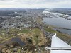
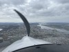
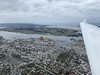

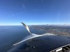
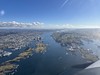
The above images may not be of the site on this page, but were taken nearby. They are loaded from Flickr so please click on them for image credits.
Click here to see more info for this site
Nearby sites
Click here to view sites on an interactive map of the areaKey: Red: member's photo, Blue: 3rd party photo, Yellow: other image, Green: no photo - please go there and take one, Grey: site destroyed
Download sites to:
KML (Google Earth)
GPX (GPS waypoints)
CSV (Garmin/Navman)
CSV (Excel)
To unlock full downloads you need to sign up as a Contributory Member. Otherwise downloads are limited to 50 sites.
Turn off the page maps and other distractions
Nearby sites listing. In the following links * = Image available
5.3km SSE 165° Storhaugen* Round Barrow(s)
5.7km S 170° Kjørkhaug* Round Barrow(s)
6.3km SSE 159° De Fem Dårlige Jomfruer* Stone Circle
7.2km S 171° Grønhaug* Round Barrow(s)
7.6km S 177° Reheia Cemetery* Barrow Cemetery
8.2km SSE 167° Flagghaugen* Round Barrow(s)
8.3km SSE 167° Sewing Needle of The Virgin Mary* Standing Stone (Menhir)
8.4km SSE 168° Kuhaugen og Kongshaugen* Round Barrow(s)
8.7km SSW 192° Avaldsnes Barrow Cemetery
11.4km E 87° Grinde Bautarsteinar, Tysvær* Standing Stones
19.6km E 86° Bautasteinene på Erland* Standing Stones
21.4km SE 135° Resastaven* Standing Stone (Menhir)
25.2km SSE 154° Øyren Standing Stone* Standing Stone (Menhir)
25.5km SSE 153° Alvestad* Cairn
26.4km SSE 150° Søre Våge Bautastein* Standing Stone (Menhir)
34.2km NE 35° Bjoavågen* Carving
34.6km NE 34° Utbjoa* Cairn
35.5km ENE 67° Østabøstødl - Rabbadn* Barrow Cemetery
37.5km ENE 77° Hundehaugene* Standing Stone (Menhir)
38.1km SSE 150° Galteveien-Hedlehaugen* Standing Stone (Menhir)
38.1km SSE 150° Leik-Haug Galta* Cairn
39.1km SSE 149° Voll Standing Stone* Standing Stone (Menhir)
39.3km SSE 151° Helleneset* Standing Stone (Menhir)
40.0km SSE 147° Sørbø Runestone* Carving
40.1km SSE 147° Austhaugstyttå* Standing Stone (Menhir)
View more nearby sites and additional images


 We would like to know more about this location. Please feel free to add a brief description and any relevant information in your own language.
 Wir möchten mehr über diese Stätte erfahren. Bitte zögern Sie nicht, eine kurze Beschreibung und relevante Informationen in Deutsch hinzuzufügen.
 Nous aimerions en savoir encore un peu sur les lieux. S'il vous plaît n'hesitez pas à ajouter une courte description et tous les renseignements pertinents dans votre propre langue.
 Quisieramos informarnos un poco más de las lugares. No dude en añadir una breve descripción y otros datos relevantes en su propio idioma.