


<< Other Photo Pages >> Pierre à marier - Natural Stone / Erratic / Other Natural Feature in Belgium in Namur
Submitted by Alta-Falisa on Wednesday, 03 May 2017 Page Views: 1262
Natural PlacesSite Name: Pierre à marierCountry: Belgium
NOTE: This site is 21.723 km away from the location you searched for.
Province: Namur Type: Natural Stone / Erratic / Other Natural Feature
Nearest Town: Bouillon
Latitude: 49.864600N Longitude: 4.885100E
Condition:
| 5 | Perfect |
| 4 | Almost Perfect |
| 3 | Reasonable but with some damage |
| 2 | Ruined but still recognisable as an ancient site |
| 1 | Pretty much destroyed, possibly visible as crop marks |
| 0 | No data. |
| -1 | Completely destroyed |
| 5 | Superb |
| 4 | Good |
| 3 | Ordinary |
| 2 | Not Good |
| 1 | Awful |
| 0 | No data. |
| 5 | Can be driven to, probably with disabled access |
| 4 | Short walk on a footpath |
| 3 | Requiring a bit more of a walk |
| 2 | A long walk |
| 1 | In the middle of nowhere, a nightmare to find |
| 0 | No data. |
| 5 | co-ordinates taken by GPS or official recorded co-ordinates |
| 4 | co-ordinates scaled from a detailed map |
| 3 | co-ordinates scaled from a bad map |
| 2 | co-ordinates of the nearest village |
| 1 | co-ordinates of the nearest town |
| 0 | no data |
Internal Links:
External Links:
")
Legendary stone, playing a role in the local folklore.
More about its discovery : Pierre à marier
Since July 1982, laid on the right bank of the River Semois, near the bridge, in the centre of the village.
You may be viewing yesterday's version of this page. To see the most up to date information please register for a free account.
")
")
Do not use the above information on other web sites or publications without permission of the contributor.
Nearby Images from Flickr


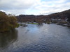

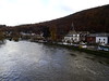
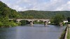
The above images may not be of the site on this page, but were taken nearby. They are loaded from Flickr so please click on them for image credits.
Click here to see more info for this site
Nearby sites
Click here to view sites on an interactive map of the areaKey: Red: member's photo, Blue: 3rd party photo, Yellow: other image, Green: no photo - please go there and take one, Grey: site destroyed
Download sites to:
KML (Google Earth)
GPX (GPS waypoints)
CSV (Garmin/Navman)
CSV (Excel)
To unlock full downloads you need to sign up as a Contributory Member. Otherwise downloads are limited to 50 sites.
Turn off the page maps and other distractions
Nearby sites listing. In the following links * = Image available
7.8km WNW 292° Roc la Tour Natural Stone / Erratic / Other Natural Feature
15.2km WNW 286° Les Dames de Meuse Natural Stone / Erratic / Other Natural Feature
26.3km WSW 246° Allée couverte de la Ganguille* Burial Chamber or Dolmen
26.8km SW 233° Dolmen dit la Table des Fées* Burial Chamber or Dolmen
29.1km NNW 330° Malgré Tout* Museum
29.6km NE 46° Pierre Misautée* Natural Stone / Erratic / Other Natural Feature
31.7km NNE 28° Lavaux-Sainte-Anne* Modern Stone Circle etc
32.4km NW 314° Roche Trouée* Cave or Rock Shelter
39.3km WNW 300° Pierre qui Tourne (Baileux)* Standing Stone (Menhir)
39.7km N 7° Trou de Chaleux* Cave or Rock Shelter
39.9km E 94° Menhir de Lahérie* Standing Stone (Menhir)
40.2km NE 43° Forrières* Stone Circle
40.9km E 97° Polissoir de Sart* Polissoir
40.9km E 80° Menhir de Renaumont* Standing Stone (Menhir)
47.7km NE 40° Bois des Lus* Modern Stone Circle etc
47.8km N 354° Montaigle Castle Caves* Museum
48.0km N 0° Pierre du Diable - Anhée* Rock Outcrop
50.8km NE 39° Pierre Saint-Hubert* Marker Stone
51.3km NE 39° Pierre de Pîrîre* Modern Stone Circle etc
53.7km N 358° Pierres Jumelles d'Annevoie* Rock Outcrop
53.9km NW 305° Rouge de Rance* Modern Stone Circle etc
53.9km N 359° Musée Archéologique de la Haute-Meuse* Museum
55.3km N 359° Menhirs de Frappe-Cul* Natural Stone / Erratic / Other Natural Feature
55.9km SW 231° Ecly Dolmen Burial Chamber or Dolmen
56.2km SW 224° Acy-Romance Ancient Village or Settlement
View more nearby sites and additional images


 We would like to know more about this location. Please feel free to add a brief description and any relevant information in your own language.
 Wir möchten mehr über diese Stätte erfahren. Bitte zögern Sie nicht, eine kurze Beschreibung und relevante Informationen in Deutsch hinzuzufügen.
 Nous aimerions en savoir encore un peu sur les lieux. S'il vous plaît n'hesitez pas à ajouter une courte description et tous les renseignements pertinents dans votre propre langue.
 Quisieramos informarnos un poco más de las lugares. No dude en añadir una breve descripción y otros datos relevantes en su propio idioma.