

, Aubrey Burl")
<< Other Photo Pages >> Cemka Hoyugu - Ancient Village or Settlement in Turkey
Submitted by davidmorgan on Saturday, 09 November 2019 Page Views: 1175
Multi-periodSite Name: Cemka Hoyugu Alternative Name: Çemka Höyüğü, Çemka HöyükCountry: Turkey
NOTE: This site is 22.627 km away from the location you searched for.
Type: Ancient Village or Settlement
Nearest Town: Dargeçit Nearest Village: Ilisu
Latitude: 37.522780N Longitude: 41.840560E
Condition:
| 5 | Perfect |
| 4 | Almost Perfect |
| 3 | Reasonable but with some damage |
| 2 | Ruined but still recognisable as an ancient site |
| 1 | Pretty much destroyed, possibly visible as crop marks |
| 0 | No data. |
| -1 | Completely destroyed |
| 5 | Superb |
| 4 | Good |
| 3 | Ordinary |
| 2 | Not Good |
| 1 | Awful |
| 0 | No data. |
| 5 | Can be driven to, probably with disabled access |
| 4 | Short walk on a footpath |
| 3 | Requiring a bit more of a walk |
| 2 | A long walk |
| 1 | In the middle of nowhere, a nightmare to find |
| 0 | No data. |
| 5 | co-ordinates taken by GPS or official recorded co-ordinates |
| 4 | co-ordinates scaled from a detailed map |
| 3 | co-ordinates scaled from a bad map |
| 2 | co-ordinates of the nearest village |
| 1 | co-ordinates of the nearest town |
| 0 | no data |
Be the first person to rate this site - see the 'Contribute!' box in the right hand menu.
Internal Links:
External Links:
")
An 11,800-year-old Neolithic settlement near the Tigris River.
Photo source: Hürriyet Daily News
You may be viewing yesterday's version of this page. To see the most up to date information please register for a free account.
Do not use the above information on other web sites or publications without permission of the contributor.
Nearby Images from Flickr


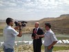
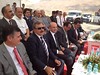

The above images may not be of the site on this page, but were taken nearby. They are loaded from Flickr so please click on them for image credits.
Click here to see more info for this site
Nearby sites
Click here to view sites on an interactive map of the areaKey: Red: member's photo, Blue: 3rd party photo, Yellow: other image, Green: no photo - please go there and take one, Grey: site destroyed
Download sites to:
KML (Google Earth)
GPX (GPS waypoints)
CSV (Garmin/Navman)
CSV (Excel)
To unlock full downloads you need to sign up as a Contributory Member. Otherwise downloads are limited to 50 sites.
Turn off the page maps and other distractions
Nearby sites listing. In the following links * = Image available
1.0km NW 316° Boncuklu Tarla* Ancient Temple
2.3km NW 305° Zeviya Tivilki Ancient Village or Settlement
22.7km N 356° Güzir Höyük Ancient Village or Settlement
42.3km WNW 301° Hasankeyf Hoyuk Ancient Village or Settlement
43.3km WNW 300° Hasankeyf* Ancient Village or Settlement
50.1km NNW 331° Ayngerm Yani Ancient Village or Settlement
62.1km SE 128° Amarsava Ancient Village or Settlement
69.5km SSW 205° Shubat-Enlil Ancient Village or Settlement
71.2km SW 229° Girnavaz* Ancient Village or Settlement
79.6km S 173° Tell Hamoukar Ancient Village or Settlement
79.9km NW 308° Demircitepe Ancient Village or Settlement
82.1km WNW 294° Körtik Tepe Ancient Village or Settlement
84.1km SSW 204° Tell Qarassa* Ancient Village or Settlement
87.4km WNW 292° Müslümantepe Ancient Village or Settlement
89.8km WNW 293° Salat Tepe Ancient Village or Settlement
90.8km SW 235° Urkesh* Ancient Village or Settlement
94.5km NW 326° Hallan Cemi Tepe Ancient Village or Settlement
97.0km WNW 288° Ziyaret Tepe Ancient Village or Settlement
101.5km WNW 288° Hakemi Use Tepe Ancient Village or Settlement
117.7km SW 216° Tell Brak* Ancient Village or Settlement
139.8km SSE 162° Rima Ancient Village or Settlement
150.4km SW 217° Tell Tuneinir Ancient Village or Settlement
150.9km SSE 159° Taya Ancient Village or Settlement
151.5km NE 52° Samran Channel* Ancient Mine, Quarry or other Industry
158.9km NW 315° Birkleyn Caves Cave or Rock Shelter
View more nearby sites and additional images


 We would like to know more about this location. Please feel free to add a brief description and any relevant information in your own language.
 Wir möchten mehr über diese Stätte erfahren. Bitte zögern Sie nicht, eine kurze Beschreibung und relevante Informationen in Deutsch hinzuzufügen.
 Nous aimerions en savoir encore un peu sur les lieux. S'il vous plaît n'hesitez pas à ajouter une courte description et tous les renseignements pertinents dans votre propre langue.
 Quisieramos informarnos un poco más de las lugares. No dude en añadir una breve descripción y otros datos relevantes en su propio idioma.