


<< Our Photo Pages >> Pierre-Fiche (Aignay-le-Duc) - Standing Stone (Menhir) in France in Bourgogne:Côte-d'Or (21)
Submitted by thecaptain on Tuesday, 17 May 2005 Page Views: 5162
Neolithic and Bronze AgeSite Name: Pierre-Fiche (Aignay-le-Duc)Country: France
NOTE: This site is 9.385 km away from the location you searched for.
Département: Bourgogne:Côte-d'Or (21) Type: Standing Stone (Menhir)
Nearest Town: Chaumont Nearest Village: Aignay-le-Duc
Latitude: 47.677200N Longitude: 4.741700E
Condition:
| 5 | Perfect |
| 4 | Almost Perfect |
| 3 | Reasonable but with some damage |
| 2 | Ruined but still recognisable as an ancient site |
| 1 | Pretty much destroyed, possibly visible as crop marks |
| 0 | No data. |
| -1 | Completely destroyed |
| 5 | Superb |
| 4 | Good |
| 3 | Ordinary |
| 2 | Not Good |
| 1 | Awful |
| 0 | No data. |
| 5 | Can be driven to, probably with disabled access |
| 4 | Short walk on a footpath |
| 3 | Requiring a bit more of a walk |
| 2 | A long walk |
| 1 | In the middle of nowhere, a nightmare to find |
| 0 | No data. |
| 5 | co-ordinates taken by GPS or official recorded co-ordinates |
| 4 | co-ordinates scaled from a detailed map |
| 3 | co-ordinates scaled from a bad map |
| 2 | co-ordinates of the nearest village |
| 1 | co-ordinates of the nearest town |
| 0 | no data |
Be the first person to rate this site - see the 'Contribute!' box in the right hand menu.
Internal Links:
External Links:
 (PID:48130)")
You may be viewing yesterday's version of this page. To see the most up to date information please register for a free account.
 (PID:48129)")
Do not use the above information on other web sites or publications without permission of the contributor.
Nearby Images from Flickr
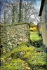
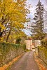
The above images may not be of the site on this page, but were taken nearby. They are loaded from Flickr so please click on them for image credits.
Click here to see more info for this site
Nearby sites
Click here to view sites on an interactive map of the areaKey: Red: member's photo, Blue: 3rd party photo, Yellow: other image, Green: no photo - please go there and take one, Grey: site destroyed
Download sites to:
KML (Google Earth)
GPX (GPS waypoints)
CSV (Garmin/Navman)
CSV (Excel)
To unlock full downloads you need to sign up as a Contributory Member. Otherwise downloads are limited to 50 sites.
Turn off the page maps and other distractions
Nearby sites listing. In the following links * = Image available
10.4km NNE 17° Le sanctuaire de la d’Essarois Ancient Temple
14.0km NE 44° Recey-Sur-Ource Oppidium Hillfort
14.8km NNW 348° Fanum du Tremblois Ancient Temple
16.9km WNW 302° La Pierre Percée (Nod-Sur-Seine)* Standing Stone (Menhir)
18.7km WNW 286° La Grande Borne (Coulmier-le-Sec)* Standing Stone (Menhir)
19.0km NE 39° Menhir dit le Cheval Gris Standing Stone (Menhir)
20.4km NE 36° La Pierre qui Vire (Gurgy)* Standing Stone (Menhir)
23.7km NNW 329° Source de la Douix* Holy Well or Sacred Spring
23.9km NNW 329° Châtillon-sur-Seine Menhir* Standing Stone (Menhir)
24.2km NNW 329° Musee du Chatillonais* Museum
25.9km NNW 328° Tumulus de la Garenne* Artificial Mound
26.4km NNW 327° Tumulus de la Butte Round Barrow(s)
27.4km S 173° Ciste du Val-Courbe Burial Chamber or Dolmen
27.4km NW 324° Sainte-Colombe Tumulus* Round Barrow(s)
27.9km NNW 331° Pierre à Cupules de Montliot-et-Courcelles Rock Art
29.0km NNW 329° Vix Tumulus IV* Artificial Mound
29.0km NNW 330° Vix Tumulus II* Artificial Mound
29.0km NNW 329° Tene Era Necropole Round Cairn
29.1km NNW 330° Vix Princess Tumulus* Artificial Mound
29.1km NNW 330° Vix Tumulus III* Artificial Mound
29.1km NNW 330° Vix Sanctuary* Ancient Temple
29.2km NW 319° Tumulus de la Motte* Artificial Mound
30.0km NNW 329° Mont Lassois* Hillfort
31.8km NW 325° Bois de Cresilles Tumuli Artificial Mound
36.4km SSW 208° Camp de Myard* Ancient Village or Settlement
View more nearby sites and additional images


 We would like to know more about this location. Please feel free to add a brief description and any relevant information in your own language.
 Wir möchten mehr über diese Stätte erfahren. Bitte zögern Sie nicht, eine kurze Beschreibung und relevante Informationen in Deutsch hinzuzufügen.
 Nous aimerions en savoir encore un peu sur les lieux. S'il vous plaît n'hesitez pas à ajouter une courte description et tous les renseignements pertinents dans votre propre langue.
 Quisieramos informarnos un poco más de las lugares. No dude en añadir una breve descripción y otros datos relevantes en su propio idioma.