


<< Our Photo Pages >> Pierre-Levée du champ de la Fa - Standing Stone (Menhir) in France in Bourgogne:Saône-et-Loire (71)
Submitted by thecaptain on Tuesday, 05 September 2006 Page Views: 7180
Neolithic and Bronze AgeSite Name: Pierre-Levée du champ de la FaCountry: France
NOTE: This site is 5.641 km away from the location you searched for.
Département: Bourgogne:Saône-et-Loire (71) Type: Standing Stone (Menhir)
Nearest Town: Chalon-Sur-Saone Nearest Village: Brancion
Latitude: 46.542700N Longitude: 4.782400E
Condition:
| 5 | Perfect |
| 4 | Almost Perfect |
| 3 | Reasonable but with some damage |
| 2 | Ruined but still recognisable as an ancient site |
| 1 | Pretty much destroyed, possibly visible as crop marks |
| 0 | No data. |
| -1 | Completely destroyed |
| 5 | Superb |
| 4 | Good |
| 3 | Ordinary |
| 2 | Not Good |
| 1 | Awful |
| 0 | No data. |
| 5 | Can be driven to, probably with disabled access |
| 4 | Short walk on a footpath |
| 3 | Requiring a bit more of a walk |
| 2 | A long walk |
| 1 | In the middle of nowhere, a nightmare to find |
| 0 | No data. |
| 5 | co-ordinates taken by GPS or official recorded co-ordinates |
| 4 | co-ordinates scaled from a detailed map |
| 3 | co-ordinates scaled from a bad map |
| 2 | co-ordinates of the nearest village |
| 1 | co-ordinates of the nearest town |
| 0 | no data |
Internal Links:
External Links:
I have visited· I would like to visit
TheCaptain visited on 2nd Aug 2005 - their rating: Cond: 4 Amb: 4 Access: 4 Near to the medieval village of Brancion, beside the D.14 road, can be found this nice menhir, which has a fine view to the west. It stands about 4 metres tall with a cross on the top in a field close to the turn off to Pierre-Levée farm, on a bad corner. It was raining horribly while I visited.
")
It stands about 4 metres tall with a cross on the top, in a field close to the turn off to Pierre-Levée farm, on a bad corner for parking and viewing.
IMPORTANT NOTE: Positional co-ordinates taken from a gps receiver.
You may be viewing yesterday's version of this page. To see the most up to date information please register for a free account.
")
")
Do not use the above information on other web sites or publications without permission of the contributor.
Nearby Images from Flickr
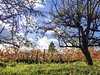
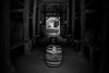
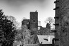

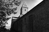
The above images may not be of the site on this page, but were taken nearby. They are loaded from Flickr so please click on them for image credits.
Click here to see more info for this site
Nearby sites
Click here to view sites on an interactive map of the areaKey: Red: member's photo, Blue: 3rd party photo, Yellow: other image, Green: no photo - please go there and take one, Grey: site destroyed
Download sites to:
KML (Google Earth)
GPX (GPS waypoints)
CSV (Garmin/Navman)
CSV (Excel)
To unlock full downloads you need to sign up as a Contributory Member. Otherwise downloads are limited to 50 sites.
Turn off the page maps and other distractions
Nearby sites listing. In the following links * = Image available
5.9km WNW 284° Menhir d'Uxelles* Standing Stone (Menhir)
11.5km ENE 62° Menhirs de Sanguignis* Standing Stone (Menhir)
14.1km S 171° Pierre des Druides de Petite Fontaine Rock Outcrop
14.9km ENE 58° Nécropole d'Ormes-Simandre Barrow Cemetery
16.2km W 266° Menhir dit la Pierre Folle (Sailly) Standing Stone (Menhir)
17.6km WNW 296° Menhir de Saint-Clément 1 Standing Stone (Menhir)
17.6km WNW 296° Menhir de Saint-Clément 2 Standing Stone (Menhir)
24.6km NW 313° Pierre-aux-Fées (St-Micaud)* Standing Stone (Menhir)
27.1km S 191° Menhir de Chancerons* Standing Stone (Menhir)
27.6km S 190° Solutré-Pouilly Gisement Prehistorique* Natural Stone / Erratic / Other Natural Feature
27.6km S 190° Musée départemental de Préhistoire Solutré* Museum
32.4km WSW 246° Monument Druidique de la Corne d'Artus Rock Outcrop
41.0km NW 323° Menhir des Caillots Standing Stone (Menhir)
41.6km NNW 333° Menhirs d'Epoigny* Standing Stones
42.6km NNW 348° Mont-de-Sene 5 Burial Chamber or Dolmen
42.7km NNW 348° Mont-de-Sene 2 Burial Chamber or Dolmen
42.8km NNW 348° Mont-de-Sène dolmen 1 Burial Chamber or Dolmen
42.9km NNW 348° Mont-de-Sene 3 Burial Chamber or Dolmen
43.0km NNW 348° Mont-de-Sene 4 Burial Chamber or Dolmen
43.4km NNW 348° Cul Blanc Dolmens* Burial Chamber or Dolmen
45.1km N 350° Allée Couverte de la Chaume Passage Grave
46.0km N 350° La Pierre qui Vire (Rochepot)* Burial Chamber or Dolmen
46.3km NNW 349° La Garenne (La Rochepot) Burial Chamber or Dolmen
46.7km N 350° Chateillon Passage Grave
47.9km NNW 330° Pierre Guénachère* Sculptured Stone
View more nearby sites and additional images


 We would like to know more about this location. Please feel free to add a brief description and any relevant information in your own language.
 Wir möchten mehr über diese Stätte erfahren. Bitte zögern Sie nicht, eine kurze Beschreibung und relevante Informationen in Deutsch hinzuzufügen.
 Nous aimerions en savoir encore un peu sur les lieux. S'il vous plaît n'hesitez pas à ajouter une courte description et tous les renseignements pertinents dans votre propre langue.
 Quisieramos informarnos un poco más de las lugares. No dude en añadir una breve descripción y otros datos relevantes en su propio idioma.