


<< Our Photo Pages >> Pierre des Druides (St Alexandre) - Standing Stone (Menhir) in France in Languedoc:Gard (30)
Submitted by archeomick on Sunday, 21 November 2010 Page Views: 3041
Neolithic and Bronze AgeSite Name: Pierre des Druides (St Alexandre) Alternative Name: Menhir de St AlexandreCountry: France
NOTE: This site is 4.949 km away from the location you searched for.
Département: Languedoc:Gard (30) Type: Standing Stone (Menhir)
Nearest Town: Pont Saint Esprit Nearest Village: Saint Alexandre
Latitude: 44.230000N Longitude: 4.620800E
Condition:
| 5 | Perfect |
| 4 | Almost Perfect |
| 3 | Reasonable but with some damage |
| 2 | Ruined but still recognisable as an ancient site |
| 1 | Pretty much destroyed, possibly visible as crop marks |
| 0 | No data. |
| -1 | Completely destroyed |
| 5 | Superb |
| 4 | Good |
| 3 | Ordinary |
| 2 | Not Good |
| 1 | Awful |
| 0 | No data. |
| 5 | Can be driven to, probably with disabled access |
| 4 | Short walk on a footpath |
| 3 | Requiring a bit more of a walk |
| 2 | A long walk |
| 1 | In the middle of nowhere, a nightmare to find |
| 0 | No data. |
| 5 | co-ordinates taken by GPS or official recorded co-ordinates |
| 4 | co-ordinates scaled from a detailed map |
| 3 | co-ordinates scaled from a bad map |
| 2 | co-ordinates of the nearest village |
| 1 | co-ordinates of the nearest town |
| 0 | no data |
Internal Links:
External Links:
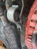
 (PID:70571)")
This place is very near the old Roman way from Nîmes to Vaison La Romaine, called "Route des Voconces".
Height: 200- Width: 70- Thickness: 20--Orientation: E/W
Wikipedia article
Sites mégalithiques du Gard
You may be viewing yesterday's version of this page. To see the most up to date information please register for a free account.
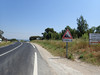
 (PID:70578)")
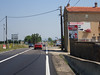
 (PID:70570)")
Do not use the above information on other web sites or publications without permission of the contributor.
Nearby Images from Flickr
The above images may not be of the site on this page, but were taken nearby. They are loaded from Flickr so please click on them for image credits.
Click here to see more info for this site
Nearby sites
Click here to view sites on an interactive map of the areaKey: Red: member's photo, Blue: 3rd party photo, Yellow: other image, Green: no photo - please go there and take one, Grey: site destroyed
Download sites to:
KML (Google Earth)
GPX (GPS waypoints)
CSV (Garmin/Navman)
CSV (Excel)
To unlock full downloads you need to sign up as a Contributory Member. Otherwise downloads are limited to 50 sites.
Turn off the page maps and other distractions
Nearby sites listing. In the following links * = Image available
5.4km SW 221° Dolmen de Coste-Rigaude Burial Chamber or Dolmen
7.3km S 180° Musée Archeologique (Bagnols)* Museum
9.6km NNW 328° Pié de Mounié Burial Chamber or Dolmen
10.4km NNW 332° Dolmen du Quartier de Feuillet Burial Chamber or Dolmen
11.4km NNW 330° Grotte dite des Deux Ouvertures Cave or Rock Shelter
11.7km NNW 330° Statue-menhir de l'Aven Meunier* Sculptured Stone
11.9km NNW 329° Grotte Chabot Cave or Rock Shelter
11.9km NW 309° La Bartre Burial Chamber or Dolmen
12.1km WNW 293° Issirac 1 Burial Chamber or Dolmen
12.1km NW 317° Dolmen du Serre de l'Habitant 3 Burial Chamber or Dolmen
12.1km NW 317° Dolmen du Serre de l'Habitant 2 Burial Chamber or Dolmen
12.1km WNW 292° Issirac 2 Burial Chamber or Dolmen
12.1km NNW 328° Grotte aux points Cave or Rock Shelter
12.1km NW 317° Dolmen du Serre de l'Habitant 1 Burial Chamber or Dolmen
12.4km NNW 332° Grotte de la Tête du Lion* Cave or Rock Shelter
12.5km NNW 330° Grotte de Saint-Marcel* Cave or Rock Shelter
12.5km SSE 168° Oppidum du Camp de César (Laudun-l'Ardoise)* Ancient Village or Settlement
12.9km NNW 332° Colombier Dolmen* Burial Chamber or Dolmen
13.0km NNW 333° Grosse Pierre Menhir* Standing Stone (Menhir)
13.0km ESE 116° La Sabliere Cave or Rock Shelter
13.4km NW 316° Menhir le Monier Standing Stone (Menhir)
13.4km NW 316° Aigueze menhir Standing Stone (Menhir)
13.9km NW 315° Dolmen dit le Pé de l'Aigo 5 Burial Chamber or Dolmen
14.0km NW 313° Dolmen du Bois de Laval 2 Burial Chamber or Dolmen
14.0km SSW 205° Dolmen de la Peira Pecolada Burial Chamber or Dolmen
View more nearby sites and additional images


 We would like to know more about this location. Please feel free to add a brief description and any relevant information in your own language.
 Wir möchten mehr über diese Stätte erfahren. Bitte zögern Sie nicht, eine kurze Beschreibung und relevante Informationen in Deutsch hinzuzufügen.
 Nous aimerions en savoir encore un peu sur les lieux. S'il vous plaît n'hesitez pas à ajouter une courte description et tous les renseignements pertinents dans votre propre langue.
 Quisieramos informarnos un poco más de las lugares. No dude en añadir una breve descripción y otros datos relevantes en su propio idioma.