


<< Our Photo Pages >> Arboretum van Groenendal - Modern Stone Circle etc in Belgium in Vlaams-Brabant
Submitted by Alta-Falisa on Sunday, 16 February 2014 Page Views: 2848
Modern SitesSite Name: Arboretum van GroenendalCountry: Belgium
NOTE: This site is 1.794 km away from the location you searched for.
Province: Vlaams-Brabant Type: Modern Stone Circle etc
Nearest Town: Hoeilaart
Latitude: 50.768462N Longitude: 4.438757E
Condition:
| 5 | Perfect |
| 4 | Almost Perfect |
| 3 | Reasonable but with some damage |
| 2 | Ruined but still recognisable as an ancient site |
| 1 | Pretty much destroyed, possibly visible as crop marks |
| 0 | No data. |
| -1 | Completely destroyed |
| 5 | Superb |
| 4 | Good |
| 3 | Ordinary |
| 2 | Not Good |
| 1 | Awful |
| 0 | No data. |
| 5 | Can be driven to, probably with disabled access |
| 4 | Short walk on a footpath |
| 3 | Requiring a bit more of a walk |
| 2 | A long walk |
| 1 | In the middle of nowhere, a nightmare to find |
| 0 | No data. |
| 5 | co-ordinates taken by GPS or official recorded co-ordinates |
| 4 | co-ordinates scaled from a detailed map |
| 3 | co-ordinates scaled from a bad map |
| 2 | co-ordinates of the nearest village |
| 1 | co-ordinates of the nearest town |
| 0 | no data |
Internal Links:
External Links:
I have visited· I would like to visit
Alta-Falisa has visited here
")
You may be viewing yesterday's version of this page. To see the most up to date information please register for a free account.
")
")
Do not use the above information on other web sites or publications without permission of the contributor.
Nearby Images from Flickr
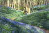
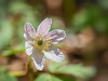
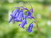
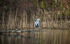
The above images may not be of the site on this page, but were taken nearby. They are loaded from Flickr so please click on them for image credits.
Click here to see more info for this site
Nearby sites
Click here to view sites on an interactive map of the areaKey: Red: member's photo, Blue: 3rd party photo, Yellow: other image, Green: no photo - please go there and take one, Grey: site destroyed
Download sites to:
KML (Google Earth)
GPX (GPS waypoints)
CSV (Garmin/Navman)
CSV (Excel)
To unlock full downloads you need to sign up as a Contributory Member. Otherwise downloads are limited to 50 sites.
Turn off the page maps and other distractions
Nearby sites listing. In the following links * = Image available
2.4km W 275° Monument aux Forestiers* Modern Stone Circle etc
5.0km N 4° Rouge-Cloître* Modern Stone Circle etc
8.6km NNW 337° Musée du Cinquantenaire - Jubelparkmuseum* Museum
8.7km NNW 330° Musée des Sciences naturelles* Museum
8.9km NE 46° Dolmen of Duisburg* Polissoir
8.9km NE 39° Africa Museum, Tervuren* Museum
9.6km NW 324° Palais d'Egmont / Egmontpaleis* Modern Stone Circle etc
9.8km NW 317° Pilgrim's Menhir* Standing Stone (Menhir)
10.7km NW 324° Plattesteen* Natural Stone / Erratic / Other Natural Feature
18.1km SE 144° Pierre qui Tourne de Beaurieux* Burial Chamber or Dolmen
20.5km SSW 203° Musée communal de Nivelles* Museum
22.1km SW 224° Table des Sorcières* Natural Stone / Erratic / Other Natural Feature
22.7km ESE 115° Cheval de Godde* Standing Stone (Menhir)
23.8km N 0° Alvensten* Ancient Cross
29.4km ESE 120° La Grosse Borne (Perwez)* Marker Stone
29.5km ESE 110° The Tumulus of Glimes Round Barrow(s)
32.3km E 89° Steen van Hoegaarden* Standing Stone (Menhir)
32.5km E 85° Geosite Goudberg* Museum
34.9km SSE 156° Polissoirs de Velaine sur Sambre* Polissoir
34.9km SSE 156° La Pierre qui Tourne (Velaine-sur-Sambre)* Standing Stone (Menhir)
35.5km SSE 153° Espace de l'Homme de Spy* Museum
35.7km SSE 155° Pierre aux Quatre-Vents* Modern Stone Circle etc
36.1km E 86° Leeuwensteen* Standing Stone (Menhir)
36.1km SSE 152° Grotte de Spy* Cave or Rock Shelter
36.2km SSW 204° Musée Royal de Mariemont* Museum
View more nearby sites and additional images


 We would like to know more about this location. Please feel free to add a brief description and any relevant information in your own language.
 Wir möchten mehr über diese Stätte erfahren. Bitte zögern Sie nicht, eine kurze Beschreibung und relevante Informationen in Deutsch hinzuzufügen.
 Nous aimerions en savoir encore un peu sur les lieux. S'il vous plaît n'hesitez pas à ajouter une courte description et tous les renseignements pertinents dans votre propre langue.
 Quisieramos informarnos un poco más de las lugares. No dude en añadir una breve descripción y otros datos relevantes en su propio idioma.