 with our Megalithic Portal iPhone app")


<< Our Photo Pages >> Pilgrim's Menhir - Standing Stone (Menhir) in Belgium in Bruxelles - Brussel
Submitted by Alta-Falisa on Thursday, 08 May 2014 Page Views: 5210
Neolithic and Bronze AgeSite Name: Pilgrim's Menhir Alternative Name: Menhir du Pélerin, Pelgrim menhirCountry: Belgium Province: Bruxelles - Brussel Type: Standing Stone (Menhir)
Nearest Town: Bruxelles
Latitude: 50.833300N Longitude: 4.344000E
Condition:
| 5 | Perfect |
| 4 | Almost Perfect |
| 3 | Reasonable but with some damage |
| 2 | Ruined but still recognisable as an ancient site |
| 1 | Pretty much destroyed, possibly visible as crop marks |
| 0 | No data. |
| -1 | Completely destroyed |
| 5 | Superb |
| 4 | Good |
| 3 | Ordinary |
| 2 | Not Good |
| 1 | Awful |
| 0 | No data. |
| 5 | Can be driven to, probably with disabled access |
| 4 | Short walk on a footpath |
| 3 | Requiring a bit more of a walk |
| 2 | A long walk |
| 1 | In the middle of nowhere, a nightmare to find |
| 0 | No data. |
| 5 | co-ordinates taken by GPS or official recorded co-ordinates |
| 4 | co-ordinates scaled from a detailed map |
| 3 | co-ordinates scaled from a bad map |
| 2 | co-ordinates of the nearest village |
| 1 | co-ordinates of the nearest town |
| 0 | no data |
Internal Links:
External Links:
")
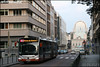
Menhir from Galicia, reworked by the sculptor Manolo Paz and presented by the Government of Galicia to the City of Brussels in 1999, in honour of the pilgrims en route towards Santiago de Compostella, and erected next to the Porte de Hal/Hallepoort (Gate of Halle), departing point of the pilgrims.
You may be viewing yesterday's version of this page. To see the most up to date information please register for a free account.
")
")
Do not use the above information on other web sites or publications without permission of the contributor.
Nearby Images from Flickr


The above images may not be of the site on this page, but were taken nearby. They are loaded from Flickr so please click on them for image credits.
Click here to see more info for this site
Nearby sites
Click here to view sites on an interactive map of the areaKey: Red: member's photo, Blue: 3rd party photo, Yellow: other image, Green: no photo - please go there and take one, Grey: site destroyed
Download sites to:
KML (Google Earth)
GPX (GPS waypoints)
CSV (Garmin/Navman)
CSV (Excel)
To unlock full downloads you need to sign up as a Contributory Member. Otherwise downloads are limited to 50 sites.
Turn off the page maps and other distractions
Nearby sites listing. In the following links * = Image available
1.1km ENE 59° Palais d'Egmont / Egmontpaleis* Modern Stone Circle etc
1.5km NNE 14° Plattesteen* Natural Stone / Erratic / Other Natural Feature
2.3km E 82° Musée des Sciences naturelles* Museum
3.4km ENE 78° Musée du Cinquantenaire - Jubelparkmuseum* Museum
7.4km ESE 108° Rouge-Cloître* Modern Stone Circle etc
8.2km SSE 149° Monument aux Forestiers* Modern Stone Circle etc
9.8km SE 137° Arboretum van Groenendal* Modern Stone Circle etc
12.3km E 91° Africa Museum, Tervuren* Museum
13.0km E 94° Dolmen of Duisburg* Polissoir
17.9km NNE 22° Alvensten* Ancient Cross
24.7km SSW 201° Table des Sorcières* Natural Stone / Erratic / Other Natural Feature
26.0km S 183° Musée communal de Nivelles* Museum
27.8km SE 142° Pierre qui Tourne de Beaurieux* Burial Chamber or Dolmen
28.0km NW 322° Vleeshuismuseum* Museum
32.0km ESE 122° Cheval de Godde* Standing Stone (Menhir)
38.5km ESE 117° The Tumulus of Glimes Round Barrow(s)
38.9km SE 125° La Grosse Borne (Perwez)* Marker Stone
39.3km E 97° Geosite Goudberg* Museum
39.5km E 99° Steen van Hoegaarden* Standing Stone (Menhir)
40.0km W 278° Provincial Archeological Museum* Museum
41.2km S 191° Musée Royal de Mariemont* Museum
42.9km E 96° Leeuwensteen* Standing Stone (Menhir)
44.3km SSE 152° Polissoirs de Velaine sur Sambre* Polissoir
44.3km SSE 152° La Pierre qui Tourne (Velaine-sur-Sambre)* Standing Stone (Menhir)
45.1km SSE 150° Espace de l'Homme de Spy* Museum
View more nearby sites and additional images


 We would like to know more about this location. Please feel free to add a brief description and any relevant information in your own language.
 Wir möchten mehr über diese Stätte erfahren. Bitte zögern Sie nicht, eine kurze Beschreibung und relevante Informationen in Deutsch hinzuzufügen.
 Nous aimerions en savoir encore un peu sur les lieux. S'il vous plaît n'hesitez pas à ajouter une courte description et tous les renseignements pertinents dans votre propre langue.
 Quisieramos informarnos un poco más de las lugares. No dude en añadir una breve descripción y otros datos relevantes en su propio idioma.