
, Aubrey Burl")
<< Our Photo Pages >> Creu d'en Ramis - Ancient Village or Settlement in Spain in Balearic Isles (Menorca / Minorca)
Submitted by SolarMegalith on Saturday, 08 February 2020 Page Views: 361
Multi-periodSite Name: Creu d'en RamisCountry: Spain
NOTE: This site is 0.906 km away from the location you searched for.
Region: Balearic Isles (Menorca / Minorca) Type: Ancient Village or Settlement
Nearest Town: Mahon
Latitude: 39.888399N Longitude: 4.253129E
Condition:
| 5 | Perfect |
| 4 | Almost Perfect |
| 3 | Reasonable but with some damage |
| 2 | Ruined but still recognisable as an ancient site |
| 1 | Pretty much destroyed, possibly visible as crop marks |
| 0 | No data. |
| -1 | Completely destroyed |
| 5 | Superb |
| 4 | Good |
| 3 | Ordinary |
| 2 | Not Good |
| 1 | Awful |
| 0 | No data. |
| 5 | Can be driven to, probably with disabled access |
| 4 | Short walk on a footpath |
| 3 | Requiring a bit more of a walk |
| 2 | A long walk |
| 1 | In the middle of nowhere, a nightmare to find |
| 0 | No data. |
| 5 | co-ordinates taken by GPS or official recorded co-ordinates |
| 4 | co-ordinates scaled from a detailed map |
| 3 | co-ordinates scaled from a bad map |
| 2 | co-ordinates of the nearest village |
| 1 | co-ordinates of the nearest town |
| 0 | no data |
Internal Links:
External Links:
I have visited· I would like to visit
SolarMegalith visited on 18th Apr 2015 - their rating: Cond: 2 Amb: 3 Access: 5
")
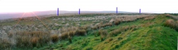
A multi-period archaeological site located within a city park in Mahon. Its major part are Bronze Age (pre-Talayotic) navetiformes (naviformes) - boat-shaped dwellings. There are also remains of a circular structure of the Talayotic period (c. 850-600 BC), as well as Roman and Islamic period structures.
You may be viewing yesterday's version of this page. To see the most up to date information please register for a free account.
")
")
Do not use the above information on other web sites or publications without permission of the contributor.
Nearby Images from Flickr

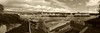
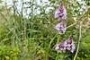
The above images may not be of the site on this page, but were taken nearby. They are loaded from Flickr so please click on them for image credits.
Click here to see more info for this site
Nearby sites
Click here to view sites on an interactive map of the areaKey: Red: member's photo, Blue: 3rd party photo, Yellow: other image, Green: no photo - please go there and take one, Grey: site destroyed
Download sites to:
KML (Google Earth)
GPX (GPS waypoints)
CSV (Garmin/Navman)
CSV (Excel)
To unlock full downloads you need to sign up as a Contributory Member. Otherwise downloads are limited to 50 sites.
Turn off the page maps and other distractions
Nearby sites listing. In the following links * = Image available
1.2km SW 216° Sa Cudia Cremada* Ancient Village or Settlement
1.8km WSW 245° Curnia* Broch or Nuraghe
1.9km SSE 147° Trepuco* Ancient Village or Settlement
2.8km WSW 252° Torrelló* Ancient Village or Settlement
2.9km WSW 253° Torellonet Vell* Broch or Nuraghe
3.3km SW 220° Biniparratx Petit* Ancient Village or Settlement
3.6km W 279° Talatí de Dalt* Ancient Village or Settlement
4.0km SE 137° Toraixa* Broch or Nuraghe
4.1km SSE 154° Trebalúger* Broch or Nuraghe
4.5km WNW 292° Biniaiet Vell* Broch or Nuraghe
4.6km WSW 258° Binimaimut Standing Stone (Menhir)
4.6km WNW 292° Sant Vicenç D'Alcaidús* Ancient Village or Settlement
5.0km SSW 198° Binisafuller* Ancient Village or Settlement
5.5km W 278° Dolmen de Montpler Holed Stone
5.5km W 278° Montplè Chambered Tomb
5.6km W 278° Tanques De Montplè Chambered Tomb
5.6km SW 221° Binidalinet* Burial Chamber or Dolmen
5.8km WNW 292° Rafal Rubí naveta* Chambered Tomb
6.4km WSW 254° Binixiquer* Broch or Nuraghe
6.5km W 267° Cotaina De Can Rabassó* Chambered Tomb
6.9km WSW 256° Binicalaf* Ancient Village or Settlement
7.0km WNW 295° L'Argentina (Oriental) naveta* Chambered Tomb
7.2km WNW 282° Cotaina d'En Carreres Ancient Village or Settlement
7.7km WNW 297° L'Argentina (Occidental) naveta* Chambered Tomb
7.8km WNW 287° Torralbet* Chambered Tomb
View more nearby sites and additional images


 We would like to know more about this location. Please feel free to add a brief description and any relevant information in your own language.
 Wir möchten mehr über diese Stätte erfahren. Bitte zögern Sie nicht, eine kurze Beschreibung und relevante Informationen in Deutsch hinzuzufügen.
 Nous aimerions en savoir encore un peu sur les lieux. S'il vous plaît n'hesitez pas à ajouter une courte description et tous les renseignements pertinents dans votre propre langue.
 Quisieramos informarnos un poco más de las lugares. No dude en añadir una breve descripción y otros datos relevantes en su propio idioma.