


<< Our Photo Pages >> Colline de Moulin Menhir - Standing Stone (Menhir) in France in Languedoc:Gard (30)
Submitted by TheCaptain on Saturday, 16 April 2005 Page Views: 2798
Neolithic and Bronze AgeSite Name: Colline de Moulin Menhir Alternative Name: Menhir de la Colline de MoulinCountry: France
NOTE: This site is 0.499 km away from the location you searched for.
Département: Languedoc:Gard (30) Type: Standing Stone (Menhir)
Nearest Town: Nîmes Nearest Village: Aubais
Latitude: 43.748600N Longitude: 4.144100E
Condition:
| 5 | Perfect |
| 4 | Almost Perfect |
| 3 | Reasonable but with some damage |
| 2 | Ruined but still recognisable as an ancient site |
| 1 | Pretty much destroyed, possibly visible as crop marks |
| 0 | No data. |
| -1 | Completely destroyed |
| 5 | Superb |
| 4 | Good |
| 3 | Ordinary |
| 2 | Not Good |
| 1 | Awful |
| 0 | No data. |
| 5 | Can be driven to, probably with disabled access |
| 4 | Short walk on a footpath |
| 3 | Requiring a bit more of a walk |
| 2 | A long walk |
| 1 | In the middle of nowhere, a nightmare to find |
| 0 | No data. |
| 5 | co-ordinates taken by GPS or official recorded co-ordinates |
| 4 | co-ordinates scaled from a detailed map |
| 3 | co-ordinates scaled from a bad map |
| 2 | co-ordinates of the nearest village |
| 1 | co-ordinates of the nearest town |
| 0 | no data |
Internal Links:
External Links:
I have visited· I would like to visit
TheCaptain visited on 21st Sep 2005 - their rating: Cond: 2 Amb: 3 Access: 4 From the cemetary to the south of Aubais, walk southwest up the little track to the ancient windmill, and after about 800 metres you arrive at the top of this windy little hill. Here, about 50 metres from the old windmill, has been re-erected the menhir, mended from several parts and mounted on a little plinth. It is only about 1.5 metres high, but has several legends associated with it. There are three circular cupules to be seen in the southern face.
regina have visited here
")
Here, about 50 metres from the old windmill, has been re-erected the menhir, mended from several parts and mounted on a little plinth. It is only about 1.5 metres high, but has several legends associated with it.
There are three circular cupules to be seen in the southern face.
IMPORTANT NOTE: Position of site taken from gps receiver.
Wikipedia article
Sites mégalithiques du Gard
You may be viewing yesterday's version of this page. To see the most up to date information please register for a free account.
")
")
")
Do not use the above information on other web sites or publications without permission of the contributor.
Nearby Images from Flickr

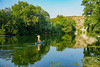
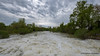
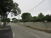
The above images may not be of the site on this page, but were taken nearby. They are loaded from Flickr so please click on them for image credits.
Click here to see more info for this site
Nearby sites
Click here to view sites on an interactive map of the areaKey: Red: member's photo, Blue: 3rd party photo, Yellow: other image, Green: no photo - please go there and take one, Grey: site destroyed
Download sites to:
KML (Google Earth)
GPX (GPS waypoints)
CSV (Garmin/Navman)
CSV (Excel)
To unlock full downloads you need to sign up as a Contributory Member. Otherwise downloads are limited to 50 sites.
Turn off the page maps and other distractions
Nearby sites listing. In the following links * = Image available
2.2km NE 49° Pierre Plantée (Congénies)* Standing Stone (Menhir)
2.4km NW 308° Mas Neuf menhir Standing Stone (Menhir)
3.7km S 173° Oppidum d'Ambrussum* Ancient Village or Settlement
4.7km NNE 26° Canteperdritz* Ancient Village or Settlement
7.3km NNW 332° Fontbouisse* Ancient Village or Settlement
8.4km NE 52° Oppidum de Nages* Ancient Village or Settlement
9.5km WSW 257° Beaulieu (Languedoc)* Standing Stone (Menhir)
9.6km NE 52° Castels Oppidum Ancient Village or Settlement
9.9km NNE 22° Oppidum de Mauressip Ancient Village or Settlement
13.3km WNW 303° Oppidum du Castellet (Bois de Paris)* Ancient Village or Settlement
13.3km NW 305° Grotte citerne du Bois de Paris Cave or Rock Shelter
16.4km NNW 328° Menhir de Deroc* Standing Stone (Menhir)
18.9km W 274° Dolmen de Sainte-Croix* Burial Chamber or Dolmen
19.8km ENE 61° Saint-Théodorit menhir-statue* Sculptured Stone
20.1km ENE 61° Musée Archéologique de Nîmes* Museum
21.1km WNW 302° Dolmen du Mas de Vedel* Burial Chamber or Dolmen
22.7km WNW 284° Valflaunès school sites* Modern Stone Circle etc
23.1km WNW 286° Menhir near Valflaunes* Standing Stone (Menhir)
23.5km NW 305° Menhir du Ranc* Standing Stone (Menhir)
23.6km NW 306° Dolmen du Ranq* Burial Chamber or Dolmen
23.7km WNW 291° Dolmen de Viastre* Burial Chamber or Dolmen
23.8km WNW 290° Oppidum Roc des Mattes* Ancient Village or Settlement
24.1km WNW 295° Rocher du Causse* Ancient Village or Settlement
24.3km NE 37° Oppidum de Castelvielh Ancient Village or Settlement
24.4km NW 310° Menhir Creux de Thomas* Standing Stone (Menhir)
View more nearby sites and additional images


 We would like to know more about this location. Please feel free to add a brief description and any relevant information in your own language.
 Wir möchten mehr über diese Stätte erfahren. Bitte zögern Sie nicht, eine kurze Beschreibung und relevante Informationen in Deutsch hinzuzufügen.
 Nous aimerions en savoir encore un peu sur les lieux. S'il vous plaît n'hesitez pas à ajouter une courte description et tous les renseignements pertinents dans votre propre langue.
 Quisieramos informarnos un poco más de las lugares. No dude en añadir una breve descripción y otros datos relevantes en su propio idioma.