


<< Our Photo Pages >> Turmaden d'es Capita - Broch or Nuraghe in Spain in Balearic Isles (Menorca / Minorca)
Submitted by SolarMegalith on Monday, 10 February 2020 Page Views: 1320
Iron Age and Later PrehistorySite Name: Turmaden d'es Capita Alternative Name: Talayot Rafal d'es CapitaCountry: Spain
NOTE: This site is 1.94 km away from the location you searched for.
Region: Balearic Isles (Menorca / Minorca) Type: Broch or Nuraghe
Nearest Town: Alaior
Latitude: 39.951888N Longitude: 4.095437E
Condition:
| 5 | Perfect |
| 4 | Almost Perfect |
| 3 | Reasonable but with some damage |
| 2 | Ruined but still recognisable as an ancient site |
| 1 | Pretty much destroyed, possibly visible as crop marks |
| 0 | No data. |
| -1 | Completely destroyed |
| 5 | Superb |
| 4 | Good |
| 3 | Ordinary |
| 2 | Not Good |
| 1 | Awful |
| 0 | No data. |
| 5 | Can be driven to, probably with disabled access |
| 4 | Short walk on a footpath |
| 3 | Requiring a bit more of a walk |
| 2 | A long walk |
| 1 | In the middle of nowhere, a nightmare to find |
| 0 | No data. |
| 5 | co-ordinates taken by GPS or official recorded co-ordinates |
| 4 | co-ordinates scaled from a detailed map |
| 3 | co-ordinates scaled from a bad map |
| 2 | co-ordinates of the nearest village |
| 1 | co-ordinates of the nearest town |
| 0 | no data |
Internal Links:
External Links:
I have visited· I would like to visit
SolarMegalith visited on 16th Apr 2015 - their rating: Cond: 3 Amb: 5 Access: 3
")
You may be viewing yesterday's version of this page. To see the most up to date information please register for a free account.
")
")
")
")
Do not use the above information on other web sites or publications without permission of the contributor.
Nearby Images from Flickr
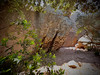
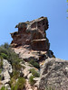
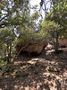
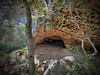
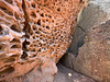
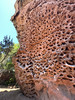
The above images may not be of the site on this page, but were taken nearby. They are loaded from Flickr so please click on them for image credits.
Click here to see more info for this site
Nearby sites
Click here to view sites on an interactive map of the areaKey: Red: member's photo, Blue: 3rd party photo, Yellow: other image, Green: no photo - please go there and take one, Grey: site destroyed
Download sites to:
KML (Google Earth)
GPX (GPS waypoints)
CSV (Garmin/Navman)
CSV (Excel)
To unlock full downloads you need to sign up as a Contributory Member. Otherwise downloads are limited to 50 sites.
Turn off the page maps and other distractions
Nearby sites listing. In the following links * = Image available
4.0km SSE 159° Llucassaldent* Broch or Nuraghe
4.1km WSW 242° Santa Mònica* Broch or Nuraghe
4.3km NE 40° El Toro* Rock Outcrop
4.3km WSW 258° Binicodrell de Darrera* Broch or Nuraghe
4.6km W 266° Binicodrell Nou* Standing Stone (Menhir)
4.6km WSW 256° Es Mestall* Broch or Nuraghe
4.9km WSW 247° Sa Pedrola d'en Magi* Broch or Nuraghe
5.7km SSE 164° Torre d'en Gaumés* Ancient Village or Settlement
5.8km WSW 243° Sant Agustí Vell* Ancient Village or Settlement
6.2km SSE 166° Ses Roques Lises* Chambered Tomb
6.2km SSE 167° Sa Comerma de sa Garita* Ancient Temple
7.2km SE 129° Na Patarrà Cave or Rock Shelter
7.3km SE 127° Torralba d'en Salord* Ancient Village or Settlement
7.3km ESE 121° Llumena* Chambered Tomb
7.4km WNW 283° Son Mercer de Dalt* Rock Cut Tomb
7.5km ESE 119° L'Argentina (Occidental) naveta* Chambered Tomb
7.6km W 272° Son Mercer de Baix* Ancient Village or Settlement
7.7km SE 129° Torralbet* Chambered Tomb
8.2km ESE 120° L'Argentina (Oriental) naveta* Chambered Tomb
8.4km SSE 150° Torrelbenc Vell* Ancient Village or Settlement
8.5km SE 131° Cotaina d'En Carreres Ancient Village or Settlement
8.5km W 279° Calafi* Ancient Village or Settlement
8.7km SE 142° Torre Llisà Vell* Ancient Temple
8.7km SSE 154° Son Rotger* Ancient Village or Settlement
8.8km W 280° Binimassó* Ancient Temple
View more nearby sites and additional images


 We would like to know more about this location. Please feel free to add a brief description and any relevant information in your own language.
 Wir möchten mehr über diese Stätte erfahren. Bitte zögern Sie nicht, eine kurze Beschreibung und relevante Informationen in Deutsch hinzuzufügen.
 Nous aimerions en savoir encore un peu sur les lieux. S'il vous plaît n'hesitez pas à ajouter une courte description et tous les renseignements pertinents dans votre propre langue.
 Quisieramos informarnos un poco más de las lugares. No dude en añadir una breve descripción y otros datos relevantes en su propio idioma.