 with our Megalithic Portal iPhone app")


<< Image Pages >> Dolmen de Balbigny - Burial Chamber or Dolmen in France in Rhone:Loire (42)
Submitted by TheCaptain on Wednesday, 08 September 2010 Page Views: 2525
Neolithic and Bronze AgeSite Name: Dolmen de BalbignyCountry: France Département: Rhone:Loire (42) Type: Burial Chamber or Dolmen
Nearest Town: St Etienne Nearest Village: Balbigny
Latitude: 45.818000N Longitude: 4.183000E
Condition:
| 5 | Perfect |
| 4 | Almost Perfect |
| 3 | Reasonable but with some damage |
| 2 | Ruined but still recognisable as an ancient site |
| 1 | Pretty much destroyed, possibly visible as crop marks |
| 0 | No data. |
| -1 | Completely destroyed |
| 5 | Superb |
| 4 | Good |
| 3 | Ordinary |
| 2 | Not Good |
| 1 | Awful |
| 0 | No data. |
| 5 | Can be driven to, probably with disabled access |
| 4 | Short walk on a footpath |
| 3 | Requiring a bit more of a walk |
| 2 | A long walk |
| 1 | In the middle of nowhere, a nightmare to find |
| 0 | No data. |
| 5 | co-ordinates taken by GPS or official recorded co-ordinates |
| 4 | co-ordinates scaled from a detailed map |
| 3 | co-ordinates scaled from a bad map |
| 2 | co-ordinates of the nearest village |
| 1 | co-ordinates of the nearest town |
| 0 | no data |
Internal Links:
External Links:
")
Dolmen de Balbigny is a burial chamber in the community of Balbigny, Departement of Loire, Region of Rhône-Alps
You may be viewing yesterday's version of this page. To see the most up to date information please register for a free account.
Do not use the above information on other web sites or publications without permission of the contributor.
Nearby Images from Flickr
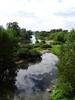
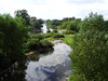
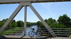
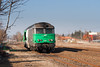
The above images may not be of the site on this page, but were taken nearby. They are loaded from Flickr so please click on them for image credits.
Click here to see more info for this site
Nearby sites
Click here to view sites on an interactive map of the areaKey: Red: member's photo, Blue: 3rd party photo, Yellow: other image, Green: no photo - please go there and take one, Grey: site destroyed
Download sites to:
KML (Google Earth)
GPX (GPS waypoints)
CSV (Garmin/Navman)
CSV (Excel)
To unlock full downloads you need to sign up as a Contributory Member. Otherwise downloads are limited to 50 sites.
Turn off the page maps and other distractions
Nearby sites listing. In the following links * = Image available
14.4km NW 311° Pierrefitte (Dancé) Burial Chamber or Dolmen
22.7km NE 51° Dolmen du Suchel Burial Chamber or Dolmen
29.0km SSW 208° Dolmen de Bard Burial Chamber or Dolmen
31.7km W 279° Pierre Branlante de Salles Rock Outcrop
32.5km W 273° Pierre Branlante des Chassagnes Rock Art
33.2km W 281° Pierre de Bachasson Sculptured Stone
33.5km SE 130° Dolmen de Vaudragon Burial Chamber or Dolmen
33.8km ESE 106° Oppidum du Châtelar Ancient Village or Settlement
34.4km WSW 245° Menhir du Col du Béal Standing Stone (Menhir)
34.4km SSW 209° Dolmen de la Roche-des-Fades Burial Chamber or Dolmen
36.0km NW 304° Pierres du Joû Rock Outcrop
36.1km WNW 282° Pierre Saint-Martin (La Croix Saint-Martin) Rock Art
36.4km ESE 109° Dolmen dit la Roche aux Fées Burial Chamber or Dolmen
36.4km WNW 290° Pierre aux Fées (Saint-Priest-la-Prugne) Sculptured Stone
36.6km NW 304° Pierres du Calvaire Rock Outcrop
37.0km WSW 256° La Renaudie menhir Standing Stone (Menhir)
38.3km W 266° Barque des Morts Rock Art
38.4km WSW 238° Dolmen de Pierre Cuberte* Burial Chamber or Dolmen
39.3km NW 308° Pierre des Seigneurs Rock Art
41.4km S 190° Dolmen de Roche-Cubertelle* Burial Chamber or Dolmen
43.8km SSW 192° Saint-Bonnet-Le-Chateau Roches* Not Known (by us)
45.1km W 273° Pierres à Bassin de Montguerlhe Rock Art
45.4km S 174° Dolmen des Echandes Burial Chamber or Dolmen
46.7km W 271° Rocher de l'Aigle Rock Art
46.7km W 271° Pierre des Mousquetaires Rock Art
View more nearby sites and additional images


 We would like to know more about this location. Please feel free to add a brief description and any relevant information in your own language.
 Wir möchten mehr über diese Stätte erfahren. Bitte zögern Sie nicht, eine kurze Beschreibung und relevante Informationen in Deutsch hinzuzufügen.
 Nous aimerions en savoir encore un peu sur les lieux. S'il vous plaît n'hesitez pas à ajouter une courte description et tous les renseignements pertinents dans votre propre langue.
 Quisieramos informarnos un poco más de las lugares. No dude en añadir una breve descripción y otros datos relevantes en su propio idioma.