


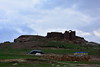
<< Other Photo Pages >> Sefer Tepe - Ancient Village or Settlement in Turkey
Submitted by davidmorgan on Wednesday, 05 January 2022 Page Views: 1480
Neolithic and Bronze AgeSite Name: Sefer TepeCountry: Turkey Type: Ancient Village or Settlement
Nearest Town: Viranşehir Nearest Village: Eskikale
Latitude: 37.172300N Longitude: 39.489500E
Condition:
| 5 | Perfect |
| 4 | Almost Perfect |
| 3 | Reasonable but with some damage |
| 2 | Ruined but still recognisable as an ancient site |
| 1 | Pretty much destroyed, possibly visible as crop marks |
| 0 | No data. |
| -1 | Completely destroyed |
| 5 | Superb |
| 4 | Good |
| 3 | Ordinary |
| 2 | Not Good |
| 1 | Awful |
| 0 | No data. |
| 5 | Can be driven to, probably with disabled access |
| 4 | Short walk on a footpath |
| 3 | Requiring a bit more of a walk |
| 2 | A long walk |
| 1 | In the middle of nowhere, a nightmare to find |
| 0 | No data. |
| 5 | co-ordinates taken by GPS or official recorded co-ordinates |
| 4 | co-ordinates scaled from a detailed map |
| 3 | co-ordinates scaled from a bad map |
| 2 | co-ordinates of the nearest village |
| 1 | co-ordinates of the nearest town |
| 0 | no data |
Internal Links:
External Links:
")
"The most intriguing aspect of the Sefer Tepe site are the 16 in-situ T-shaped pillars. Most of the pillars were buried and placed side-by-side in a conjugate formation at c. 1.5 up to 2m intervals. The upper sections above the surface are c. 50cm long and 20cm wide. The positioning of the pillars is very similar to the architecture at Göbekli Tepe Level II and the monolithic in-situ pillars on the surface at Karahan Tepe. Moreover, another pillar was revealed during the construction of the country house in the south-eastern corner of the site. This pillar was found intact; its length is 198cm and the width of the head section is 72cm, the width of the body section 54cm and the thickness 25cm. The head section of this undecorated stele is extremely flattened; it has features identical with the pillars discovered at Nevali Çori, Göbekli Tepe, Karahan Tepe, Hamzan Tepe and Taşlı Tepe."
Sefer Tepe: A New Pre-Pottery Neolithic Site in Southeastern Turkey by Bahattin Çelik.
You may be viewing yesterday's version of this page. To see the most up to date information please register for a free account.
Do not use the above information on other web sites or publications without permission of the contributor.
Nearby Images from Flickr
The above images may not be of the site on this page, but were taken nearby. They are loaded from Flickr so please click on them for image credits.
Click here to see more info for this site
Nearby sites
Click here to view sites on an interactive map of the areaKey: Red: member's photo, Blue: 3rd party photo, Yellow: other image, Green: no photo - please go there and take one, Grey: site destroyed
Download sites to:
KML (Google Earth)
GPX (GPS waypoints)
CSV (Garmin/Navman)
CSV (Excel)
To unlock full downloads you need to sign up as a Contributory Member. Otherwise downloads are limited to 50 sites.
Turn off the page maps and other distractions
Nearby sites listing. In the following links * = Image available
18.9km WSW 242° Karahan Tepe* Ancient Village or Settlement
23.0km WNW 288° Kurt Tepesi Ancient Village or Settlement
25.1km WSW 237° Harbetsuvan Tepesi Ancient Village or Settlement
27.6km NW 318° Tasli Tepe Ancient Village or Settlement
27.7km NW 318° Başbük Ancient Village or Settlement
42.5km SSW 205° Bazda Cave* Cave or Rock Shelter
50.6km W 277° Göbekli Tepe* Ancient Temple
53.1km SW 230° Harran* Ancient Village or Settlement
57.3km W 264° Gürcütepe Ancient Village or Settlement
58.0km SW 222° Kucuk Hedbe Ancient Village or Settlement
61.6km W 261° Hamzan Tepe Ancient Village or Settlement
62.5km W 268° Yeni Mahalle Ancient Village or Settlement
62.5km SE 128° Tell Halaf* Ancient Village or Settlement
77.3km W 265° Sayburç* Ancient Village or Settlement
79.3km W 261° Çakmaktepe Ancient Village or Settlement
79.5km WNW 295° Titris Höyük* Ancient Village or Settlement
82.5km W 271° Ayanlar Höyük Ancient Village or Settlement
88.8km WNW 301° Nevali Cori Ancient Temple
91.7km WNW 298° Gritille Ancient Village or Settlement
93.1km WNW 297° Sürük Mevkii Ancient Village or Settlement
102.6km WSW 250° Arslan Tash* Ancient Village or Settlement
108.8km NW 313° Karakus Tumulus* Artificial Mound
111.5km NW 324° Nemrut Dag* Artificial Mound
112.6km NW 319° Arsameia* Ancient Village or Settlement
112.9km NW 310° Kilisik Statue Sculptured Stone
View more nearby sites and additional images


 We would like to know more about this location. Please feel free to add a brief description and any relevant information in your own language.
 Wir möchten mehr über diese Stätte erfahren. Bitte zögern Sie nicht, eine kurze Beschreibung und relevante Informationen in Deutsch hinzuzufügen.
 Nous aimerions en savoir encore un peu sur les lieux. S'il vous plaît n'hesitez pas à ajouter une courte description et tous les renseignements pertinents dans votre propre langue.
 Quisieramos informarnos un poco más de las lugares. No dude en añadir una breve descripción y otros datos relevantes en su propio idioma.