


<< Our Photo Pages >> Kolomna Hillfort-1 - Hillfort in Russia
Submitted by Ogneslav on Sunday, 27 July 2014 Page Views: 2424
Iron Age and Later PrehistorySite Name: Kolomna Hillfort-1 Alternative Name: Gorodischi, ГородищиCountry: Russia
NOTE: This site is 8.483 km away from the location you searched for.
Type: Hillfort
Nearest Town: Kolomna
Latitude: 55.100079N Longitude: 38.719511E
Condition:
| 5 | Perfect |
| 4 | Almost Perfect |
| 3 | Reasonable but with some damage |
| 2 | Ruined but still recognisable as an ancient site |
| 1 | Pretty much destroyed, possibly visible as crop marks |
| 0 | No data. |
| -1 | Completely destroyed |
| 5 | Superb |
| 4 | Good |
| 3 | Ordinary |
| 2 | Not Good |
| 1 | Awful |
| 0 | No data. |
| 5 | Can be driven to, probably with disabled access |
| 4 | Short walk on a footpath |
| 3 | Requiring a bit more of a walk |
| 2 | A long walk |
| 1 | In the middle of nowhere, a nightmare to find |
| 0 | No data. |
| 5 | co-ordinates taken by GPS or official recorded co-ordinates |
| 4 | co-ordinates scaled from a detailed map |
| 3 | co-ordinates scaled from a bad map |
| 2 | co-ordinates of the nearest village |
| 1 | co-ordinates of the nearest town |
| 0 | no data |
Internal Links:
External Links:
")
Iron age hillfort on the left bank of Kolomenka river in Kolomna town, Moscow Region. In use from approx. 700 to 1200 AD. Remnants of rampart (on the South, East and West sides) and ditch (only on the NE side) should be visible but due to high grass I could find none of them.
Archaeological excavations opened 1m thick occupation level consisting of three horizons. Old Russian pottery and iron knives were found in the upper horizon. Numerous debris of the molded ceramics of the late Dyakovo Culture were typical for the middle horizon. In the lower horizon containing bone arrowheads, needles, awls and ceramics of the early Dyakovo Culture the remains of a semi-earthhouse with a wattle and daub fireplace were explored.
Collection is kept in the Kolomensky Museum of Regional Studies.
Reference: Arkheologicheskaya karta Rossii: Moskovskaya oblast (Archaeological map of Russia: Moscow Region), v. 4, ISBN 5-85663-013-0.
You may be viewing yesterday's version of this page. To see the most up to date information please register for a free account.
")
")
Do not use the above information on other web sites or publications without permission of the contributor.
Nearby Images from Flickr
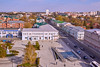

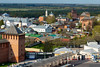
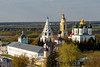
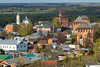

The above images may not be of the site on this page, but were taken nearby. They are loaded from Flickr so please click on them for image credits.
Click here to see more info for this site
Nearby sites
Click here to view sites on an interactive map of the areaKey: Red: member's photo, Blue: 3rd party photo, Yellow: other image, Green: no photo - please go there and take one, Grey: site destroyed
Download sites to:
KML (Google Earth)
GPX (GPS waypoints)
CSV (Garmin/Navman)
CSV (Excel)
To unlock full downloads you need to sign up as a Contributory Member. Otherwise downloads are limited to 50 sites.
Turn off the page maps and other distractions
Nearby sites listing. In the following links * = Image available
60.4km NE 48° Serpentine stone* Natural Stone / Erratic / Other Natural Feature
76.3km SSW 196° Shuchye settlement* Ancient Village or Settlement
86.7km NW 311° Tsaritsyno-2* Barrow Cemetery
86.8km NW 311° Tsaritsyno-1* Barrow Cemetery
91.4km NW 308° Biryulevo-2* Barrow Cemetery
91.4km NW 308° Biryulevo-1* Barrow Cemetery
91.5km NW 314° The Maiden Stone* Natural Stone / Erratic / Other Natural Feature
91.5km NW 314° The Goose Stone* Natural Stone / Erratic / Other Natural Feature
91.6km NW 314° Polovetskaya Baba* Sculptured Stone
91.7km NW 314° Borisov kamen* Early Christian Sculptured Stone
94.1km NW 309° Uzkoe-2* Barrow Cemetery
94.4km SSE 161° Zhokinskoe complex* Hillfort
97.1km NW 308° Kon'kovo-4* Barrow Cemetery
97.2km NW 308° Kon'kovo-3* Barrow Cemetery
100.6km NW 316° The Pushkin State Museum of Fine Arts* Museum
100.7km NW 317° State Historical Museum (Moscow)* Museum
106.6km NW 313° Fili-1* Barrow Cemetery
126.3km NW 309° Veles Stone* Holed Stone
134.5km SE 125° Hillfort Old Rezan'* Hillfort
150.3km WNW 293° Stone idol Moscow river* Sculptured Stone
164.1km NE 42° Sungir Ancient Village or Settlement
165.9km NW 325° Shutov stone* Natural Stone / Erratic / Other Natural Feature
183.8km NNE 30° Irmes* Ancient Village or Settlement
186.1km S 172° Kudeyar stone* Natural Stone / Erratic / Other Natural Feature
186.5km N 2° Hillfort Kleschin* Hillfort
View more nearby sites and additional images


 We would like to know more about this location. Please feel free to add a brief description and any relevant information in your own language.
 Wir möchten mehr über diese Stätte erfahren. Bitte zögern Sie nicht, eine kurze Beschreibung und relevante Informationen in Deutsch hinzuzufügen.
 Nous aimerions en savoir encore un peu sur les lieux. S'il vous plaît n'hesitez pas à ajouter une courte description et tous les renseignements pertinents dans votre propre langue.
 Quisieramos informarnos un poco más de las lugares. No dude en añadir una breve descripción y otros datos relevantes en su propio idioma.