


<< Text Pages >> Yeni Mahalle - Ancient Village or Settlement in Turkey
Submitted by AlexHunger on Sunday, 27 August 2006 Page Views: 5468
Neolithic and Bronze AgeSite Name: Yeni Mahalle Alternative Name: Yeni YolCountry: Turkey
NOTE: This site is 4.526 km away from the location you searched for.
Type: Ancient Village or Settlement
Nearest Town: Şanlıurfa
Latitude: 37.148700N Longitude: 38.785000E
Condition:
| 5 | Perfect |
| 4 | Almost Perfect |
| 3 | Reasonable but with some damage |
| 2 | Ruined but still recognisable as an ancient site |
| 1 | Pretty much destroyed, possibly visible as crop marks |
| 0 | No data. |
| -1 | Completely destroyed |
| 5 | Superb |
| 4 | Good |
| 3 | Ordinary |
| 2 | Not Good |
| 1 | Awful |
| 0 | No data. |
| 5 | Can be driven to, probably with disabled access |
| 4 | Short walk on a footpath |
| 3 | Requiring a bit more of a walk |
| 2 | A long walk |
| 1 | In the middle of nowhere, a nightmare to find |
| 0 | No data. |
| 5 | co-ordinates taken by GPS or official recorded co-ordinates |
| 4 | co-ordinates scaled from a detailed map |
| 3 | co-ordinates scaled from a bad map |
| 2 | co-ordinates of the nearest village |
| 1 | co-ordinates of the nearest town |
| 0 | no data |
Be the first person to rate this site - see the 'Contribute!' box in the right hand menu.
Internal Links:
External Links:
Ancient Settlement in Şanlıurfa Province, Turkey
Pre-Pottery Neolithic Settlement belonging to Urfa culture almost totally destroyed by spreading modern Şanlıurfa town.
You may be viewing yesterday's version of this page. To see the most up to date information please register for a free account.
Do not use the above information on other web sites or publications without permission of the contributor.
Nearby Images from Flickr
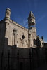
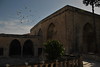
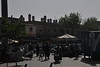

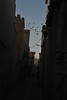
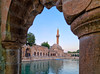
The above images may not be of the site on this page, but were taken nearby. They are loaded from Flickr so please click on them for image credits.
Click here to see more info for this site
Nearby sites
Click here to view sites on an interactive map of the areaKey: Red: member's photo, Blue: 3rd party photo, Yellow: other image, Green: no photo - please go there and take one, Grey: site destroyed
Download sites to:
KML (Google Earth)
GPX (GPS waypoints)
CSV (Garmin/Navman)
CSV (Excel)
To unlock full downloads you need to sign up as a Contributory Member. Otherwise downloads are limited to 50 sites.
Turn off the page maps and other distractions
Nearby sites listing. In the following links * = Image available
6.3km ESE 121° Gürcütepe Ancient Village or Settlement
7.4km SSE 167° Hamzan Tepe Ancient Village or Settlement
14.7km NE 56° Göbekli Tepe* Ancient Temple
15.1km WSW 254° Sayburç* Ancient Village or Settlement
18.7km WSW 238° Çakmaktepe Ancient Village or Settlement
20.5km WNW 282° Ayanlar Höyük Ancient Village or Settlement
37.7km NNW 345° Titris Höyük* Ancient Village or Settlement
38.5km SE 145° Harran* Ancient Village or Settlement
41.6km ENE 77° Kurt Tepesi Ancient Village or Settlement
42.9km ESE 105° Harbetsuvan Tepesi Ancient Village or Settlement
46.3km E 98° Karahan Tepe* Ancient Village or Settlement
46.8km SSE 150° Kucuk Hedbe Ancient Village or Settlement
47.3km SW 225° Arslan Tash* Ancient Village or Settlement
48.6km NNW 337° Gritille Ancient Village or Settlement
49.2km NNW 335° Sürük Mevkii Ancient Village or Settlement
49.4km ENE 62° Tasli Tepe Ancient Village or Settlement
49.4km ENE 62° Başbük Ancient Village or Settlement
50.6km NNW 344° Nevali Cori Ancient Temple
57.5km SE 129° Bazda Cave* Cave or Rock Shelter
62.5km E 87° Sefer Tepe* Ancient Village or Settlement
63.3km NW 310° Girik Tepe Ancient Village or Settlement
72.1km WSW 249° Akarcay Tepe Ancient Village or Settlement
72.6km WSW 254° Mezraa Hoyuk Ancient Village or Settlement
74.9km W 262° Surtepe Round Barrow(s)
76.1km WSW 240° Shoukh Tahtani Ancient Village or Settlement
View more nearby sites and additional images


 We would like to know more about this location. Please feel free to add a brief description and any relevant information in your own language.
 Wir möchten mehr über diese Stätte erfahren. Bitte zögern Sie nicht, eine kurze Beschreibung und relevante Informationen in Deutsch hinzuzufügen.
 Nous aimerions en savoir encore un peu sur les lieux. S'il vous plaît n'hesitez pas à ajouter une courte description et tous les renseignements pertinents dans votre propre langue.
 Quisieramos informarnos un poco más de las lugares. No dude en añadir una breve descripción y otros datos relevantes en su propio idioma.