


<< Our Photo Pages >> Palmyra Temple of Baal Shameen - Ancient Temple in Syria
Submitted by AlexHunger on Monday, 24 August 2015 Page Views: 8055
Site WatchSite Name: Palmyra Temple of Baal ShameenCountry: Syria
NOTE: This site is 0.278 km away from the location you searched for.
Type: Ancient Temple
Nearest Town: Palmyra Nearest Village: Tadmor
Latitude: 34.553418N Longitude: 38.269957E
Condition:
| 5 | Perfect |
| 4 | Almost Perfect |
| 3 | Reasonable but with some damage |
| 2 | Ruined but still recognisable as an ancient site |
| 1 | Pretty much destroyed, possibly visible as crop marks |
| 0 | No data. |
| -1 | Completely destroyed |
| 5 | Superb |
| 4 | Good |
| 3 | Ordinary |
| 2 | Not Good |
| 1 | Awful |
| 0 | No data. |
| 5 | Can be driven to, probably with disabled access |
| 4 | Short walk on a footpath |
| 3 | Requiring a bit more of a walk |
| 2 | A long walk |
| 1 | In the middle of nowhere, a nightmare to find |
| 0 | No data. |
| 5 | co-ordinates taken by GPS or official recorded co-ordinates |
| 4 | co-ordinates scaled from a detailed map |
| 3 | co-ordinates scaled from a bad map |
| 2 | co-ordinates of the nearest village |
| 1 | co-ordinates of the nearest town |
| 0 | no data |
Internal Links:
External Links:
I have visited· I would like to visit
Jansold visited on 1st Apr 2007 - their rating: Cond: 3 Amb: 5 Access: 4
")
The door frieze is in the Palmyra Museum.
Note: Isis blows up Palmyra Temple of Baal Shameen
You may be viewing yesterday's version of this page. To see the most up to date information please register for a free account.
")
")
Do not use the above information on other web sites or publications without permission of the contributor.
Nearby Images from Flickr
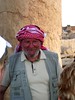
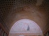
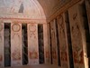
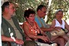
The above images may not be of the site on this page, but were taken nearby. They are loaded from Flickr so please click on them for image credits.
Click here to see more info for this site
Nearby sites
Click here to view sites on an interactive map of the areaKey: Red: member's photo, Blue: 3rd party photo, Yellow: other image, Green: no photo - please go there and take one, Grey: site destroyed
Download sites to:
KML (Google Earth)
GPX (GPS waypoints)
CSV (Garmin/Navman)
CSV (Excel)
To unlock full downloads you need to sign up as a Contributory Member. Otherwise downloads are limited to 50 sites.
Turn off the page maps and other distractions
Nearby sites listing. In the following links * = Image available
397m S 172° Palmyra Temple of Nabu* Ancient Temple
502m ENE 63° Palmyra Museum* Museum
722m NNE 28° Palmyra* Ancient Village or Settlement
748m WNW 289° Palmyra Temple of Fire* Ancient Temple
774m WNW 283° Palmyra Temple of Allat* Ancient Temple
778m SSE 151° Palmyra Temple of Baal* Ancient Temple
846m WNW 282° Palmyra Palace of Diocletian* Ancient Palace
1.8km W 270° Palmyra Valley of the Tombs* Rock Cut Tomb
127.6km NNE 20° Resafe* Ancient Village or Settlement
132.1km WNW 284° Qatna Ancient Village or Settlement
143.9km WSW 246° Deir Mar Musa al-Habashi* Standing Stones
150.7km N 2° Abu Hureyra Ancient Village or Settlement
153.0km WNW 295° Hama National Museum Museum
153.2km WNW 295° Hama.* Ancient Village or Settlement
160.0km N 355° Barbalissos Ancient Village or Settlement
160.3km W 271° Kadesh Tell* Ancient Village or Settlement
161.7km WSW 247° Yabrud Temple* Ancient Temple
166.1km W 265° Qamouat el-Hermel Marker Stone
168.9km NNE 25° Tell Zeidan Ancient Village or Settlement
170.3km NNE 24° Tal al-Khwaira Ancient Village or Settlement
174.0km NNE 23° Tuttul Ancient Village or Settlement
175.1km W 263° Deir Mar Maroun Ancient Village or Settlement
175.6km W 268° Brissa Stele Sculptured Stone
179.0km W 273° Beit Djallou Temple of Nemesis Ancient Temple
179.2km N 359° Jebel Aruda Ancient Temple
View more nearby sites and additional images


 We would like to know more about this location. Please feel free to add a brief description and any relevant information in your own language.
 Wir möchten mehr über diese Stätte erfahren. Bitte zögern Sie nicht, eine kurze Beschreibung und relevante Informationen in Deutsch hinzuzufügen.
 Nous aimerions en savoir encore un peu sur les lieux. S'il vous plaît n'hesitez pas à ajouter une courte description et tous les renseignements pertinents dans votre propre langue.
 Quisieramos informarnos un poco más de las lugares. No dude en añadir una breve descripción y otros datos relevantes en su propio idioma.