

<< Text Pages >> Birtlan - Ancient Village or Settlement in Turkey
Submitted by AlexHunger on Sunday, 27 August 2006 Page Views: 3208
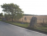
Multi-periodSite Name: Birtlan Alternative Name: Böğürtlen HöyükCountry: Turkey
NOTE: This site is 35.516 km away from the location you searched for.
Type: Ancient Village or Settlement
Nearest Town: Sakçagözü Nearest Village: Şatırhüyük
Latitude: 37.217729N Longitude: 36.973622E
Condition:
| 5 | Perfect |
| 4 | Almost Perfect |
| 3 | Reasonable but with some damage |
| 2 | Ruined but still recognisable as an ancient site |
| 1 | Pretty much destroyed, possibly visible as crop marks |
| 0 | No data. |
| -1 | Completely destroyed |
| 5 | Superb |
| 4 | Good |
| 3 | Ordinary |
| 2 | Not Good |
| 1 | Awful |
| 0 | No data. |
| 5 | Can be driven to, probably with disabled access |
| 4 | Short walk on a footpath |
| 3 | Requiring a bit more of a walk |
| 2 | A long walk |
| 1 | In the middle of nowhere, a nightmare to find |
| 0 | No data. |
| 5 | co-ordinates taken by GPS or official recorded co-ordinates |
| 4 | co-ordinates scaled from a detailed map |
| 3 | co-ordinates scaled from a bad map |
| 2 | co-ordinates of the nearest village |
| 1 | co-ordinates of the nearest town |
| 0 | no data |
Be the first person to rate this site - see the 'Contribute!' box in the right hand menu.
Internal Links:
External Links:
Ancient Village or Settlement in Gaziantep Province, Turkey.
Neolithic Settlement in Gaziantep Province, Turkey.
You may be viewing yesterday's version of this page. To see the most up to date information please register for a free account.
Do not use the above information on other web sites or publications without permission of the contributor.
Click here to see more info for this site
Nearby sites
Click here to view sites on an interactive map of the areaKey: Red: member's photo, Blue: 3rd party photo, Yellow: other image, Green: no photo - please go there and take one, Grey: site destroyed
Download sites to:
KML (Google Earth)
GPX (GPS waypoints)
CSV (Garmin/Navman)
CSV (Excel)
To unlock full downloads you need to sign up as a Contributory Member. Otherwise downloads are limited to 50 sites.
Turn off the page maps and other distractions
Nearby sites listing. In the following links * = Image available
8.1km WSW 245° Coba Höyük* Ancient Village or Settlement
12.8km NNE 25° Domuztepe Ancient Village or Settlement
29.2km WSW 244° Sam'al* Ancient Village or Settlement
40.3km SSW 210° Yesemek Ancient Mine, Quarry or other Industry
41.3km N 354° Marash* Ancient Village or Settlement
53.6km ENE 75° Yavuzeli Dolmen* Burial Chamber or Dolmen
60.5km SSE 162° Oylum Hoyuk Ancient Village or Settlement
64.3km W 278° Karatepe Ancient Village or Settlement
69.9km W 266° Castabala Ancient Village or Settlement
71.5km ESE 103° Sehzade Höyük Ancient Village or Settlement
77.4km NNW 338° Direkli Cave Cave or Rock Shelter
79.8km S 186° Ain Dara* Ancient Temple
80.4km WSW 250° Issus (Cilicia) Ancient Village or Settlement
81.5km ESE 102° Zeugma Ancient Village or Settlement
88.3km ESE 102° Surtepe Round Barrow(s)
91.9km S 186° Bit-Agusi Ancient Village or Settlement
92.8km ENE 64° Levzin Höyuk Ancient Village or Settlement
94.9km ESE 107° Mezraa Hoyuk Ancient Village or Settlement
95.2km W 273° Anazarbus Ancient Village or Settlement
99.1km ESE 109° Akarcay Tepe Ancient Village or Settlement
102.0km WNW 289° Uzunoglantepe Relief Sculptured Stone
102.1km ESE 115° Carchemish* Ancient Village or Settlement
102.5km ESE 115° Carchemish, Syrian* Ancient Village or Settlement
105.2km ESE 115° Shoukh Tahtani Ancient Village or Settlement
110.4km ESE 119° Mureybet Ancient Village or Settlement
View more nearby sites and additional images


 We would like to know more about this location. Please feel free to add a brief description and any relevant information in your own language.
 Wir möchten mehr über diese Stätte erfahren. Bitte zögern Sie nicht, eine kurze Beschreibung und relevante Informationen in Deutsch hinzuzufügen.
 Nous aimerions en savoir encore un peu sur les lieux. S'il vous plaît n'hesitez pas à ajouter une courte description et tous les renseignements pertinents dans votre propre langue.
 Quisieramos informarnos un poco más de las lugares. No dude en añadir una breve descripción y otros datos relevantes en su propio idioma.