


<< Other Photo Pages >> Baalbek Temple - Ancient Temple in Lebanon
Submitted by AlexHunger on Monday, 10 July 2006 Page Views: 9860
Multi-periodSite Name: Baalbek Temple Alternative Name: HeliopolisCountry: Lebanon
NOTE: This site is 0.355 km away from the location you searched for.
Type: Ancient Temple
Nearest Town: Ba‘albak Nearest Village: Beirut
Latitude: 34.007070N Longitude: 36.204940E
Condition:
| 5 | Perfect |
| 4 | Almost Perfect |
| 3 | Reasonable but with some damage |
| 2 | Ruined but still recognisable as an ancient site |
| 1 | Pretty much destroyed, possibly visible as crop marks |
| 0 | No data. |
| -1 | Completely destroyed |
| 5 | Superb |
| 4 | Good |
| 3 | Ordinary |
| 2 | Not Good |
| 1 | Awful |
| 0 | No data. |
| 5 | Can be driven to, probably with disabled access |
| 4 | Short walk on a footpath |
| 3 | Requiring a bit more of a walk |
| 2 | A long walk |
| 1 | In the middle of nowhere, a nightmare to find |
| 0 | No data. |
| 5 | co-ordinates taken by GPS or official recorded co-ordinates |
| 4 | co-ordinates scaled from a detailed map |
| 3 | co-ordinates scaled from a bad map |
| 2 | co-ordinates of the nearest village |
| 1 | co-ordinates of the nearest town |
| 0 | no data |
Internal Links:
External Links:
I have visited· I would like to visit
DrewParsons would like to visit
Jansold visited on 9th Oct 2019 - their rating: Cond: 3 Amb: 5 Access: 5 One of the best Roman sites outside of Italy. The preservation and scale of the temples are really impressive
")
Roman Temples built over older ruins. Originally dedicated to Baal, but then used for entire Roman Pantheon.
You may be viewing yesterday's version of this page. To see the most up to date information please register for a free account.
")
")
")
")
Do not use the above information on other web sites or publications without permission of the contributor.
Nearby Images from Flickr
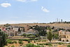
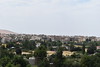
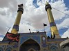
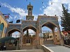
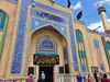
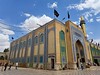
The above images may not be of the site on this page, but were taken nearby. They are loaded from Flickr so please click on them for image credits.
Click here to see more info for this site
Nearby sites
Click here to view sites on an interactive map of the areaKey: Red: member's photo, Blue: 3rd party photo, Yellow: other image, Green: no photo - please go there and take one, Grey: site destroyed
Download sites to:
KML (Google Earth)
GPX (GPS waypoints)
CSV (Garmin/Navman)
CSV (Excel)
To unlock full downloads you need to sign up as a Contributory Member. Otherwise downloads are limited to 50 sites.
Turn off the page maps and other distractions
Nearby sites listing. In the following links * = Image available
982m SSW 207° Baalbek Quarry* Ancient Mine, Quarry or other Industry
25.5km WSW 241° Nihata Temple of Hadaranes Ancient Temple
25.6km WSW 241° Nihata Temple of Atargatis Ancient Temple
26.1km WSW 245° Hosn Niha Temple C Ancient Temple
26.3km WSW 245° Hosn Niha Temple D Ancient Temple
29.6km WNW 293° Aphaca* Holy Well or Sacred Spring
37.3km WNW 284° Yanouh Ancient Temple
38.8km NW 322° Monastery of Saint Anthony of Qozhaya Ancient Temple
39.3km W 267° Qal'at Faqra Ancient Temple
41.1km WNW 283° Machnaka Ancient Temple
41.5km NNE 22° Deir Mar Maroun Ancient Village or Settlement
41.9km E 95° Yabrud Temple* Ancient Temple
45.6km NW 314° Qasr Naous Temple Ancient Temple
45.7km NW 313° Qasr Naous West Temple Ancient Temple
45.8km NW 310° Bziza Temple Ancient Temple
45.8km NNW 343° Sfire Temples Ancient Temple
47.1km SSW 214° Majdel Aanjar Tempel Ancient Temple
48.6km NW 312° Amioun Necropolis Rock Cut Tomb
49.5km SSW 200° Deir el-Aachayer Temple Ancient Temple
52.0km NNE 27° Qamouat el-Hermel Marker Stone
52.5km WNW 284° The monastery of Saint Antonio Ancient Palace
53.0km WNW 284° Byblos* Ancient Village or Settlement
54.3km NNE 15° Brissa Stele Sculptured Stone
54.4km SW 220° Dakoue Temple Ancient Temple
54.7km S 172° Tal al-Humira Ancient Village or Settlement
View more nearby sites and additional images


 We would like to know more about this location. Please feel free to add a brief description and any relevant information in your own language.
 Wir möchten mehr über diese Stätte erfahren. Bitte zögern Sie nicht, eine kurze Beschreibung und relevante Informationen in Deutsch hinzuzufügen.
 Nous aimerions en savoir encore un peu sur les lieux. S'il vous plaît n'hesitez pas à ajouter une courte description et tous les renseignements pertinents dans votre propre langue.
 Quisieramos informarnos un poco más de las lugares. No dude en añadir una breve descripción y otros datos relevantes en su propio idioma.