 with our Megalithic Portal iPhone app")


<< Text Pages >> Amioun Necropolis - Rock Cut Tomb in Lebanon
Submitted by AlexHunger on Monday, 19 November 2007 Page Views: 4236
Multi-periodSite Name: Amioun Necropolis Alternative Name: AmmiyaCountry: Lebanon
NOTE: This site is 8.209 km away from the location you searched for.
Type: Rock Cut Tomb
Nearest Town: Tripoli Nearest Village: Amioun
Latitude: 34.299593N Longitude: 35.812039E
Condition:
| 5 | Perfect |
| 4 | Almost Perfect |
| 3 | Reasonable but with some damage |
| 2 | Ruined but still recognisable as an ancient site |
| 1 | Pretty much destroyed, possibly visible as crop marks |
| 0 | No data. |
| -1 | Completely destroyed |
| 5 | Superb |
| 4 | Good |
| 3 | Ordinary |
| 2 | Not Good |
| 1 | Awful |
| 0 | No data. |
| 5 | Can be driven to, probably with disabled access |
| 4 | Short walk on a footpath |
| 3 | Requiring a bit more of a walk |
| 2 | A long walk |
| 1 | In the middle of nowhere, a nightmare to find |
| 0 | No data. |
| 5 | co-ordinates taken by GPS or official recorded co-ordinates |
| 4 | co-ordinates scaled from a detailed map |
| 3 | co-ordinates scaled from a bad map |
| 2 | co-ordinates of the nearest village |
| 1 | co-ordinates of the nearest town |
| 0 | no data |
Internal Links:
External Links:
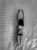
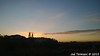
Rock Cut Tomb in Lebanon
Rock cut tombs in cliff below Saint John Al Chir Church.
The own was inhabited since at least the Bronze age.
You may be viewing yesterday's version of this page. To see the most up to date information please register for a free account.
Do not use the above information on other web sites or publications without permission of the contributor.
Nearby Images from Flickr
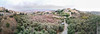
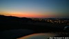
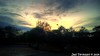

The above images may not be of the site on this page, but were taken nearby. They are loaded from Flickr so please click on them for image credits.
Click here to see more info for this site
Nearby sites
Click here to view sites on an interactive map of the areaKey: Red: member's photo, Blue: 3rd party photo, Yellow: other image, Green: no photo - please go there and take one, Grey: site destroyed
Download sites to:
KML (Google Earth)
GPX (GPS waypoints)
CSV (Garmin/Navman)
CSV (Excel)
To unlock full downloads you need to sign up as a Contributory Member. Otherwise downloads are limited to 50 sites.
Turn off the page maps and other distractions
Nearby sites listing. In the following links * = Image available
3.1km ESE 111° Qasr Naous West Temple Ancient Temple
3.3km ESE 110° Qasr Naous Temple Ancient Temple
3.4km SSE 165° Bziza Temple Ancient Temple
12.5km E 98° Monastery of Saint Anthony of Qozhaya Ancient Temple
16.4km N 4° Tripoli (Lebanon)* Ancient Village or Settlement
23.0km SSE 157° Aphaca* Holy Well or Sacred Spring
23.4km S 180° Yanouh Ancient Temple
23.6km S 189° Machnaka Ancient Temple
24.5km SW 217° The monastery of Saint Antonio Ancient Palace
25.1km SW 217° Byblos* Ancient Village or Settlement
25.4km ENE 63° Sfire Temples Ancient Temple
34.8km S 185° Qal'at Faqra Ancient Temple
43.1km SSW 207° Nahr el-Kalb Steles Rock Art
45.4km SSE 164° Hosn Niha Temple C Ancient Temple
45.4km SSE 164° Hosn Niha Temple D Ancient Temple
47.1km SSE 163° Nihata Temple of Hadaranes Ancient Temple
47.1km SSE 163° Nihata Temple of Atargatis Ancient Temple
48.6km SE 132° Baalbek Temple * Ancient Temple
48.9km SE 133° Baalbek Quarry* Ancient Mine, Quarry or other Industry
52.1km E 83° Deir Mar Maroun Ancient Village or Settlement
52.6km SSW 212° Beirut* Ancient Village or Settlement
53.3km SSW 202° Beit Meri Temple of Baal Marqod Ancient Temple
53.7km ENE 68° Brissa Stele Sculptured Stone
53.7km SW 214° American University Museum Museum
54.3km SSW 210° Beirut National Museum* Museum
View more nearby sites and additional images


 We would like to know more about this location. Please feel free to add a brief description and any relevant information in your own language.
 Wir möchten mehr über diese Stätte erfahren. Bitte zögern Sie nicht, eine kurze Beschreibung und relevante Informationen in Deutsch hinzuzufügen.
 Nous aimerions en savoir encore un peu sur les lieux. S'il vous plaît n'hesitez pas à ajouter une courte description et tous les renseignements pertinents dans votre propre langue.
 Quisieramos informarnos un poco más de las lugares. No dude en añadir una breve descripción y otros datos relevantes en su propio idioma.