


<< Text Pages >> King Muwatalli Relief - Rock Art in Turkey
Submitted by AlexHunger on Sunday, 25 March 2007 Page Views: 5093
Rock ArtSite Name: King Muwatalli Relief Alternative Name: Sirkeli HöyükCountry: Turkey
NOTE: This site is 0.158 km away from the location you searched for.
Type: Rock Art
Nearest Town: Ceyhan Nearest Village: Sirkeli
Latitude: 37.004151N Longitude: 35.745659E
Condition:
| 5 | Perfect |
| 4 | Almost Perfect |
| 3 | Reasonable but with some damage |
| 2 | Ruined but still recognisable as an ancient site |
| 1 | Pretty much destroyed, possibly visible as crop marks |
| 0 | No data. |
| -1 | Completely destroyed |
| 5 | Superb |
| 4 | Good |
| 3 | Ordinary |
| 2 | Not Good |
| 1 | Awful |
| 0 | No data. |
| 5 | Can be driven to, probably with disabled access |
| 4 | Short walk on a footpath |
| 3 | Requiring a bit more of a walk |
| 2 | A long walk |
| 1 | In the middle of nowhere, a nightmare to find |
| 0 | No data. |
| 5 | co-ordinates taken by GPS or official recorded co-ordinates |
| 4 | co-ordinates scaled from a detailed map |
| 3 | co-ordinates scaled from a bad map |
| 2 | co-ordinates of the nearest village |
| 1 | co-ordinates of the nearest town |
| 0 | no data |
Internal Links:
External Links:
I have visited· I would like to visit
davidmorgan would like to visit
Reliefs carved on the banks of the River Ceyhan.
The excavation website.
You may be viewing yesterday's version of this page. To see the most up to date information please register for a free account.
Do not use the above information on other web sites or publications without permission of the contributor.
Nearby Images from Flickr

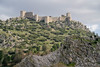

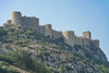


The above images may not be of the site on this page, but were taken nearby. They are loaded from Flickr so please click on them for image credits.
Click here to see more info for this site
Nearby sites
Click here to view sites on an interactive map of the areaKey: Red: member's photo, Blue: 3rd party photo, Yellow: other image, Green: no photo - please go there and take one, Grey: site destroyed
Download sites to:
KML (Google Earth)
GPX (GPS waypoints)
CSV (Garmin/Navman)
CSV (Excel)
To unlock full downloads you need to sign up as a Contributory Member. Otherwise downloads are limited to 50 sites.
Turn off the page maps and other distractions
Nearby sites listing. In the following links * = Image available
12.0km WSW 245° Mopsuestia* Ancient Village or Settlement
26.1km S 172° Aegeae Ancient Village or Settlement
31.1km NNE 26° Anazarbus Ancient Village or Settlement
33.5km E 96° Issus (Cilicia) Ancient Village or Settlement
38.4km W 269° Adana Archaeological Museum* Museum
43.5km ENE 64° Castabala Ancient Village or Settlement
53.8km W 267° Zeytinli Hoyuk Ancient Village or Settlement
55.5km NE 54° Karatepe Ancient Village or Settlement
58.0km NNE 12° Uzunoglantepe Relief Sculptured Stone
62.0km SW 215° Magarsus Ancient Village or Settlement
74.9km W 274° Kurbanli Roman Road* Ancient Trackway
83.5km E 82° Sam'al* Ancient Village or Settlement
89.5km E 97° Yesemek Ancient Mine, Quarry or other Industry
95.5km SSE 156° Antakya Museum Museum
97.0km SSE 157° Antioch on the Orontes Ancient Village or Settlement
99.6km S 171° Seleukeia Temple of Zeus Ancient Temple
101.2km SE 146° Tell Ta’yinat* Ancient Village or Settlement
102.2km SE 146° Alalakh* Ancient Village or Settlement
103.6km ENE 78° Coba Höyük* Ancient Village or Settlement
104.0km WSW 258° Yümük Tepe Ancient Village or Settlement
108.1km SSE 168° Al Mina Ancient Village or Settlement
111.2km WSW 255° Pompeiopolis* Ancient Village or Settlement
111.5km ENE 77° Birtlan Ancient Village or Settlement
115.2km ESE 119° Ain Dara* Ancient Temple
116.1km NW 321° Kestel Ancient Mine, Quarry or other Industry
View more nearby sites and additional images


 We would like to know more about this location. Please feel free to add a brief description and any relevant information in your own language.
 Wir möchten mehr über diese Stätte erfahren. Bitte zögern Sie nicht, eine kurze Beschreibung und relevante Informationen in Deutsch hinzuzufügen.
 Nous aimerions en savoir encore un peu sur les lieux. S'il vous plaît n'hesitez pas à ajouter une courte description et tous les renseignements pertinents dans votre propre langue.
 Quisieramos informarnos un poco más de las lugares. No dude en añadir una breve descripción y otros datos relevantes en su propio idioma.