


<< Other Photo Pages >> Mopsuestia - Ancient Village or Settlement in Turkey
Submitted by davidmorgan on Tuesday, 03 February 2015 Page Views: 3613
Multi-periodSite Name: Mopsuestia Alternative Name: Mopsouestia, Mamistra, MisisCountry: Turkey Type: Ancient Village or Settlement
Nearest Town: Ceyhan Nearest Village: Yakapinar
Latitude: 36.957677N Longitude: 35.623688E
Condition:
| 5 | Perfect |
| 4 | Almost Perfect |
| 3 | Reasonable but with some damage |
| 2 | Ruined but still recognisable as an ancient site |
| 1 | Pretty much destroyed, possibly visible as crop marks |
| 0 | No data. |
| -1 | Completely destroyed |
| 5 | Superb |
| 4 | Good |
| 3 | Ordinary |
| 2 | Not Good |
| 1 | Awful |
| 0 | No data. |
| 5 | Can be driven to, probably with disabled access |
| 4 | Short walk on a footpath |
| 3 | Requiring a bit more of a walk |
| 2 | A long walk |
| 1 | In the middle of nowhere, a nightmare to find |
| 0 | No data. |
| 5 | co-ordinates taken by GPS or official recorded co-ordinates |
| 4 | co-ordinates scaled from a detailed map |
| 3 | co-ordinates scaled from a bad map |
| 2 | co-ordinates of the nearest village |
| 1 | co-ordinates of the nearest town |
| 0 | no data |
Internal Links:
External Links:
")
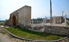
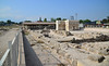
Note: Turkey’s immortal city gets a new lease of life with archaeological work that is revealing the ancient city’s rich history
You may be viewing yesterday's version of this page. To see the most up to date information please register for a free account.
Do not use the above information on other web sites or publications without permission of the contributor.
Nearby Images from Flickr
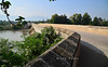
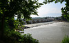


The above images may not be of the site on this page, but were taken nearby. They are loaded from Flickr so please click on them for image credits.
Click here to see more info for this site
Nearby sites
Click here to view sites on an interactive map of the areaKey: Red: member's photo, Blue: 3rd party photo, Yellow: other image, Green: no photo - please go there and take one, Grey: site destroyed
Download sites to:
KML (Google Earth)
GPX (GPS waypoints)
CSV (Garmin/Navman)
CSV (Excel)
To unlock full downloads you need to sign up as a Contributory Member. Otherwise downloads are limited to 50 sites.
Turn off the page maps and other distractions
Nearby sites listing. In the following links * = Image available
12.0km ENE 64° King Muwatalli Relief Rock Art
25.3km SE 145° Aegeae Ancient Village or Settlement
27.9km W 279° Adana Archaeological Museum* Museum
41.2km NE 36° Anazarbus Ancient Village or Settlement
42.9km W 273° Zeytinli Hoyuk Ancient Village or Settlement
44.2km E 88° Issus (Cilicia) Ancient Village or Settlement
52.0km SSW 208° Magarsus Ancient Village or Settlement
55.5km ENE 64° Castabala Ancient Village or Settlement
64.8km W 279° Kurbanli Roman Road* Ancient Trackway
66.0km NNE 20° Uzunoglantepe Relief Sculptured Stone
67.3km NE 56° Karatepe Ancient Village or Settlement
92.3km W 259° Yümük Tepe Ancient Village or Settlement
95.0km E 80° Sam'al* Ancient Village or Settlement
96.0km SSE 148° Antakya Museum Museum
96.9km SSE 164° Seleukeia Temple of Zeus Ancient Temple
97.2km SSE 150° Antioch on the Orontes Ancient Village or Settlement
99.4km WSW 256° Pompeiopolis* Ancient Village or Settlement
99.9km E 93° Yesemek Ancient Mine, Quarry or other Industry
103.7km SE 139° Tell Ta’yinat* Ancient Village or Settlement
104.6km SE 139° Alalakh* Ancient Village or Settlement
105.9km SSE 162° Al Mina Ancient Village or Settlement
113.8km NNW 326° Kestel Ancient Mine, Quarry or other Industry
115.3km ENE 77° Coba Höyük* Ancient Village or Settlement
122.6km ESE 114° Ain Dara* Ancient Temple
123.2km ENE 76° Birtlan Ancient Village or Settlement
View more nearby sites and additional images


 We would like to know more about this location. Please feel free to add a brief description and any relevant information in your own language.
 Wir möchten mehr über diese Stätte erfahren. Bitte zögern Sie nicht, eine kurze Beschreibung und relevante Informationen in Deutsch hinzuzufügen.
 Nous aimerions en savoir encore un peu sur les lieux. S'il vous plaît n'hesitez pas à ajouter une courte description et tous les renseignements pertinents dans votre propre langue.
 Quisieramos informarnos un poco más de las lugares. No dude en añadir una breve descripción y otros datos relevantes en su propio idioma.