

<< Our Photo Pages >> Naburiya synagogue in Biriya Forest - Ancient Temple in Israel
Submitted by motist on Thursday, 28 September 2017 Page Views: 1302
Neolithic and Bronze AgeSite Name: Naburiya synagogue in Biriya ForestCountry: Israel Type: Ancient Temple
Nearest Town: Safad Nearest Village: Birya
Latitude: 33.003545N Longitude: 35.508951E
Condition:
| 5 | Perfect |
| 4 | Almost Perfect |
| 3 | Reasonable but with some damage |
| 2 | Ruined but still recognisable as an ancient site |
| 1 | Pretty much destroyed, possibly visible as crop marks |
| 0 | No data. |
| -1 | Completely destroyed |
| 5 | Superb |
| 4 | Good |
| 3 | Ordinary |
| 2 | Not Good |
| 1 | Awful |
| 0 | No data. |
| 5 | Can be driven to, probably with disabled access |
| 4 | Short walk on a footpath |
| 3 | Requiring a bit more of a walk |
| 2 | A long walk |
| 1 | In the middle of nowhere, a nightmare to find |
| 0 | No data. |
| 5 | co-ordinates taken by GPS or official recorded co-ordinates |
| 4 | co-ordinates scaled from a detailed map |
| 3 | co-ordinates scaled from a bad map |
| 2 | co-ordinates of the nearest village |
| 1 | co-ordinates of the nearest town |
| 0 | no data |
Internal Links:
External Links:
")
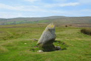
Naburiya synagogue in Biriya Forest – Navoriya ancient synagogue in the Galilee
The town of Naburiya, also known as Nevoraya, was occupied during the first and second temple periods. It was then abandoned for about 200 years before it was resettled by Jews. The village was mentioned in the Talmud. The ancient synagogue dates to the Roman period, sometime between the 2nd and 4th c CE, and was used until the 7th c CE.
The synagogue had two rows of four stone columns. The façade was reconstructed by the JNF. The entrance to the synagogue was from the south side, and the ark was next to the entrance on the south. In its final stage, a northern entrance was added to the synagogue.
The major finds were the lintels; one was decorated with a menorah inside of a wreath, with a Hebrew inscription which dates the lintel to the year 564. The inscription is unique in that it dates from the destruction of the second temple in 70 CE. It was discovered by archaeologist Nachman Avigad, and can be seen in the Israel Museum.
Part of the ark was found, which probably had shelves for Torah scrolls. Above the ark, 2 lions were engraved into the stone which also had a hole for the eternal fire. This can be found in the Rockefeller Museum.
You may be viewing yesterday's version of this page. To see the most up to date information please register for a free account.
")
")
")
")
")
")
")
")
")
")
")
")
")
")
")
")
")
")
")
")
")
")
")
")
These are just the first 25 photos of Naburiya synagogue in Biriya Forest. If you log in with a free user account you will be able to see our entire collection.
Do not use the above information on other web sites or publications without permission of the contributor.
Click here to see more info for this site
Nearby sites
Click here to view sites on an interactive map of the areaKey: Red: member's photo, Blue: 3rd party photo, Yellow: other image, Green: no photo - please go there and take one, Grey: site destroyed
Download sites to:
KML (Google Earth)
GPX (GPS waypoints)
CSV (Garmin/Navman)
CSV (Excel)
To unlock full downloads you need to sign up as a Contributory Member. Otherwise downloads are limited to 50 sites.
Turn off the page maps and other distractions
Nearby sites listing. In the following links * = Image available
5.7km ENE 75° Tel Hatzor* Artificial Mound
9.9km WNW 297° Baram Synagogue* Ancient Temple
10.5km SW 227° Crescent-shaped monument near Shefer* Artificial Mound
12.4km N 9° Tel Kadesh Naftali* Ancient Village or Settlement
13.4km SSW 192° Hukok* Ancient Temple
15.4km SE 133° Bethsaida* Ancient Village or Settlement
16.4km W 260° PEKI''IN old Synagogue * Ancient Temple
18.2km S 180° Dalmanutha* Ancient Village or Settlement
22.9km NE 39° Engraved dolmen near Kibbutz Shamir* Burial Chamber or Dolmen
23.0km WSW 255° Khirbet Mehoz* Ancient Village or Settlement
23.8km SE 146° Kursi National Park* Ancient Village or Settlement
24.7km ESE 116° The ancient city of Gamla* Ancient Village or Settlement
24.9km ESE 116° Gamla Dolmen field* Burial Chamber or Dolmen
25.1km WSW 242° Hilazon Tachtit* Cave or Rock Shelter
26.7km S 172° Hammat Tiberias* Ancient Village or Settlement
28.3km SSE 149° Wadi Ein Gev Ancient Village or Settlement
28.3km SSE 149° NEG II Prehistoric Village* Ancient Village or Settlement
28.7km SSE 151° Sussita* Ancient Village or Settlement
28.7km WSW 251° HaYonim cave* Cave or Rock Shelter
28.8km SW 229° Tel Yodfat * Hillfort
29.2km ESE 111° Rujm el-Hiri* Stone Circle
29.3km NNE 13° Tel Abel Beth Maacah* Ancient Village or Settlement
29.5km W 277° Manot cave* Cave or Rock Shelter
30.4km NNE 26° Tel Dan Ancient Village or Settlement
30.4km ESE 115° Dolmen field near Natur on the Golan Heights* Barrow Cemetery
View more nearby sites and additional images


 We would like to know more about this location. Please feel free to add a brief description and any relevant information in your own language.
 Wir möchten mehr über diese Stätte erfahren. Bitte zögern Sie nicht, eine kurze Beschreibung und relevante Informationen in Deutsch hinzuzufügen.
 Nous aimerions en savoir encore un peu sur les lieux. S'il vous plaît n'hesitez pas à ajouter une courte description et tous les renseignements pertinents dans votre propre langue.
 Quisieramos informarnos un poco más de las lugares. No dude en añadir una breve descripción y otros datos relevantes en su propio idioma.