


<< Our Photo Pages >> Fraktin - Carving in Turkey
Submitted by davidmorgan on Monday, 14 July 2008 Page Views: 6465
Multi-periodSite Name: Fraktin Alternative Name: FiraktinCountry: Turkey
NOTE: This site is 30.09 km away from the location you searched for.
Type: Carving
Nearest Town: Develi Nearest Village: Gümüşören
Latitude: 38.268900N Longitude: 35.629800E
Condition:
| 5 | Perfect |
| 4 | Almost Perfect |
| 3 | Reasonable but with some damage |
| 2 | Ruined but still recognisable as an ancient site |
| 1 | Pretty much destroyed, possibly visible as crop marks |
| 0 | No data. |
| -1 | Completely destroyed |
| 5 | Superb |
| 4 | Good |
| 3 | Ordinary |
| 2 | Not Good |
| 1 | Awful |
| 0 | No data. |
| 5 | Can be driven to, probably with disabled access |
| 4 | Short walk on a footpath |
| 3 | Requiring a bit more of a walk |
| 2 | A long walk |
| 1 | In the middle of nowhere, a nightmare to find |
| 0 | No data. |
| 5 | co-ordinates taken by GPS or official recorded co-ordinates |
| 4 | co-ordinates scaled from a detailed map |
| 3 | co-ordinates scaled from a bad map |
| 2 | co-ordinates of the nearest village |
| 1 | co-ordinates of the nearest town |
| 0 | no data |
Internal Links:
External Links:
I have visited· I would like to visit
davidmorgan has visited here
")
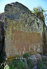
A 13th century BCE Hittite carving depicting king Hattuşili III pouring a libation to the Storm God, and queen Puduhepa pouring one to Hepat, the Sun Goddess.
You may be viewing yesterday's version of this page. To see the most up to date information please register for a free account.
")
")
")
")
Do not use the above information on other web sites or publications without permission of the contributor.
Nearby Images from Flickr
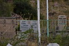

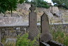
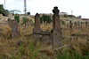

The above images may not be of the site on this page, but were taken nearby. They are loaded from Flickr so please click on them for image credits.
Click here to see more info for this site
Nearby sites
Click here to view sites on an interactive map of the areaKey: Red: member's photo, Blue: 3rd party photo, Yellow: other image, Green: no photo - please go there and take one, Grey: site destroyed
Download sites to:
KML (Google Earth)
GPX (GPS waypoints)
CSV (Garmin/Navman)
CSV (Excel)
To unlock full downloads you need to sign up as a Contributory Member. Otherwise downloads are limited to 50 sites.
Turn off the page maps and other distractions
Nearby sites listing. In the following links * = Image available
26.2km E 95° Imamkullu* Carving
34.2km E 100° Gezbeli* Carving
51.7km NNW 346° Kayseri Archaeological Museum* Museum
58.8km NW 324° Örenşehir* Ancient Village or Settlement
61.2km E 83° Comana Chryse* Ancient Village or Settlement
61.8km WNW 291° Sobessos* Ancient Village or Settlement
64.7km N 0° Kültepe Kanes* Ancient Village or Settlement
65.0km N 1° Karum Kanes* Ancient Village or Settlement
78.9km W 279° Derinkuyu Underground City* Ancient Village or Settlement
79.4km WNW 286° Kaymakli Underground City* Ancient Village or Settlement
80.4km WNW 303° Rock Cones of Urgup (Cappadocia)* Natural Stone / Erratic / Other Natural Feature
81.5km SW 231° Kestel Ancient Mine, Quarry or other Industry
81.9km NNE 16° Sultan Hani Stele* Rock Art
86.8km SSE 165° Uzunoglantepe Relief Sculptured Stone
88.8km WNW 296° Nevsehir Underground City* Cave or Rock Shelter
89.7km WSW 248° Nahita Ancient Village or Settlement
94.2km W 270° Golludag* Ancient Village or Settlement
99.6km ESE 117° Direkli Cave Cave or Rock Shelter
99.8km W 264° Tepecik Çiftlik* Ancient Village or Settlement
100.7km WSW 243° Kösk Höyük* Ancient Village or Settlement
102.0km W 266° Divarli Hoyuk* Ancient Village or Settlement
102.5km WNW 301° Arapsun* Ancient Village or Settlement
103.2km WNW 284° Topada* Carving
104.8km WSW 242° Tyana (Kemerhisar)* Ancient Village or Settlement
107.8km NW 320° Topakli Hoyuk Ancient Village or Settlement
View more nearby sites and additional images


 We would like to know more about this location. Please feel free to add a brief description and any relevant information in your own language.
 Wir möchten mehr über diese Stätte erfahren. Bitte zögern Sie nicht, eine kurze Beschreibung und relevante Informationen in Deutsch hinzuzufügen.
 Nous aimerions en savoir encore un peu sur les lieux. S'il vous plaît n'hesitez pas à ajouter une courte description et tous les renseignements pertinents dans votre propre langue.
 Quisieramos informarnos un poco más de las lugares. No dude en añadir una breve descripción y otros datos relevantes en su propio idioma.