 with our Megalithic Portal iPhone app")


<< Our Photo Pages >> Gadara - Ancient Village or Settlement in Jordan
Submitted by SolarMegalith on Monday, 08 November 2010 Page Views: 3933
Multi-periodSite Name: GadaraCountry: Jordan
NOTE: This site is 4.76 km away from the location you searched for.
Type: Ancient Village or Settlement
Nearest Town: Umm Qeis
Latitude: 32.392000N Longitude: 35.404000E
Condition:
| 5 | Perfect |
| 4 | Almost Perfect |
| 3 | Reasonable but with some damage |
| 2 | Ruined but still recognisable as an ancient site |
| 1 | Pretty much destroyed, possibly visible as crop marks |
| 0 | No data. |
| -1 | Completely destroyed |
| 5 | Superb |
| 4 | Good |
| 3 | Ordinary |
| 2 | Not Good |
| 1 | Awful |
| 0 | No data. |
| 5 | Can be driven to, probably with disabled access |
| 4 | Short walk on a footpath |
| 3 | Requiring a bit more of a walk |
| 2 | A long walk |
| 1 | In the middle of nowhere, a nightmare to find |
| 0 | No data. |
| 5 | co-ordinates taken by GPS or official recorded co-ordinates |
| 4 | co-ordinates scaled from a detailed map |
| 3 | co-ordinates scaled from a bad map |
| 2 | co-ordinates of the nearest village |
| 1 | co-ordinates of the nearest town |
| 0 | no data |
Internal Links:
External Links:
I have visited· I would like to visit
asiklosi visited on 1st Jan 2007 - their rating: Cond: 4 Amb: 4
")
Remains of a Roman town founded on a place of the earlier settlement. The name Gadara comes from Semitic language, while the oldest part of the site, the rock cut tombs, is located East from the Roman ruins.
Gadara was captured by Vespasian who placed Roman troops here. During the Roman times many important buildings were constructed, including the 2nd century aqueduct and the theatre. Gadara flourished in Byzantine period as well, however after defeat of emperor Heraclius army in Yarmouk battle (636 AD) the city was ruled by the Muslims.
Remains of Gadara are located West from current city of Umm Qeis. Among the best preserved monuments there's a Roman theatre and ruins of Byzantine church.
You may be viewing yesterday's version of this page. To see the most up to date information please register for a free account.
")
")
")
")
Do not use the above information on other web sites or publications without permission of the contributor.
Nearby Images from Flickr
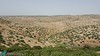
The above images may not be of the site on this page, but were taken nearby. They are loaded from Flickr so please click on them for image credits.
Click here to see more info for this site
Nearby sites
Click here to view sites on an interactive map of the areaKey: Red: member's photo, Blue: 3rd party photo, Yellow: other image, Green: no photo - please go there and take one, Grey: site destroyed
Download sites to:
KML (Google Earth)
GPX (GPS waypoints)
CSV (Garmin/Navman)
CSV (Excel)
To unlock full downloads you need to sign up as a Contributory Member. Otherwise downloads are limited to 50 sites.
Turn off the page maps and other distractions
Nearby sites listing. In the following links * = Image available
13.6km E 83° Tel Tsaf* Ancient Village or Settlement
14.3km N 9° Beit Alpha Ancient Synagogue Mosaic Floor* Ancient Temple
15.6km NE 37° Tel Beth Shean* Ancient Village or Settlement
19.7km NNW 339° Jezreel* Ancient Village or Settlement
20.8km ENE 72° Pella (Jordan) Ancient Village or Settlement
20.8km ENE 66° Wadi Hammeh 27 Ancient Village or Settlement
21.1km SW 215° Mount 'Ebal Ancient Temple
22.4km NW 308° Tel Taanach* Ancient Village or Settlement
23.3km SSW 211° Jacob's Well (Bir Ya'Qub)* Holy Well or Sacred Spring
27.6km SSE 158° Argaman-Gilgal sanctuary Ancient Temple
29.5km WNW 290° El-ahwat near kibuts Katsir-Harish* Ancient Village or Settlement
29.8km NW 316° Megiddo* Ancient Village or Settlement
35.1km NNW 345° Mary's Well (Nazareth)* Holy Well or Sacred Spring
36.2km SSE 155° Damiyah dolmen field* Burial Chamber or Dolmen
36.5km NNW 340° Kfar HaHoresh Ancient Temple
37.2km NW 316° Ein el-Jarba* Ancient Village or Settlement
37.3km NNE 30° Sha'ar HaGolan* Ancient Village or Settlement
37.5km WNW 286° Tel Esur Ancient Village or Settlement
38.8km SSW 196° Tel Shiloh Ancient Village or Settlement
39.1km NNE 24° Tel Bet Yerah Artificial Mound
39.3km NNE 24° Ohalo II* Ancient Village or Settlement
39.8km NNW 342° 'Ain zippori* Ancient Village or Settlement
40.0km NNE 24° Sea of Galilee Cairn* Cairn
41.0km NW 318° Tel Yokneam* Artificial Mound
41.6km NNW 344° Tzippori* Ancient Village or Settlement
View more nearby sites and additional images


 We would like to know more about this location. Please feel free to add a brief description and any relevant information in your own language.
 Wir möchten mehr über diese Stätte erfahren. Bitte zögern Sie nicht, eine kurze Beschreibung und relevante Informationen in Deutsch hinzuzufügen.
 Nous aimerions en savoir encore un peu sur les lieux. S'il vous plaît n'hesitez pas à ajouter une courte description et tous les renseignements pertinents dans votre propre langue.
 Quisieramos informarnos un poco más de las lugares. No dude en añadir una breve descripción y otros datos relevantes en su propio idioma.