


<< Our Photo Pages >> Jabal Fatouma Dolmen - Burial Chamber or Dolmen in Jordan
Submitted by Bashendi on Monday, 26 December 2022 Page Views: 1138
Neolithic and Bronze AgeSite Name: Jabal Fatouma DolmenCountry: Jordan
NOTE: This site is 3.459 km away from the location you searched for.
Type: Burial Chamber or Dolmen
Nearest Town: Petra Nearest Village: ad-Deir
Latitude: 30.342010N Longitude: 35.429190E
Condition:
| 5 | Perfect |
| 4 | Almost Perfect |
| 3 | Reasonable but with some damage |
| 2 | Ruined but still recognisable as an ancient site |
| 1 | Pretty much destroyed, possibly visible as crop marks |
| 0 | No data. |
| -1 | Completely destroyed |
| 5 | Superb |
| 4 | Good |
| 3 | Ordinary |
| 2 | Not Good |
| 1 | Awful |
| 0 | No data. |
| 5 | Can be driven to, probably with disabled access |
| 4 | Short walk on a footpath |
| 3 | Requiring a bit more of a walk |
| 2 | A long walk |
| 1 | In the middle of nowhere, a nightmare to find |
| 0 | No data. |
| 5 | co-ordinates taken by GPS or official recorded co-ordinates |
| 4 | co-ordinates scaled from a detailed map |
| 3 | co-ordinates scaled from a bad map |
| 2 | co-ordinates of the nearest village |
| 1 | co-ordinates of the nearest town |
| 0 | no data |
Internal Links:
External Links:
")
My guide on that walk was Haroun who was born in the caves in front of the ad-Deir monument, and of course knows the plateau like the back of his hand.
As mentioned, I can find no reference to it, even in the definitive work on megaliths in Jordan:
Scheltema, Megalithic Jordan: An Introduction and Field Guide, ACOR 2008
You may be viewing yesterday's version of this page. To see the most up to date information please register for a free account.
")
")
Do not use the above information on other web sites or publications without permission of the contributor.
Nearby Images from Flickr
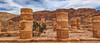
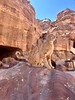
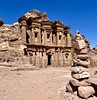
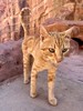
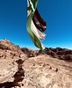
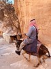
The above images may not be of the site on this page, but were taken nearby. They are loaded from Flickr so please click on them for image credits.
Click here to see more info for this site
Nearby sites
Click here to view sites on an interactive map of the areaKey: Red: member's photo, Blue: 3rd party photo, Yellow: other image, Green: no photo - please go there and take one, Grey: site destroyed
Download sites to:
KML (Google Earth)
GPX (GPS waypoints)
CSV (Garmin/Navman)
CSV (Excel)
To unlock full downloads you need to sign up as a Contributory Member. Otherwise downloads are limited to 50 sites.
Turn off the page maps and other distractions
Nearby sites listing. In the following links * = Image available
1.9km SE 139° Petra, Nabataean Town* Ancient Village or Settlement
3.7km NNE 29° Beidha* Ancient Village or Settlement
4.3km NNE 30° Siq al-Barid-Little Petra* Ancient Village or Settlement
13.0km SW 236° Wadi Masoudah - David Roberts Rock* Rock Cut Tomb
15.1km E 96° Big Circle J5 Misc. Earthwork
17.0km ENE 77° Big Circle J6 Misc. Earthwork
22.2km SW 217° Petroglyphs near Jebel al Samra Um al Hidha* Carving
22.4km NNE 31° Al-Shobak Dolmen* Burial Chamber or Dolmen
22.5km N 6° Wadi Malaqa Petroglyphs* Carving
23.2km N 7° Small Wadi Malaqa Petroglyph* Carving
24.6km NNE 31° Shobak Castle* Hillfort
25.7km W 272° Kipat 'Eshet rock shelter* Ancient Village or Settlement
30.1km WNW 285° Ramat Tsofar early Islamic settlement* Ancient Village or Settlement
31.3km WSW 244° South of Lower Wadi Hayun Masseboth* Standing Stones
31.3km NW 304° lower wadi 'Ashosh* Ancient Temple
31.5km NE 40° East of Dana Nature Reserve* Ancient Village or Settlement
32.0km SSE 153° M'aan district* Carving
32.3km N 11° Wadi Feinan* Ancient Mine, Quarry or other Industry
32.7km WSW 244° Beer-Menucha* Ancient Temple
32.8km W 263° wadi Dmama open air sanctuaries* Ancient Temple
33.5km S 171° Big Circle J8 Misc. Earthwork
33.9km W 265° Mt. 'Eshet* Ancient Trackway
34.2km W 267° Wadi Paran tributary camp site & Tumuli* Ancient Village or Settlement
34.2km WSW 255° Tsuky (cliff ) Hidud* Ancient Temple
34.6km WSW 255° Wadi Yaziz (2)* Ancient Village or Settlement
View more nearby sites and additional images


 We would like to know more about this location. Please feel free to add a brief description and any relevant information in your own language.
 Wir möchten mehr über diese Stätte erfahren. Bitte zögern Sie nicht, eine kurze Beschreibung und relevante Informationen in Deutsch hinzuzufügen.
 Nous aimerions en savoir encore un peu sur les lieux. S'il vous plaît n'hesitez pas à ajouter une courte description et tous les renseignements pertinents dans votre propre langue.
 Quisieramos informarnos un poco más de las lugares. No dude en añadir una breve descripción y otros datos relevantes en su propio idioma.