


<< Our Photo Pages >> Herodion - Ancient Palace in Israel
Submitted by motist on Monday, 30 January 2012 Page Views: 7628
Roman, Greek and ClassicalSite Name: Herodion Alternative Name: HerodiumCountry: Israel
NOTE: This site is 4.305 km away from the location you searched for.
Type: Ancient Palace
Nearest Town: Betthlehem Nearest Village: Teko'a
Latitude: 31.665730N Longitude: 35.241776E
Condition:
| 5 | Perfect |
| 4 | Almost Perfect |
| 3 | Reasonable but with some damage |
| 2 | Ruined but still recognisable as an ancient site |
| 1 | Pretty much destroyed, possibly visible as crop marks |
| 0 | No data. |
| -1 | Completely destroyed |
| 5 | Superb |
| 4 | Good |
| 3 | Ordinary |
| 2 | Not Good |
| 1 | Awful |
| 0 | No data. |
| 5 | Can be driven to, probably with disabled access |
| 4 | Short walk on a footpath |
| 3 | Requiring a bit more of a walk |
| 2 | A long walk |
| 1 | In the middle of nowhere, a nightmare to find |
| 0 | No data. |
| 5 | co-ordinates taken by GPS or official recorded co-ordinates |
| 4 | co-ordinates scaled from a detailed map |
| 3 | co-ordinates scaled from a bad map |
| 2 | co-ordinates of the nearest village |
| 1 | co-ordinates of the nearest town |
| 0 | no data |
Internal Links:
External Links:
")
But Herodion is even unique among his other creations, like the Temple Mount and Second Temple in Jerusalem, the city and harbor of Caesarea, and the fortress at Masada. What's so special about it? Not that Herod built another splendid building. That he did many times. No, the truly unique thing is that Herodion is not built on earlier occupation layers. Before King Herod arrived at Herodion, nobody had ever seen anything special in that location. Literally.
Herodion was built in three years, from 23-20 BCE. With his usual extraordinary megalomania and energetic will-power Herod completely changed the natural landscape in order to elevate his palace to a lofty place. The hill, remindful of a volcano, is visible from a great distance, because it is isolated, and also because it is much higher than the surrounding hill tops. The upper third of the hill has been artificially superimposed. In order to do this he would have had to lower a nearby hill with a third, too!
More at Jewishmag
Note: Top archaeologists condemn Israeli plan to rebuild ancient tomb
You may be viewing yesterday's version of this page. To see the most up to date information please register for a free account.
")
")
")
Do not use the above information on other web sites or publications without permission of the contributor.
Nearby Images from Flickr
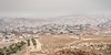
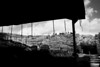
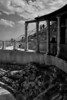


The above images may not be of the site on this page, but were taken nearby. They are loaded from Flickr so please click on them for image credits.
Click here to see more info for this site
Nearby sites
Click here to view sites on an interactive map of the areaKey: Red: member's photo, Blue: 3rd party photo, Yellow: other image, Green: no photo - please go there and take one, Grey: site destroyed
Download sites to:
KML (Google Earth)
GPX (GPS waypoints)
CSV (Garmin/Navman)
CSV (Excel)
To unlock full downloads you need to sign up as a Contributory Member. Otherwise downloads are limited to 50 sites.
Turn off the page maps and other distractions
Nearby sites listing. In the following links * = Image available
7.1km NNW 329° Rachel's Tomb Ancient Temple
9.7km NNW 346° Talpiot Tomb Rock Cut Tomb
11.9km N 357° Hezekiah's Tunnel* Ancient Mine, Quarry or other Industry
12.1km N 357° City of David* Ancient Village or Settlement
12.5km N 357° Temple Mount* Ancient Temple
13.2km N 358° 2000 year old stone fragment in Jerusalem* Marker Stone
15.4km NNW 334° Tel Motza* Ancient Village or Settlement
15.9km N 360° Shuafat road Chalcolithic period site* Ancient Village or Settlement
17.3km NNW 328° Motza Neolithic City* Ancient Village or Settlement
20.0km SW 218° Cave of the Patriarchs Rock Cut Tomb
22.3km ENE 68° Qumran* Ancient Village or Settlement
22.9km W 276° 2,000-year-old ‘Emperor’s Road’ near Beit Shemesh* Ancient Trackway
23.8km W 278° Ramat Beit Shemesh ritual baths* Ancient Village or Settlement
24.9km WNW 291° Tel Beth-Shemesh* Artificial Mound
25.6km W 266° Khirbat Ethri* Ancient Village or Settlement
26.0km W 263° Tel Burgin* Ancient Village or Settlement
26.1km SSE 148° Ein Gedi Chalcolithic Temple* Ancient Temple
26.8km SSE 149° Tel Goren* Ancient Village or Settlement
26.8km SSE 148° Ein Gedi ancient Synagogue* Ancient Temple
27.1km W 277° Khirbet Qeiyafa* Ancient Village or Settlement
27.6km NE 42° Jericho* Ancient Village or Settlement
29.2km W 278° Tel Azeqa Ancient Village or Settlement
30.6km NW 309° Emmaus Ancient Village or Settlement
31.0km W 263° Tel Goded Ancient Village or Settlement
31.7km SSE 164° Cave of the Treasure in wadi Mishmar* Cave or Rock Shelter
View more nearby sites and additional images


 We would like to know more about this location. Please feel free to add a brief description and any relevant information in your own language.
 Wir möchten mehr über diese Stätte erfahren. Bitte zögern Sie nicht, eine kurze Beschreibung und relevante Informationen in Deutsch hinzuzufügen.
 Nous aimerions en savoir encore un peu sur les lieux. S'il vous plaît n'hesitez pas à ajouter une courte description et tous les renseignements pertinents dans votre propre langue.
 Quisieramos informarnos un poco más de las lugares. No dude en añadir una breve descripción y otros datos relevantes en su propio idioma.