


<< Other Photo Pages >> HaYonim cave - Cave or Rock Shelter in Israel
Submitted by Andy B on Saturday, 16 July 2022 Page Views: 757
Natural PlacesSite Name: HaYonim cave Alternative Name: Me'arat HaYonim, Cave of the PigeonsCountry: Israel
NOTE: This site is 5.79 km away from the location you searched for.
Type: Cave or Rock Shelter
Latitude: 32.920089N Longitude: 35.218264E
Condition:
| 5 | Perfect |
| 4 | Almost Perfect |
| 3 | Reasonable but with some damage |
| 2 | Ruined but still recognisable as an ancient site |
| 1 | Pretty much destroyed, possibly visible as crop marks |
| 0 | No data. |
| -1 | Completely destroyed |
| 5 | Superb |
| 4 | Good |
| 3 | Ordinary |
| 2 | Not Good |
| 1 | Awful |
| 0 | No data. |
| 5 | Can be driven to, probably with disabled access |
| 4 | Short walk on a footpath |
| 3 | Requiring a bit more of a walk |
| 2 | A long walk |
| 1 | In the middle of nowhere, a nightmare to find |
| 0 | No data. |
| 5 | co-ordinates taken by GPS or official recorded co-ordinates |
| 4 | co-ordinates scaled from a detailed map |
| 3 | co-ordinates scaled from a bad map |
| 2 | co-ordinates of the nearest village |
| 1 | co-ordinates of the nearest town |
| 0 | no data |
Internal Links:
External Links:
")
The Mousterian occupation of the cave included Levallois debitage and early Middle Paleolithic blade technology, as well as a series of hearths.
In Hayonim were also found wall carvings depicting symbolic shapes and animals, such a running horse dated to between 40,000-18,500 BP, possibly to the Levantine Aurignacian circa 28,000 BP, and now visible in the Israel Museum.[2][3][4][5][6] This is considered as the first art object found within the context of the Levantine Upper Paleolithic.
The Natufian occupation of the cave featured circular rooms with prepared floors, with a thick midden of lithics, groundstone objects, and worked bone. There were several hearths, and single graves located in abandoned rooms or outside inhabited rooms.
(Hebrew: מערת היונים, Me'arat HaYonim, lit. Cave of the Pigeons)
Source: Wikipedia
You may be viewing yesterday's version of this page. To see the most up to date information please register for a free account.
")
Do not use the above information on other web sites or publications without permission of the contributor.
Nearby Images from Flickr
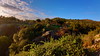

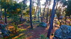
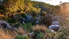
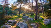
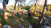
The above images may not be of the site on this page, but were taken nearby. They are loaded from Flickr so please click on them for image credits.
Click here to see more info for this site
Nearby sites
Click here to view sites on an interactive map of the areaKey: Red: member's photo, Blue: 3rd party photo, Yellow: other image, Green: no photo - please go there and take one, Grey: site destroyed
Download sites to:
KML (Google Earth)
GPX (GPS waypoints)
CSV (Garmin/Navman)
CSV (Excel)
To unlock full downloads you need to sign up as a Contributory Member. Otherwise downloads are limited to 50 sites.
Turn off the page maps and other distractions
Nearby sites listing. In the following links * = Image available
4.9km W 259° Ahihud Ancient Settlement* Ancient Village or Settlement
5.4km ESE 116° Hilazon Tachtit* Cave or Rock Shelter
5.9km NE 55° Khirbet Mehoz* Ancient Village or Settlement
11.2km SSE 150° Tel Yodfat * Hillfort
12.3km NW 322° Tel Kabri* Ancient Palace
12.7km ENE 60° PEKI''IN old Synagogue * Ancient Temple
12.9km SW 230° Tel Afek* Ancient Village or Settlement
13.1km N 350° Manot cave* Cave or Rock Shelter
13.9km W 271° Ancient Acre* Ancient Village or Settlement
18.1km NW 323° Tel Achziv* Ancient Village or Settlement
18.8km NNW 334° Shlomi ,1,600 year-old kiln* Ancient Mine, Quarry or other Industry
19.6km E 84° Crescent-shaped monument near Shefer* Artificial Mound
19.6km SSE 163° Tzippori* Ancient Village or Settlement
21.5km SSE 166° 'Ain zippori* Ancient Village or Settlement
22.0km NNW 332° Milkashtart Temple Ancient Temple
22.9km NE 53° Baram Synagogue* Ancient Temple
24.7km E 99° Hukok* Ancient Temple
24.9km SSE 168° Kfar HaHoresh Ancient Temple
25.5km SSW 199° Beit She'arim* Chambered Tomb
26.2km SSE 161° Mary's Well (Nazareth)* Holy Well or Sacred Spring
28.0km SSW 201° Tel Qashish Ancient Village or Settlement
28.7km ESE 108° Dalmanutha* Ancient Village or Settlement
28.7km ENE 71° Naburiya synagogue in Biriya Forest* Ancient Temple
30.2km SSW 200° Tel Yokneam* Artificial Mound
33.0km SSW 195° Ein el-Jarba* Ancient Village or Settlement
View more nearby sites and additional images


 We would like to know more about this location. Please feel free to add a brief description and any relevant information in your own language.
 Wir möchten mehr über diese Stätte erfahren. Bitte zögern Sie nicht, eine kurze Beschreibung und relevante Informationen in Deutsch hinzuzufügen.
 Nous aimerions en savoir encore un peu sur les lieux. S'il vous plaît n'hesitez pas à ajouter une courte description et tous les renseignements pertinents dans votre propre langue.
 Quisieramos informarnos un poco más de las lugares. No dude en añadir una breve descripción y otros datos relevantes en su propio idioma.