<< Our Photo Pages >> El-ahwat near kibuts Katsir-Harish - Ancient Village or Settlement in Israel
Submitted by motist on Friday, 06 August 2010 Page Views: 7878
DigsSite Name: El-ahwat near kibuts Katsir-HarishCountry: Israel
NOTE: This site is 5.538 km away from the location you searched for.
Type: Ancient Village or Settlement
Nearest Town: Hadera Nearest Village: Katsir-Harish
Latitude: 32.484658N Longitude: 35.109039E
Condition:
| 5 | Perfect |
| 4 | Almost Perfect |
| 3 | Reasonable but with some damage |
| 2 | Ruined but still recognisable as an ancient site |
| 1 | Pretty much destroyed, possibly visible as crop marks |
| 0 | No data. |
| -1 | Completely destroyed |
| 5 | Superb |
| 4 | Good |
| 3 | Ordinary |
| 2 | Not Good |
| 1 | Awful |
| 0 | No data. |
| 5 | Can be driven to, probably with disabled access |
| 4 | Short walk on a footpath |
| 3 | Requiring a bit more of a walk |
| 2 | A long walk |
| 1 | In the middle of nowhere, a nightmare to find |
| 0 | No data. |
| 5 | co-ordinates taken by GPS or official recorded co-ordinates |
| 4 | co-ordinates scaled from a detailed map |
| 3 | co-ordinates scaled from a bad map |
| 2 | co-ordinates of the nearest village |
| 1 | co-ordinates of the nearest town |
| 0 | no data |
Be the first person to rate this site - see the 'Contribute!' box in the right hand menu.
Internal Links:
External Links:

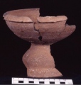
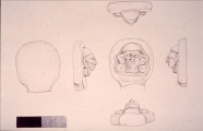
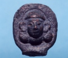
“Such an identification reinforces the claim that a high-ranking Egyptian or local ruler was based at this location, and is likely to support the theory that the site is Harosheth Haggoyim, the home town of Sisera, as mentioned in Judges 4-5,” says Prof. Zertal.
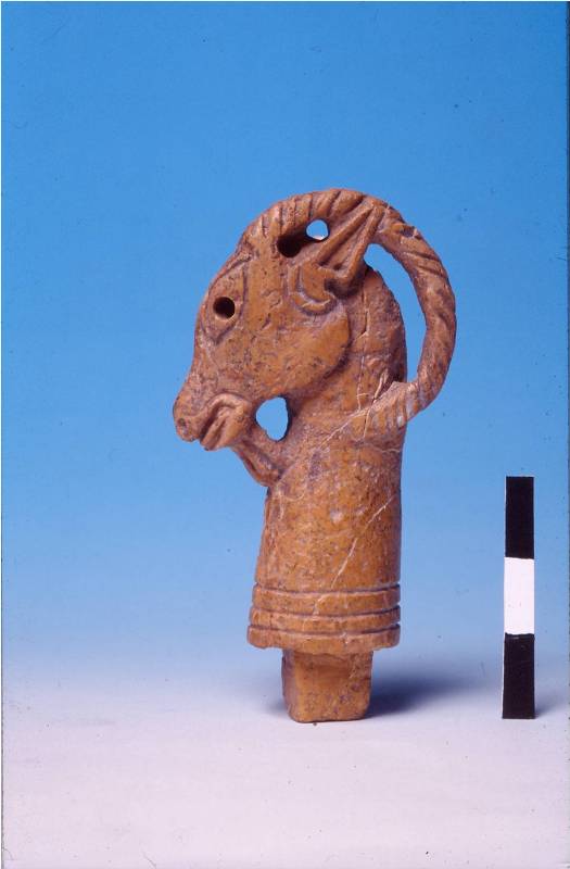
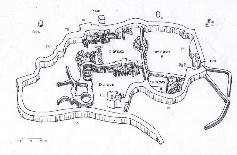
The El-ahwat site, near Nahal ‘Iron, was exposed by a cooperative delegation excavating there during 1993-2000 from the Universities of Haifa and Cagliari (Sardinia), headed by Prof. Zertal. The excavated city has been dated back to the end of the Bronze Age and early Iron Age (13th-12th centuries B.C.E.). The city’s uniqueness - its fortifications, passageways in the walls, and rounded huts - made it foreign amidst the Canaanite landscape.
More at the University of Haifa
Note: All images by Prof. Adam Zertal
You may be viewing yesterday's version of this page. To see the most up to date information please register for a free account.






Do not use the above information on other web sites or publications without permission of the contributor.
Click here to see more info for this site
Nearby sites
Click here to view sites on an interactive map of the areaKey: Red: member's photo, Blue: 3rd party photo, Yellow: other image, Green: no photo - please go there and take one, Grey: site destroyed
Download sites to:
KML (Google Earth)
GPX (GPS waypoints)
CSV (Garmin/Navman)
CSV (Excel)
To unlock full downloads you need to sign up as a Contributory Member. Otherwise downloads are limited to 50 sites.
Turn off the page maps and other distractions
Nearby sites listing. In the following links * = Image available
8.4km W 268° Tel Esur Ancient Village or Settlement
10.7km ENE 71° Tel Taanach* Ancient Village or Settlement
13.3km NNE 32° Megiddo* Ancient Village or Settlement
16.6km N 6° Ein el-Jarba* Ancient Village or Settlement
17.5km WNW 292° Horvat 'Aqev* Ancient Village or Settlement
18.1km WNW 297° Kebara Cave Cave or Rock Shelter
19.5km W 277° The Bird Mosaic, Caesarea, Israel* Ancient Palace
20.0km N 360° Tel Yokneam* Artificial Mound
20.4km W 276° Caesarea Maritima* Ancient Village or Settlement
22.2km ENE 68° Jezreel* Ancient Village or Settlement
22.3km N 0° Tel Qashish Ancient Village or Settlement
23.3km NW 309° Tel Dor* Ancient Village or Settlement
24.4km N 4° Beit She'arim* Chambered Tomb
24.7km NNW 327° Carmel Prehistoric Caves Cave or Rock Shelter
27.6km NW 325° Atlit-Yam Ancient Village or Settlement
28.5km NNE 32° Kfar HaHoresh Ancient Temple
29.5km ESE 110° Gadara* Ancient Village or Settlement
30.1km E 83° Beit Alpha Ancient Synagogue Mosaic Floor* Ancient Temple
30.1km NE 38° Mary's Well (Nazareth)* Holy Well or Sacred Spring
31.5km NNE 29° 'Ain zippori* Ancient Village or Settlement
31.8km SSE 150° Mount 'Ebal Ancient Temple
33.8km NNE 28° Tzippori* Ancient Village or Settlement
34.2km SSE 152° Jacob's Well (Bir Ya'Qub)* Holy Well or Sacred Spring
37.0km E 87° Tel Beth Shean* Ancient Village or Settlement
39.4km SSW 202° The Gilgal associated violently with Joshua Stone Circle
View more nearby sites and additional images


 We would like to know more about this location. Please feel free to add a brief description and any relevant information in your own language.
 Wir möchten mehr über diese Stätte erfahren. Bitte zögern Sie nicht, eine kurze Beschreibung und relevante Informationen in Deutsch hinzuzufügen.
 Nous aimerions en savoir encore un peu sur les lieux. S'il vous plaît n'hesitez pas à ajouter une courte description et tous les renseignements pertinents dans votre propre langue.
 Quisieramos informarnos un poco más de las lugares. No dude en añadir una breve descripción y otros datos relevantes en su propio idioma.