


<< Text Pages >> Milkashtart Temple - Ancient Temple in Lebanon
Submitted by AlexHunger on Wednesday, 17 October 2007 Page Views: 6725
Multi-periodSite Name: Milkashtart Temple Alternative Name: Umm el-AmedCountry: Lebanon
NOTE: This site is 0.48 km away from the location you searched for.
Type: Ancient Temple
Nearest Town: Sour Nearest Village: Naquora
Latitude: 33.095397N Longitude: 35.108416E
Condition:
| 5 | Perfect |
| 4 | Almost Perfect |
| 3 | Reasonable but with some damage |
| 2 | Ruined but still recognisable as an ancient site |
| 1 | Pretty much destroyed, possibly visible as crop marks |
| 0 | No data. |
| -1 | Completely destroyed |
| 5 | Superb |
| 4 | Good |
| 3 | Ordinary |
| 2 | Not Good |
| 1 | Awful |
| 0 | No data. |
| 5 | Can be driven to, probably with disabled access |
| 4 | Short walk on a footpath |
| 3 | Requiring a bit more of a walk |
| 2 | A long walk |
| 1 | In the middle of nowhere, a nightmare to find |
| 0 | No data. |
| 5 | co-ordinates taken by GPS or official recorded co-ordinates |
| 4 | co-ordinates scaled from a detailed map |
| 3 | co-ordinates scaled from a bad map |
| 2 | co-ordinates of the nearest village |
| 1 | co-ordinates of the nearest town |
| 0 | no data |
Internal Links:
External Links:
Ancient Temple in Lebanon
5th Century BCE temple of Milkashtart, the Phoenician prototype for Herakles. There is an oher unalocated temple directly to the East.
The site is suposed to be complictaed to access due to the proximity of the Israeli border and due to being partially blocked by fields and agricultural equipment.
You may be viewing yesterday's version of this page. To see the most up to date information please register for a free account.
Do not use the above information on other web sites or publications without permission of the contributor.
Nearby Images from Flickr
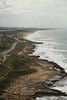
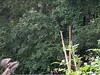
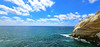
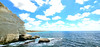
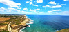
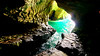
The above images may not be of the site on this page, but were taken nearby. They are loaded from Flickr so please click on them for image credits.
Click here to see more info for this site
Nearby sites
Click here to view sites on an interactive map of the areaKey: Red: member's photo, Blue: 3rd party photo, Yellow: other image, Green: no photo - please go there and take one, Grey: site destroyed
Download sites to:
KML (Google Earth)
GPX (GPS waypoints)
CSV (Garmin/Navman)
CSV (Excel)
To unlock full downloads you need to sign up as a Contributory Member. Otherwise downloads are limited to 50 sites.
Turn off the page maps and other distractions
Nearby sites listing. In the following links * = Image available
3.3km SE 144° Shlomi ,1,600 year-old kiln* Ancient Mine, Quarry or other Industry
5.1km S 188° Tel Achziv* Ancient Village or Settlement
10.2km SSE 165° Tel Kabri* Ancient Palace
10.4km SE 129° Manot cave* Cave or Rock Shelter
19.5km S 191° Ancient Acre* Ancient Village or Settlement
21.1km SSE 165° Ahihud Ancient Settlement* Ancient Village or Settlement
21.2km NNE 22° Tyre.* Ancient Village or Settlement
21.5km NNE 34° Ras el-Ain Reservoir Holy Well or Sacred Spring
22.0km SSE 152° HaYonim cave* Cave or Rock Shelter
22.1km SE 137° Khirbet Mehoz* Ancient Village or Settlement
22.4km NE 47° Hiram's Tomb* Rock Cut Tomb
24.9km ESE 122° PEKI''IN old Synagogue * Ancient Temple
26.6km SE 145° Hilazon Tachtit* Cave or Rock Shelter
27.7km S 179° Tel Afek* Ancient Village or Settlement
29.1km E 101° Baram Synagogue* Ancient Temple
33.3km SSE 152° Tel Yodfat * Hillfort
34.4km ESE 120° Crescent-shaped monument near Shefer* Artificial Mound
38.7km ESE 105° Naburiya synagogue in Biriya Forest* Ancient Temple
39.2km E 87° Tel Kadesh Naftali* Ancient Village or Settlement
41.5km SSE 157° Tzippori* Ancient Village or Settlement
41.8km SE 124° Hukok* Ancient Temple
43.2km SSE 159° 'Ain zippori* Ancient Village or Settlement
43.7km S 177° Beit She'arim* Chambered Tomb
43.7km ESE 101° Tel Hatzor* Artificial Mound
45.6km S 180° Tel Qashish Ancient Village or Settlement
View more nearby sites and additional images


 We would like to know more about this location. Please feel free to add a brief description and any relevant information in your own language.
 Wir möchten mehr über diese Stätte erfahren. Bitte zögern Sie nicht, eine kurze Beschreibung und relevante Informationen in Deutsch hinzuzufügen.
 Nous aimerions en savoir encore un peu sur les lieux. S'il vous plaît n'hesitez pas à ajouter une courte description et tous les renseignements pertinents dans votre propre langue.
 Quisieramos informarnos un poco más de las lugares. No dude en añadir una breve descripción y otros datos relevantes en su propio idioma.