

<< Text Pages >> Carmel Prehistoric Caves - Cave or Rock Shelter in Israel
Submitted by motist on Tuesday, 27 July 2010 Page Views: 3850
Natural PlacesSite Name: Carmel Prehistoric Caves Alternative Name: Tabun, Jamal, el-Wad, SkhulCountry: Israel
NOTE: This site is 0.123 km away from the location you searched for.
Type: Cave or Rock Shelter
Nearest Town: Atlit Nearest Village: Ein Carmel
Latitude: 32.671101N Longitude: 34.965111E
Condition:
| 5 | Perfect |
| 4 | Almost Perfect |
| 3 | Reasonable but with some damage |
| 2 | Ruined but still recognisable as an ancient site |
| 1 | Pretty much destroyed, possibly visible as crop marks |
| 0 | No data. |
| -1 | Completely destroyed |
| 5 | Superb |
| 4 | Good |
| 3 | Ordinary |
| 2 | Not Good |
| 1 | Awful |
| 0 | No data. |
| 5 | Can be driven to, probably with disabled access |
| 4 | Short walk on a footpath |
| 3 | Requiring a bit more of a walk |
| 2 | A long walk |
| 1 | In the middle of nowhere, a nightmare to find |
| 0 | No data. |
| 5 | co-ordinates taken by GPS or official recorded co-ordinates |
| 4 | co-ordinates scaled from a detailed map |
| 3 | co-ordinates scaled from a bad map |
| 2 | co-ordinates of the nearest village |
| 1 | co-ordinates of the nearest town |
| 0 | no data |
Internal Links:
External Links:
Caves in Israel
The caves are located on the western slopes of Mount Carmel, some 20 km. south of Haifa, where Nahal Me'arot (Valley of the Caves) emerges into the Coastal Plain. They were first excavated in the 1920s and 1930s. Then new digs were conducted from the late 1960s onwards, using advanced scientific methods based on modern geological, archeological and palynological (paleontological study of pollen, fossils, etc.) research.
Flint tools, animal bones and human burials found in the Carmel Caves contribute greatly to the understanding of the physical and cultural evolution of man in the early phases of his existence.
A UNESCO World Heritage site.
You may be viewing yesterday's version of this page. To see the most up to date information please register for a free account.
Do not use the above information on other web sites or publications without permission of the contributor.
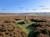
Nearby Images from Flickr
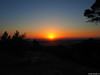


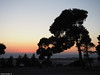
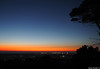

The above images may not be of the site on this page, but were taken nearby. They are loaded from Flickr so please click on them for image credits.
Click here to see more info for this site
Nearby sites
Click here to view sites on an interactive map of the areaKey: Red: member's photo, Blue: 3rd party photo, Yellow: other image, Green: no photo - please go there and take one, Grey: site destroyed
Download sites to:
KML (Google Earth)
GPX (GPS waypoints)
CSV (Garmin/Navman)
CSV (Excel)
To unlock full downloads you need to sign up as a Contributory Member. Otherwise downloads are limited to 50 sites.
Turn off the page maps and other distractions
Nearby sites listing. In the following links * = Image available
3.1km NW 306° Atlit-Yam Ancient Village or Settlement
7.6km SW 217° Tel Dor* Ancient Village or Settlement
12.8km SSW 192° Kebara Cave Cave or Rock Shelter
13.5km E 93° Tel Yokneam* Artificial Mound
13.7km E 83° Tel Qashish Ancient Village or Settlement
14.5km S 191° Horvat 'Aqev* Ancient Village or Settlement
15.8km ENE 77° Beit She'arim* Chambered Tomb
15.9km ESE 105° Ein el-Jarba* Ancient Village or Settlement
19.2km SSW 198° The Bird Mosaic, Caesarea, Israel* Ancient Palace
19.8km SSW 200° Caesarea Maritima* Ancient Village or Settlement
21.6km SSE 166° Tel Esur Ancient Village or Settlement
22.7km ESE 115° Megiddo* Ancient Village or Settlement
23.8km NE 35° Tel Afek* Ancient Village or Settlement
24.7km SSE 147° El-ahwat near kibuts Katsir-Harish* Ancient Village or Settlement
29.0km E 83° Kfar HaHoresh Ancient Temple
29.2km SE 126° Tel Taanach* Ancient Village or Settlement
29.5km ENE 77° 'Ain zippori* Ancient Village or Settlement
29.7km NNE 19° Ancient Acre* Ancient Village or Settlement
30.9km ENE 73° Tzippori* Ancient Village or Settlement
32.2km E 85° Mary's Well (Nazareth)* Holy Well or Sacred Spring
32.7km NE 35° Ahihud Ancient Settlement* Ancient Village or Settlement
34.3km ENE 58° Tel Yodfat * Hillfort
36.3km ESE 110° Jezreel* Ancient Village or Settlement
36.4km NE 40° HaYonim cave* Cave or Rock Shelter
38.2km NE 48° Hilazon Tachtit* Cave or Rock Shelter
View more nearby sites and additional images


 We would like to know more about this location. Please feel free to add a brief description and any relevant information in your own language.
 Wir möchten mehr über diese Stätte erfahren. Bitte zögern Sie nicht, eine kurze Beschreibung und relevante Informationen in Deutsch hinzuzufügen.
 Nous aimerions en savoir encore un peu sur les lieux. S'il vous plaît n'hesitez pas à ajouter une courte description et tous les renseignements pertinents dans votre propre langue.
 Quisieramos informarnos un poco más de las lugares. No dude en añadir una breve descripción y otros datos relevantes en su propio idioma.