<< Our Photo Pages >> Horvat 'Aqev - Ancient Village or Settlement in Israel
Submitted by motist on Tuesday, 16 January 2018 Page Views: 1222
Multi-periodSite Name: Horvat 'Aqev Alternative Name: Mansur El -'AqebCountry: Israel
NOTE: This site is 2.799 km away from the location you searched for.
Type: Ancient Village or Settlement
Nearest Town: Zicron Yakov
Latitude: 32.543510N Longitude: 34.935464E
Condition:
| 5 | Perfect |
| 4 | Almost Perfect |
| 3 | Reasonable but with some damage |
| 2 | Ruined but still recognisable as an ancient site |
| 1 | Pretty much destroyed, possibly visible as crop marks |
| 0 | No data. |
| -1 | Completely destroyed |
| 5 | Superb |
| 4 | Good |
| 3 | Ordinary |
| 2 | Not Good |
| 1 | Awful |
| 0 | No data. |
| 5 | Can be driven to, probably with disabled access |
| 4 | Short walk on a footpath |
| 3 | Requiring a bit more of a walk |
| 2 | A long walk |
| 1 | In the middle of nowhere, a nightmare to find |
| 0 | No data. |
| 5 | co-ordinates taken by GPS or official recorded co-ordinates |
| 4 | co-ordinates scaled from a detailed map |
| 3 | co-ordinates scaled from a bad map |
| 2 | co-ordinates of the nearest village |
| 1 | co-ordinates of the nearest town |
| 0 | no data |
Internal Links:
External Links:
Horvat 'Aqav
This is the highest point of Ramat Hanadiv, 141 metres above sea level. Its Hebrew name comes from the Arabic one, Hirbat Mansour el-'Eqeb. In front of it is a sign with text in red, describing the site during the Second Temple period (1st century CE). The green text gives the history of the rustic manor house that was built during the Byzantine period on the remains of the earlier farmstead.
Professor Yizhar Hirshfeld directed the archaeological excavations here from 1984-87. Shards from the Persian period (5th and 3rd centuries BCE), buried beneath the farmstead's walls, indicate that it may have served previously as a ritual site. In the late 19th century most of the original building stones were apparently removed and used for the construction of Beit Khouri (see the Spring Trail leaflet for details).
The archaeological site was rehabilitated in memory of Amschel Rothschild, who died in 1996. Olive trees, figs and grapevines – important crops throughout the land of Israel in early times – have been planted, along with Mediterranean herbs like wild marjoram (Majorana syriaca), Cretan germander (Teucrium creticum), and African rue (Ruta chalepensis).
Horvat 'Aqav in the Second Temple Period
The remains of the fortified farmstead here date from the Second Temple period, when a large complex was constructed adjacent to the spring of Ein Tzur. The building, surrounded by an L-shaped wall, extended across 2800 square metres. Its owner, probably of high rank, had under his authority workers, servants, and an estate overseer. Four or five families, a total of about 20 people, lived here until the Jewish uprising against the Romans (66-70 CE), when the place was abandoned.
Horvat 'Aqav in the Byzantine Era
The site was resettled in the Byzantine period (4th-7th centuries CE), when the rustic manor house was built. Though stones from the old farmstead were used generously in its construction, the manor house had walls made primarily of sandstone quarried on the coastal plain. The building lasted from the mid-5th century till the Arab conquest 200 years later.
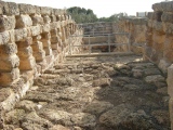
A large cistern found next to the entrance gate served the estate's residents both in the Second Temple and Byzantine periods. Rainwater drained from the rooftops and courtyard into the cistern, which measured some 110 square metres – large enough to provide water for all the people and livestock at the complex.
The Courtyard and the Ritual Bath (Mikva)
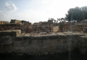
Built in a rustic style, the manor house seems to have been used simultaneously as a residence, workplace, and storehouse. Its rooms open onto a tiled interior courtyard where the livestock were kept.
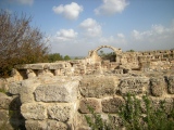
It is likely that the northern wing served as a wine cellar and storeroom. The large arch in the northeastern corner of the manor house indicates that both the northern and western wings had two stories. The upper floors, which may have had balconies, were used as living quarters.
With the Arab conquest in 640 CE, the demand for wine must have decreased: Alcohol is forbidden to Moslems. The residents of the estate, vintners by trade, lost their livelihood and left the Byzantine manor house to the elements.
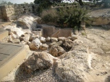
Beyond the Byzantine drainage canal is a ritual bath (mikva), a remnant from the Second Temple period. Three stairs hewn into the rock descend to the immersion pool. The side walls of the pool, also carved from the rock, were covered with grayish plaster. It was filled with rainwater, which poured in through a channel from an adjacent rooftop. In size and structure, it fufills all the requirements for a Jewish ritual bath. Six metres east of the pool, beyond the low wall to the right, is a basin carved in the rock, used for washing before entering the ritual bath.
The tour of Horvat 'Aqav continues via the western exit from the manor house.
Winepress
At the western side of the complex, overlooking the Carmel coastal plain, the agricultural processing facilities of the Second Temple period farmstead were discovered. A press for crushing grapes is adjacent to the western portal; another is next to the eastern wall. Most features of the winepress, such as the pressing floor, were hewn out of the rock. Coated with a thick layer of white plaster, the floor slanted towards a pit where the fresh grape juice collected. The wide walls were partially constructed, and apparently they were also plastered. The final squeezing of the grapes was carried out in the press using a board and weights, the method common at the time.
The Pit of Shards
During the Byzantine period, a new and improved winepress was built south of the manor house. Stairs were carved into
the rock east of the pit where the newly-squeezed juice had previously collected. These stairs led to the residential wing of the manor house and now served as its main entrance. The manor house's later occupants seem to have enlarged the grape juice pit and used it for rubbish. More than 30 clay pieces were excavated here, among them cooking pots, tableware, clay lamps, coins and broken building stones, as well as bits of windows and marble.
Olive press
North (to the right) of the winepress stands a heavy round stone. This stone (called a memel in the Mishna) was part of the olive press; it crushed the olives into a mash from which the oil was extracted.
The Barn
During the threshing process, sheaves of grain were beaten in threshing tools to separate the grains from the husks; afterwards the grains were winnowed from the chaff by tossing them into the air. The heavy grains fell down, while the lightweight chaff blew aside. The threshing floor's location at the edge of the cliff, exposed to the west wind, made the work easier. The sheaves were brought to the barn from the wheat field, which seems to have stretched across the expanse east of the estate. The barn's threshing floor is north of the olive press at the northwest corner of the Second Temple period complex.
The tour of Horvat 'Aqav continues on the paved path to the south (at the left), parallel to the stone walls at the western part of the Second Temple period estate.
Observation Plaza
At the edges of the Ramat Hanadiv ridge unfurl the agricultural fields of the Carmel coastal plain. To the north is Kibbutz Ma'agan Michael; to the left of it, Jasser e-Zarka, Caesarea and Or Akiva. The sand dunes enveloping ancient Caesarea can be seen to the south; further along, the chimneys of the Orot Rabin power station pierce the sky. The hills of Samaria, Ramot Menashe and the Carmel range are to the east. Along the ridge, Keren Hacarmel (Mukhraka) stands out as the major landmark.
Until it was felled by a winter storm not long ago, a large carob tree stood next to this plaza, marking what is thought to be the grave of Mansour el-'Aqeb. Until the 1940s the Arab residents of the area would make pilgrimages to this tree; according to the German scholar Von Mullinen, they believed it grew upon the grave of a holy person. Writing in 1907, Von Mullinen suggested that this was the burial site of the revered Rabbi Akiva – who had been tortured by the Romans and executed in nearby Caesarea – and that its name, Hirbat Mansour el-'Eqeb, was derived from his.
Beyond the wall, to the south, the paved path arrives at the Byzantine winepress.
Byzantine Winepress
Very few circular winepresses have been discovered in this area. This one, its crushing floor tiled with mosaic, is installed permanently with a huge wooden screw. Both the mosaic floor and the screw are characteristic of Byzantine winepresses. The screw was used as a roller, which wrung the last drops of juice out of the grapes after they had been crushed underfoot in the press. The juice then flowed into the large storage pit.
Cistern
Southeast of the winepress is Horvat 'Aqav's second water cistern, with a volume of some 50 cubic metres. It was used during the Byzantine period and probably during the Second Temple period as well. Around its opening are engraved stones and the remains of a channel carved into the rock, which brought rainwater into the cistern.
The trail goes east again towards the entrance of the Byzantine manor house, passing in front of the cistern (from the right), and the main entrance (from the left). Then it turns left and passes the lime kiln (from the left).
Lime Kiln
This pit, used in the Second Temple period for collecting grape juice from the winepress, remained almost intact until the Middle Ages when, apparently during the Mameluk period (13th-14th centuries CE), it was turned into a lime kiln. Limestone was fired here together with trees and shrubs in a slow, controlled process that transformed the mix into plaster. The large amount of ash found in the kiln bears witness to this medieval production.
The findings from the Middle Ages point to a small settlement at Horvat 'Aqav. Its members found temporary shelter in the ruins of the old manor house. Coins and shards of vessels they left behind were discovered on the floor of the residential wing.
Near the group of carob trees and the benches beneath them, the trail leaves Horvat 'Aqav, turns left, and goes north through the mastic shrubs. Further along, it comes to an observation point overlooking the Carmel coastal plain (Station #4).
You may be viewing yesterday's version of this page. To see the most up to date information please register for a free account.







These are just the first 25 photos of Horvat 'Aqev. If you log in with a free user account you will be able to see our entire collection.
Do not use the above information on other web sites or publications without permission of the contributor.
Click here to see more info for this site
Nearby sites
Click here to view sites on an interactive map of the areaKey: Red: member's photo, Blue: 3rd party photo, Yellow: other image, Green: no photo - please go there and take one, Grey: site destroyed
Download sites to:
KML (Google Earth)
GPX (GPS waypoints)
CSV (Garmin/Navman)
CSV (Excel)
To unlock full downloads you need to sign up as a Contributory Member. Otherwise downloads are limited to 50 sites.
Turn off the page maps and other distractions
Nearby sites listing. In the following links * = Image available
1.7km N 5° Kebara Cave Cave or Rock Shelter
5.1km SW 217° The Bird Mosaic, Caesarea, Israel* Ancient Palace
6.0km SW 222° Caesarea Maritima* Ancient Village or Settlement
8.3km NNW 347° Tel Dor* Ancient Village or Settlement
10.4km SE 131° Tel Esur Ancient Village or Settlement
14.5km N 11° Carmel Prehistoric Caves Cave or Rock Shelter
16.0km N 1° Atlit-Yam Ancient Village or Settlement
17.5km ESE 112° El-ahwat near kibuts Katsir-Harish* Ancient Village or Settlement
20.7km ENE 61° Ein el-Jarba* Ancient Village or Settlement
21.1km NE 50° Tel Yokneam* Artificial Mound
22.7km NE 46° Tel Qashish Ancient Village or Settlement
23.8km ENE 79° Megiddo* Ancient Village or Settlement
25.4km NE 46° Beit She'arim* Chambered Tomb
26.5km E 96° Tel Taanach* Ancient Village or Settlement
36.1km ENE 61° Kfar HaHoresh Ancient Temple
36.9km E 87° Jezreel* Ancient Village or Settlement
37.5km NNE 26° Tel Afek* Ancient Village or Settlement
37.9km ENE 56° 'Ain zippori* Ancient Village or Settlement
38.8km ENE 64° Mary's Well (Nazareth)* Holy Well or Sacred Spring
39.8km NE 54° Tzippori* Ancient Village or Settlement
40.6km SSW 197° Apollonia (Israel)* Ancient Village or Settlement
43.1km S 178° The Gilgal associated violently with Joshua Stone Circle
44.0km NNE 17° Ancient Acre* Ancient Village or Settlement
45.3km NE 45° Tel Yodfat * Hillfort
46.2km E 93° Beit Alpha Ancient Synagogue Mosaic Floor* Ancient Temple
View more nearby sites and additional images





 We would like to know more about this location. Please feel free to add a brief description and any relevant information in your own language.
 Wir möchten mehr über diese Stätte erfahren. Bitte zögern Sie nicht, eine kurze Beschreibung und relevante Informationen in Deutsch hinzuzufügen.
 Nous aimerions en savoir encore un peu sur les lieux. S'il vous plaît n'hesitez pas à ajouter une courte description et tous les renseignements pertinents dans votre propre langue.
 Quisieramos informarnos un poco más de las lugares. No dude en añadir una breve descripción y otros datos relevantes en su propio idioma.