


<< Text Pages >> Tel Gath - Ancient Village or Settlement in Israel
Submitted by motist on Wednesday, 19 January 2011 Page Views: 9961
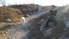
DigsSite Name: Tel Gath Alternative Name: Tell es-Safi, Tel ZafitCountry: Israel Type: Ancient Village or Settlement
Nearest Town: Kiryat Malakhi Nearest Village: luzit
Latitude: 31.700717N Longitude: 34.847355E
Condition:
| 5 | Perfect |
| 4 | Almost Perfect |
| 3 | Reasonable but with some damage |
| 2 | Ruined but still recognisable as an ancient site |
| 1 | Pretty much destroyed, possibly visible as crop marks |
| 0 | No data. |
| -1 | Completely destroyed |
| 5 | Superb |
| 4 | Good |
| 3 | Ordinary |
| 2 | Not Good |
| 1 | Awful |
| 0 | No data. |
| 5 | Can be driven to, probably with disabled access |
| 4 | Short walk on a footpath |
| 3 | Requiring a bit more of a walk |
| 2 | A long walk |
| 1 | In the middle of nowhere, a nightmare to find |
| 0 | No data. |
| 5 | co-ordinates taken by GPS or official recorded co-ordinates |
| 4 | co-ordinates scaled from a detailed map |
| 3 | co-ordinates scaled from a bad map |
| 2 | co-ordinates of the nearest village |
| 1 | co-ordinates of the nearest town |
| 0 | no data |
Internal Links:
External Links:
Ancient Village or Settlement in Israel.Gath, Gat, or Geth (Hebrew: גַּת, Winepress; Latin: Geth) 'Gath of the Philistines' was one of the five Philistine city-states, established in northwestern Philistia.
According to the Bible, the king of the city was Achish, in the times of both David and Solomon. It is not certain whether this refers to two kings of this name or not. Gath was also the home city of Goliath, as well as of Itai and his 600 soldiers who aided David in his exile from Absalom. David, while running from Saul, escaped to Gath, and served under its king Achish. During Solomon's reign, Shemei goes to Gath to return his escaped slave (I Kings 2:39–2:40). In II Kings 12:18, the city of Gath is mentioned as being captured by Hazael of Aram Damascus. Recent excavations at the site have produced dramatic evidence of a siege and subsequent destruction of the site in the late 9th century BC, most probably related to this event.
Gath is also mentioned in the El-Amarna letters as "Gimti/Gintu", ruled by a king Shuwardata, and possibly by Abdi-Ashirti as well.
Tell es-Safi or Tel Zafit (Arabic: تل الصافي, Tall aṣ-Ṣāfī; Hebrew: תל צפית, Tel Tzafit) are the Arabic and Hebrew names for the ancient mound now identified as Gath, one of the five cities in the ancient Canaanite and Philistine Pentapolis (along with Gaza, Ekron, Ashkelon, and Ashdod). It is a large multi-period site that is located in central Israel, approximately half way between Jerusalem and Ashkelon, on the border between the southern Coastal Plain of Israel and the Judean foothills
More:
http://en.wikipedia.org/wiki/Gath_(city)
http://www.bibleplaces.com/gath.htm
And latest news and Discovery: Philistine Temple Ruins Uncovered in Goliath's Hometown Bar Ilan University archaeologists have uncovered the ruins of a Philistine temple in the ancient city of Gath, home of the Biblical Goliath, buried in one of the largest tels (ancient ruin mounds) in Israel. The temple and a number of ritual items dating back to the 10th century BCE were discovered at Tel Tsafit (Tell es-Safit/Gath) by Professor Aren Maeir of BIU's Martin (Szusz) Department of Land of Israel Studies and Archaeology and his international team. The tel is located about halfway between Ashkelon and Jerusalem, near Kiryat Gat along the southern coastal plain. “Interestingly, the architectural design of this temple, with its two central pillars, is reminiscent of the architectural image that is described in the well-known Biblical story of Samson and the Philistines,” Maeir said. He added that the discovery could indicate that the story of Samson reflects a type of temple that was in use in Philistia at the time. More: http://www.israelnationalnews.com/News/News.aspx/138843
Note: New Archeological Device to Determine Origin of Ancient Samples - Used at Goliath's Hometown.
You may be viewing yesterday's version of this page. To see the most up to date information please register for a free account.
Do not use the above information on other web sites or publications without permission of the contributor.
Nearby Images from Flickr

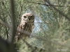
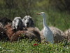
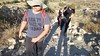
The above images may not be of the site on this page, but were taken nearby. They are loaded from Flickr so please click on them for image credits.
Click here to see more info for this site
Nearby sites
Click here to view sites on an interactive map of the areaKey: Red: member's photo, Blue: 3rd party photo, Yellow: other image, Green: no photo - please go there and take one, Grey: site destroyed
Download sites to:
KML (Google Earth)
GPX (GPS waypoints)
CSV (Garmin/Navman)
CSV (Excel)
To unlock full downloads you need to sign up as a Contributory Member. Otherwise downloads are limited to 50 sites.
Turn off the page maps and other distractions
Nearby sites listing. In the following links * = Image available
8.2km SSE 163° Tel Burna* Ancient Village or Settlement
8.3km SSE 163° Tel Burna* Ancient Village or Settlement
8.4km E 91° Tel Azeqa Ancient Village or Settlement
8.5km N 3° Tel 'Ekron Ancient Village or Settlement
10.0km SE 139° Tel Goded Ancient Village or Settlement
10.4km E 93° Khirbet Qeiyafa* Ancient Village or Settlement
11.9km SSE 157° Bet Guvrin-Maresha National Park* Ancient Village or Settlement
12.5km SSW 192° Ziklag* Ancient Village or Settlement
13.2km ESE 116° Khirbat Ethri* Ancient Village or Settlement
13.7km ESE 122° Tel Burgin* Ancient Village or Settlement
13.8km E 92° Ramat Beit Shemesh ritual baths* Ancient Village or Settlement
14.6km E 96° 2,000-year-old ‘Emperor’s Road’ near Beit Shemesh* Ancient Trackway
14.8km ENE 71° Tel Beth-Shemesh* Artificial Mound
15.1km S 179° Tel Lachish* Artificial Mound
18.8km NNE 21° Tel Gezer* Ancient Village or Settlement
18.9km WNW 289° Tel Ashdod Ancient Village or Settlement
19.8km SSE 160° Amatzia* Ancient Mine, Quarry or other Industry
19.9km WNW 292° Hill of Jonah* Hillfort
20.3km SSW 213° Tel El-Hesi Ancient Village or Settlement
20.4km NE 41° Emmaus Ancient Village or Settlement
28.7km NNW 330° Yavne Yam Ancient Village or Settlement
28.8km W 262° Tel Ashkelon* Ancient Village or Settlement
28.8km N 11° Lod Mosaic Ancient Palace
30.1km ENE 69° Motza Neolithic City* Ancient Village or Settlement
31.7km SE 128° Cave of the Patriarchs Rock Cut Tomb
View more nearby sites and additional images


 We would like to know more about this location. Please feel free to add a brief description and any relevant information in your own language.
 Wir möchten mehr über diese Stätte erfahren. Bitte zögern Sie nicht, eine kurze Beschreibung und relevante Informationen in Deutsch hinzuzufügen.
 Nous aimerions en savoir encore un peu sur les lieux. S'il vous plaît n'hesitez pas à ajouter une courte description et tous les renseignements pertinents dans votre propre langue.
 Quisieramos informarnos un poco más de las lugares. No dude en añadir una breve descripción y otros datos relevantes en su propio idioma.