

, Aubrey Burl")
<< Text Pages >> Tel Ashdod - Ancient Village or Settlement in Israel
Submitted by motist on Monday, 02 August 2010 Page Views: 3706
Multi-periodSite Name: Tel Ashdod Alternative Name: IsdudCountry: Israel
NOTE: This site is 11.984 km away from the location you searched for.
Type: Ancient Village or Settlement
Nearest Town: Ashdod Nearest Village: Sde Uziyahu
Latitude: 31.756435N Longitude: 34.658738E
Condition:
| 5 | Perfect |
| 4 | Almost Perfect |
| 3 | Reasonable but with some damage |
| 2 | Ruined but still recognisable as an ancient site |
| 1 | Pretty much destroyed, possibly visible as crop marks |
| 0 | No data. |
| -1 | Completely destroyed |
| 5 | Superb |
| 4 | Good |
| 3 | Ordinary |
| 2 | Not Good |
| 1 | Awful |
| 0 | No data. |
| 5 | Can be driven to, probably with disabled access |
| 4 | Short walk on a footpath |
| 3 | Requiring a bit more of a walk |
| 2 | A long walk |
| 1 | In the middle of nowhere, a nightmare to find |
| 0 | No data. |
| 5 | co-ordinates taken by GPS or official recorded co-ordinates |
| 4 | co-ordinates scaled from a detailed map |
| 3 | co-ordinates scaled from a bad map |
| 2 | co-ordinates of the nearest village |
| 1 | co-ordinates of the nearest town |
| 0 | no data |
Internal Links:
External Links:
Ancient Village or Settlement in ISrael
Following the expansion of Assyrian Empire to our region (734 – 627 BCE) Philistia in general and Ashdod in particular became a target for Assyrian armies for its economic status as a coastal city with a nearby port (Ashdod Yam) and strategic location on the sea route to Egypt.
From the Bible and written Assyrian source we know about two uprisings in Ashdod against the Assyrian occupation that happened in the period of Assyrian king Sargon II (722 – 705 BCE). Following the uprisings Ashdod was conquered and made an Assyrian vassal city-state headed by an Assyrian governor.
More:
http://www.jewishvirtuallibrary.org/jsource/Archaeology/tel_ashdod.html
http://www.visualbiblealive.com/religiouspictures/Tel+Ashdod+(Israel).html
You may be viewing yesterday's version of this page. To see the most up to date information please register for a free account.
Do not use the above information on other web sites or publications without permission of the contributor.
Nearby Images from Flickr

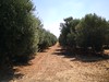


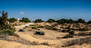
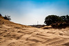
The above images may not be of the site on this page, but were taken nearby. They are loaded from Flickr so please click on them for image credits.
Click here to see more info for this site
Nearby sites
Click here to view sites on an interactive map of the areaKey: Red: member's photo, Blue: 3rd party photo, Yellow: other image, Green: no photo - please go there and take one, Grey: site destroyed
Download sites to:
KML (Google Earth)
GPX (GPS waypoints)
CSV (Garmin/Navman)
CSV (Excel)
To unlock full downloads you need to sign up as a Contributory Member. Otherwise downloads are limited to 50 sites.
Turn off the page maps and other distractions
Nearby sites listing. In the following links * = Image available
1.4km NNW 334° Hill of Jonah* Hillfort
14.9km SW 226° Tel Ashkelon* Ancient Village or Settlement
18.4km E 83° Tel 'Ekron Ancient Village or Settlement
18.8km N 10° Yavne Yam Ancient Village or Settlement
18.9km ESE 109° Tel Gath Ancient Village or Settlement
23.9km SE 140° Ziklag* Ancient Village or Settlement
24.2km SSE 164° Tel El-Hesi Ancient Village or Settlement
24.7km SE 125° Tel Burna* Ancient Village or Settlement
24.7km SE 125° Tel Burna* Ancient Village or Settlement
27.0km ESE 103° Tel Azeqa Ancient Village or Settlement
27.0km ENE 65° Tel Gezer* Ancient Village or Settlement
27.9km SE 140° Tel Lachish* Artificial Mound
28.0km ESE 119° Tel Goded Ancient Village or Settlement
28.3km SE 127° Bet Guvrin-Maresha National Park* Ancient Village or Settlement
29.0km ESE 103° Khirbet Qeiyafa* Ancient Village or Settlement
31.9km E 92° Tel Beth-Shemesh* Artificial Mound
32.0km ESE 112° Khirbat Ethri* Ancient Village or Settlement
32.0km NE 46° Lod Mosaic Ancient Palace
32.3km ESE 102° Ramat Beit Shemesh ritual baths* Ancient Village or Settlement
32.4km ESE 115° Tel Burgin* Ancient Village or Settlement
32.6km ENE 74° Emmaus Ancient Village or Settlement
33.3km ESE 103° 2,000-year-old ‘Emperor’s Road’ near Beit Shemesh* Ancient Trackway
34.9km SE 135° Amatzia* Ancient Mine, Quarry or other Industry
38.2km NE 46° Mosaic and Stone structure near Shoham Ancient Village or Settlement
40.2km NNE 16° Tel Qudadi Ancient Village or Settlement
View more nearby sites and additional images


 We would like to know more about this location. Please feel free to add a brief description and any relevant information in your own language.
 Wir möchten mehr über diese Stätte erfahren. Bitte zögern Sie nicht, eine kurze Beschreibung und relevante Informationen in Deutsch hinzuzufügen.
 Nous aimerions en savoir encore un peu sur les lieux. S'il vous plaît n'hesitez pas à ajouter une courte description et tous les renseignements pertinents dans votre propre langue.
 Quisieramos informarnos un poco más de las lugares. No dude en añadir una breve descripción y otros datos relevantes en su propio idioma.