


<< Our Photo Pages >> Moiat Dhaba'iya Masseboth - Standing Stones in Egypt in Sinai
Submitted by Motist on Monday, 29 May 2006 Page Views: 5169
Neolithic and Bronze AgeSite Name: Moiat Dhaba'iya MassebothCountry: Egypt
NOTE: This site is 10.402 km away from the location you searched for.
Region: Sinai Type: Standing Stones
Nearest Town: St. Katherina Nearest Village: Moiat Dhaba'iya
Latitude: 28.775509N Longitude: 34.090655E
Condition:
| 5 | Perfect |
| 4 | Almost Perfect |
| 3 | Reasonable but with some damage |
| 2 | Ruined but still recognisable as an ancient site |
| 1 | Pretty much destroyed, possibly visible as crop marks |
| 0 | No data. |
| -1 | Completely destroyed |
| 5 | Superb |
| 4 | Good |
| 3 | Ordinary |
| 2 | Not Good |
| 1 | Awful |
| 0 | No data. |
| 5 | Can be driven to, probably with disabled access |
| 4 | Short walk on a footpath |
| 3 | Requiring a bit more of a walk |
| 2 | A long walk |
| 1 | In the middle of nowhere, a nightmare to find |
| 0 | No data. |
| 5 | co-ordinates taken by GPS or official recorded co-ordinates |
| 4 | co-ordinates scaled from a detailed map |
| 3 | co-ordinates scaled from a bad map |
| 2 | co-ordinates of the nearest village |
| 1 | co-ordinates of the nearest town |
| 0 | no data |
Internal Links:
External Links:
")
Note: Coordinates converted from old Israel datum: 64900E, 797820N.
You may be viewing yesterday's version of this page. To see the most up to date information please register for a free account.
")
")
")
Do not use the above information on other web sites or publications without permission of the contributor.
Nearby Images from Flickr
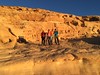
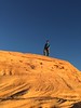
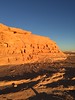
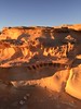
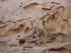
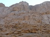
The above images may not be of the site on this page, but were taken nearby. They are loaded from Flickr so please click on them for image credits.
Click here to see more info for this site
Nearby sites
Click here to view sites on an interactive map of the areaKey: Red: member's photo, Blue: 3rd party photo, Yellow: other image, Green: no photo - please go there and take one, Grey: site destroyed
Download sites to:
KML (Google Earth)
GPX (GPS waypoints)
CSV (Garmin/Navman)
CSV (Excel)
To unlock full downloads you need to sign up as a Contributory Member. Otherwise downloads are limited to 50 sites.
Turn off the page maps and other distractions
Nearby sites listing. In the following links * = Image available
1.1km NNE 25° Zaranich Ras Al Zalaka rock painting* Cave or Rock Shelter
2.6km WNW 282° Al trefiya Nawamis* Portal Tomb
24.4km WSW 240° Aqrat Safna nabatean village in Sinai Ancient Village or Settlement
29.3km ENE 72° Hdhabat Chajaj Nawamis* Burial Chamber or Dolmen
47.3km SSW 199° Mount Umm Shomar Predator Trap* Ancient Mine, Quarry or other Industry
68.0km WNW 295° Serabit el-Khadem Temple of Hathor* Ancient Temple
71.2km W 281° Wadi Maghareh* Ancient Mine, Quarry or other Industry
109.6km NE 43° Wadi Tweiba* Rock Art
112.5km NNE 28° Gebel Khashm el Tarif* Ancient Temple
116.5km NE 43° Ramat Yotam 'roded' type site* Ancient Temple
118.8km NE 40° Netafim Neolithic sanctuary* Ancient Temple
119.9km NE 40° North of Netafim spring* Ancient Temple
121.4km NE 41° Roded cult sites* Ancient Temple
121.6km NE 41° Wadi Tawahin* Ancient Mine, Quarry or other Industry
122.1km NE 41° Wadi Roded Open Air Sanctuaries* Ancient Temple
122.5km NE 43° Shahmon Desert Kite* Misc. Earthwork
123.0km NE 41° Yedidyah pass Roded type cult site* Ancient Village or Settlement
124.0km NE 38° Mount Uzia West Predators Trap* Misc. Earthwork
124.9km NE 42° Shehoret Hills Desert Kite* Misc. Earthwork
125.0km NE 42° Shchoret habitation site* Ancient Village or Settlement
125.0km NE 42° Arround Shchoret hills* Ancient Village or Settlement
125.3km NE 42° Shchoret hills Open Air Mosque* Ancient Temple
127.4km NE 39° Upper Wadi Racham Camp* Standing Stones
127.9km NE 36° W' Se'ipim valley* Ancient Village or Settlement
127.9km NE 37° SE' Se'ipim valley* Ancient Village or Settlement
View more nearby sites and additional images


 We would like to know more about this location. Please feel free to add a brief description and any relevant information in your own language.
 Wir möchten mehr über diese Stätte erfahren. Bitte zögern Sie nicht, eine kurze Beschreibung und relevante Informationen in Deutsch hinzuzufügen.
 Nous aimerions en savoir encore un peu sur les lieux. S'il vous plaît n'hesitez pas à ajouter une courte description et tous les renseignements pertinents dans votre propre langue.
 Quisieramos informarnos un poco más de las lugares. No dude en añadir una breve descripción y otros datos relevantes en su propio idioma.