


<< Image Pages >> Chersonesus - Ancient Village or Settlement in Ukraine
Submitted by durhamnature on Thursday, 03 January 2013 Page Views: 3503
Multi-periodSite Name: ChersonesusCountry: Ukraine
NOTE: This site is 15.236 km away from the location you searched for.
Type: Ancient Village or Settlement
Nearest Town: Sevastopol
Latitude: 44.611667N Longitude: 33.493333E
Condition:
| 5 | Perfect |
| 4 | Almost Perfect |
| 3 | Reasonable but with some damage |
| 2 | Ruined but still recognisable as an ancient site |
| 1 | Pretty much destroyed, possibly visible as crop marks |
| 0 | No data. |
| -1 | Completely destroyed |
| 5 | Superb |
| 4 | Good |
| 3 | Ordinary |
| 2 | Not Good |
| 1 | Awful |
| 0 | No data. |
| 5 | Can be driven to, probably with disabled access |
| 4 | Short walk on a footpath |
| 3 | Requiring a bit more of a walk |
| 2 | A long walk |
| 1 | In the middle of nowhere, a nightmare to find |
| 0 | No data. |
| 5 | co-ordinates taken by GPS or official recorded co-ordinates |
| 4 | co-ordinates scaled from a detailed map |
| 3 | co-ordinates scaled from a bad map |
| 2 | co-ordinates of the nearest village |
| 1 | co-ordinates of the nearest town |
| 0 | no data |
Internal Links:
External Links:
")
Note: As a result of the annexation of Crimea by Russia, the city is currently a subject of territorial dispute between Ukraine, which considers Sevastopol as a city with special status, and Russia, which considers it a federal city within the Crimean Federal District.
You may be viewing yesterday's version of this page. To see the most up to date information please register for a free account.
Do not use the above information on other web sites or publications without permission of the contributor.
Nearby Images from Flickr
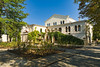
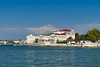
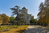
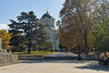
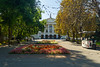
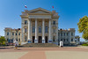
The above images may not be of the site on this page, but were taken nearby. They are loaded from Flickr so please click on them for image credits.
Click here to see more info for this site
Nearby sites
Click here to view sites on an interactive map of the areaKey: Red: member's photo, Blue: 3rd party photo, Yellow: other image, Green: no photo - please go there and take one, Grey: site destroyed
Download sites to:
KML (Google Earth)
GPX (GPS waypoints)
CSV (Garmin/Navman)
CSV (Excel)
To unlock full downloads you need to sign up as a Contributory Member. Otherwise downloads are limited to 50 sites.
Turn off the page maps and other distractions
Nearby sites listing. In the following links * = Image available
15.6km E 88° Dolmens Inkerman 2nd Cardon* Burial Chamber or Dolmen
19.4km E 92° Eski-Kermen* Promontory Fort / Cliff Castle
19.6km E 91° Eski Kermen* Promontory Fort / Cliff Castle
31.7km ENE 74° Megaliths in the Alima* Ancient Palace
53.5km ESE 108° Dolmens Of Oreanda* Burial Chamber or Dolmen
64.5km ENE 69° Dolmens Of Roman-Kosh* Burial Chamber or Dolmen
70.5km E 84° Cromlech Alushta* Stone Circle
84.1km NNW 335° Modern Stonehenge on the beach at Popovka Modern Stone Circle etc
96.4km ENE 68° Dolmens Of Krasnosyolovka* Burial Chamber or Dolmen
244.4km NNW 335° Kherson Cliffs* Natural Stone / Erratic / Other Natural Feature
246.1km ENE 70° Pantikapaion* Ancient Village or Settlement
247.6km ENE 70° Kul-Oba* Round Barrow(s)
253.1km ENE 69° Tsarsky Kurgan* Chambered Cairn
261.9km NNW 332° Olbia Ancient Village or Settlement
262.0km NNE 16° Oguz Burial Mound Round Barrow(s)
270.1km NNE 15° Kozel Burial Mound Round Barrow(s)
288.4km NNE 30° Melitopol Museum of Local History* Museum
301.8km NNE 30° Kamyana Mohyla Rock Cut Tomb
302.3km NW 307° Tira (Ukraine) Ancient Village or Settlement
303.0km E 83° Gorgippia* Ancient Village or Settlement
307.0km NW 316° Kuyalnik Temple Ancient Temple
308.8km NNE 12° Znamenskoye Round Barrow(s)
319.5km N 11° Mamay-Hora* Round Barrow(s)
328.9km E 86° Vasilyevka 1* Burial Chamber or Dolmen
329.4km E 86° Vasilyevka 2* Burial Chamber or Dolmen
View more nearby sites and additional images


 We would like to know more about this location. Please feel free to add a brief description and any relevant information in your own language.
 Wir möchten mehr über diese Stätte erfahren. Bitte zögern Sie nicht, eine kurze Beschreibung und relevante Informationen in Deutsch hinzuzufügen.
 Nous aimerions en savoir encore un peu sur les lieux. S'il vous plaît n'hesitez pas à ajouter une courte description et tous les renseignements pertinents dans votre propre langue.
 Quisieramos informarnos un poco más de las lugares. No dude en añadir una breve descripción y otros datos relevantes en su propio idioma.