


<< Our Photo Pages >> Gavurkale - Ancient Village or Settlement in Turkey
Submitted by davidmorgan on Wednesday, 06 December 2006 Page Views: 6720
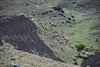
Multi-periodSite Name: Gavurkale Alternative Name: Gavur KalesiCountry: Turkey
NOTE: This site is 4.412 km away from the location you searched for.
Type: Ancient Village or Settlement
Nearest Town: Haymana Nearest Village: Derekoy
Latitude: 39.531485N Longitude: 32.559135E
Condition:
| 5 | Perfect |
| 4 | Almost Perfect |
| 3 | Reasonable but with some damage |
| 2 | Ruined but still recognisable as an ancient site |
| 1 | Pretty much destroyed, possibly visible as crop marks |
| 0 | No data. |
| -1 | Completely destroyed |
| 5 | Superb |
| 4 | Good |
| 3 | Ordinary |
| 2 | Not Good |
| 1 | Awful |
| 0 | No data. |
| 5 | Can be driven to, probably with disabled access |
| 4 | Short walk on a footpath |
| 3 | Requiring a bit more of a walk |
| 2 | A long walk |
| 1 | In the middle of nowhere, a nightmare to find |
| 0 | No data. |
| 5 | co-ordinates taken by GPS or official recorded co-ordinates |
| 4 | co-ordinates scaled from a detailed map |
| 3 | co-ordinates scaled from a bad map |
| 2 | co-ordinates of the nearest village |
| 1 | co-ordinates of the nearest town |
| 0 | no data |
Internal Links:
External Links:
I have visited· I would like to visit
davidmorgan has visited here
")
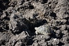
Originally a Hittite fortress, later settled by the Phrygians.
You may be viewing yesterday's version of this page. To see the most up to date information please register for a free account.
")
")
Do not use the above information on other web sites or publications without permission of the contributor.
Nearby Images from Flickr

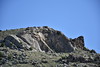
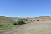
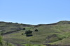
The above images may not be of the site on this page, but were taken nearby. They are loaded from Flickr so please click on them for image credits.
Click here to see more info for this site
Nearby sites
Click here to view sites on an interactive map of the areaKey: Red: member's photo, Blue: 3rd party photo, Yellow: other image, Green: no photo - please go there and take one, Grey: site destroyed
Download sites to:
KML (Google Earth)
GPX (GPS waypoints)
CSV (Garmin/Navman)
CSV (Excel)
To unlock full downloads you need to sign up as a Contributory Member. Otherwise downloads are limited to 50 sites.
Turn off the page maps and other distractions
Nearby sites listing. In the following links * = Image available
34.9km NW 304° Hacitugrul Tumulus Ancient Village or Settlement
41.1km NNE 28° Kocumbeli Ancient Village or Settlement
41.3km WNW 292° Beycegiz Tumulus* Chambered Tomb
45.0km NNE 24° Middle East Technical University Museum Museum
49.8km NNE 28° Ankara Tumuli* Round Barrow(s)
50.0km WNW 286° Midas Tumulus* Artificial Mound
50.0km WNW 286° Gordion Museum Museum
51.5km WNW 285° Gordion* Ancient Village or Settlement
52.1km NNE 30° Ankara Museum of Anatolian Civilizations* Museum
52.5km NNE 29° Ankara Temple of Augustus and Roma* Ancient Temple
60.1km WSW 254° Yagri* Ancient Village or Settlement
74.8km E 85° Büklükale Ancient Village or Settlement
86.7km WSW 255° Pessinous* Ancient Temple
107.1km E 100° Kaman Kalehoyuk* Ancient Village or Settlement
107.7km E 101° Kaman Kalehoyuk Archaeological Museum* Museum
129.8km SSW 203° Yalburt* Carving
132.3km ESE 109° Malkaya* Carving
132.4km E 100° Yassihöyük Ancient Village or Settlement
139.7km E 93° Hashöyük Ancient Village or Settlement
144.0km ESE 107° Kirsehir Museum Museum
155.7km W 272° Kulluoba Hoyuk Ancient Village or Settlement
156.1km NNW 329° Bithynium Ancient Village or Settlement
161.5km WSW 258° Pismis Kale Hillfort
162.8km WSW 258° Areyastis Monument* Sculptured Stone
162.9km WSW 257° Midas City* Ancient Village or Settlement
View more nearby sites and additional images


 We would like to know more about this location. Please feel free to add a brief description and any relevant information in your own language.
 Wir möchten mehr über diese Stätte erfahren. Bitte zögern Sie nicht, eine kurze Beschreibung und relevante Informationen in Deutsch hinzuzufügen.
 Nous aimerions en savoir encore un peu sur les lieux. S'il vous plaît n'hesitez pas à ajouter une courte description et tous les renseignements pertinents dans votre propre langue.
 Quisieramos informarnos un poco más de las lugares. No dude en añadir una breve descripción y otros datos relevantes en su propio idioma.