 with our Megalithic Portal iPhone app")


<< Our Photo Pages >> Solomennoe Stone Circle (modern) - Modern Stone Circle etc in Russia
Submitted by Sunny100 on Tuesday, 17 May 2016 Page Views: 2238
Modern SitesSite Name: Solomennoe Stone Circle (modern)Country: Russia
NOTE: This site is 162.983 km away from the location you searched for.
Type: Modern Stone Circle etc
Nearest Town: Petrosawodsk Nearest Village: Solomennoe
Latitude: 61.843367N Longitude: 34.383162E
Condition:
| 5 | Perfect |
| 4 | Almost Perfect |
| 3 | Reasonable but with some damage |
| 2 | Ruined but still recognisable as an ancient site |
| 1 | Pretty much destroyed, possibly visible as crop marks |
| 0 | No data. |
| -1 | Completely destroyed |
| 5 | Superb |
| 4 | Good |
| 3 | Ordinary |
| 2 | Not Good |
| 1 | Awful |
| 0 | No data. |
| 5 | Can be driven to, probably with disabled access |
| 4 | Short walk on a footpath |
| 3 | Requiring a bit more of a walk |
| 2 | A long walk |
| 1 | In the middle of nowhere, a nightmare to find |
| 0 | No data. |
| 5 | co-ordinates taken by GPS or official recorded co-ordinates |
| 4 | co-ordinates scaled from a detailed map |
| 3 | co-ordinates scaled from a bad map |
| 2 | co-ordinates of the nearest village |
| 1 | co-ordinates of the nearest town |
| 0 | no data |
Be the first person to rate this site - see the 'Contribute!' box in the right hand menu.
Internal Links:
External Links:
 (PID:149163)")
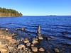
Modern Stone Circle at 'The Meadow Of The Idols' - Botanic Gardens, Solomennoe (Solomenskiy) near Petrozavodsk, in Karelia, north-western Russia. (Botonicheskiy sad Petrozavodskogo)
You may be viewing yesterday's version of this page. To see the most up to date information please register for a free account.
Do not use the above information on other web sites or publications without permission of the contributor.
Nearby Images from Flickr
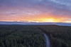
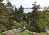
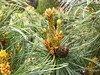
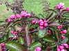
The above images may not be of the site on this page, but were taken nearby. They are loaded from Flickr so please click on them for image credits.
Click here to see more info for this site
Nearby sites
Click here to view sites on an interactive map of the areaKey: Red: member's photo, Blue: 3rd party photo, Yellow: other image, Green: no photo - please go there and take one, Grey: site destroyed
Download sites to:
KML (Google Earth)
GPX (GPS waypoints)
CSV (Garmin/Navman)
CSV (Excel)
To unlock full downloads you need to sign up as a Contributory Member. Otherwise downloads are limited to 50 sites.
Turn off the page maps and other distractions
Nearby sites listing. In the following links * = Image available
47.2km ENE 69° Oleny Ostrov burial* Ancient Village or Settlement
47.4km ENE 70° Olene-ostrovsky burial ground* Ancient Village or Settlement
88.9km E 101° Lake Onega Rock Art* Rock Art
216.9km ESE 122° Vytegorsky Boulder* Natural Stone / Erratic / Other Natural Feature
232.2km SSW 210° Lyubshanskoe settlement* Ancient Village or Settlement
232.6km SSW 210° Staraya Ladoga* Barrow Cemetery
242.9km WSW 252° Seid island Burnev* Natural Stone / Erratic / Other Natural Feature
247.5km W 278° Pirunpöytä* Rock Art
267.3km WSW 247° Tiversk* Ancient Village or Settlement
272.6km SE 136° Belozersky Val* Ancient Village or Settlement
293.3km N 2° Zalavruga* Rock Art
305.2km SW 228° Hermitage Museum* Museum
316.6km W 266° Strange rock Kummakivi* Natural Stone / Erratic / Other Natural Feature
327.6km SW 231° Stone Head Peterhof* Sculptured Stone
348.9km N 6° Oleshin Island* Turf Maze
353.0km SSE 163° Complex Kurevaniha* Artificial Mound
353.5km N 10° Labyrinth Big Zayatsky Island* Turf Maze
358.2km SW 218° Oredezh River stones* Polissoir
360.1km W 259° Lemin Heiluvakivi* Natural Stone / Erratic / Other Natural Feature
363.9km W 266° Astuvansalmi rock paintings* Rock Art
374.8km NNW 345° Vottovaara Mountain* Natural Stone / Erratic / Other Natural Feature
375.7km NNE 12° Pyramid island Anzer* Artificial Mound
377.9km SSW 203° Kamen Scheglets* Carving
380.9km WSW 249° Labyrinth Krutoyar* Turf Maze
407.4km SSW 206° Historical Museum of Novgorod* Museum
View more nearby sites and additional images


 We would like to know more about this location. Please feel free to add a brief description and any relevant information in your own language.
 Wir möchten mehr über diese Stätte erfahren. Bitte zögern Sie nicht, eine kurze Beschreibung und relevante Informationen in Deutsch hinzuzufügen.
 Nous aimerions en savoir encore un peu sur les lieux. S'il vous plaît n'hesitez pas à ajouter une courte description et tous les renseignements pertinents dans votre propre langue.
 Quisieramos informarnos un poco más de las lugares. No dude en añadir una breve descripción y otros datos relevantes en su propio idioma.